|
|
|
|
|
This page last updated March 8, 2024 |
Below are historical photos of various streets downtown and in the Southtown area. The photos were sourced from the TxDOT photo library and the San Antonio TxDOT district office.
Locations are given using the present-day roadway names. The photos are generally arranged from north to south. Click on each photo for an enlarged view.
Click here to return to the historical photo galleries page.
|
ADVERTISEMENT |
|
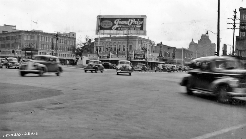
Romana Plaza looking southeast (ca. 1940) The Sears building at the left is the location of today's Central Library. (TxDOT) |
|
Romana Plaza looking southeast (ca. 1940) The Sears building at the left is the location of today's Central Library. (TxDOT) |
|
|
|
|
|
Commerce St. at the railroad tracks east of Hoefgen St. looking west (ca. 1940) Sunset Station is to the left. (TxDOT) |
|
Commerce St. at the railroad tracks east of Hoefgen St. looking west (ca. 1940) Sunset Station is to the left. (TxDOT) |
|
|
|
|
|
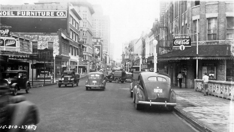
Commerce St. at Alamo St. looking west (ca. 1940) The buildings across the intersection to the left were removed for the Riverwalk extension for HemisFair and is the location of the "Torch of Friendship" statue today. The storefront for Joske's (subsequently Dillard's and now H&M) is at the right. (TxDOT) |
|
|
|
|
|
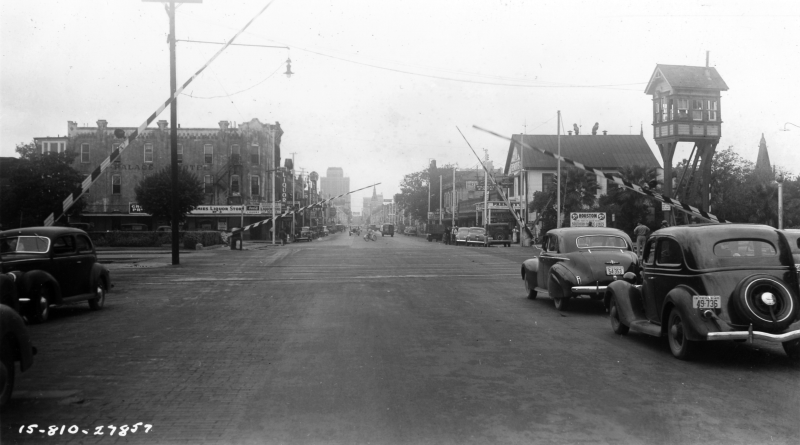
Commerce St. at Lasoya St. looking west (ca. 1940) This is on the bridge over the Riverwalk. Schilo's is at the left. Notice that Commerce St. was two-way at this time. (TxDOT) |
|
Commerce St. at Lasoya St. looking west (ca. 1940) This is on the bridge over the Riverwalk. Schilo's is at the left. Notice that Commerce St. was two-way at this time. (TxDOT) |
|
|
|
|
|
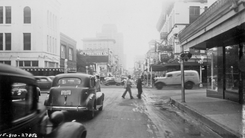
Commerce St. at Pecos St. looking east (ca. 1940) You can see the facade of Market Square a few blocks down on the right. (TxDOT) |
|
Commerce St. at Pecos St. looking east (ca. 1940) You can see the facade of Market Square a few blocks down on the right. (TxDOT) |
|
|
|
|
|
Commerce St. at Salado St. looking west (ca. 1940) The Commerce St. overpass is at this location now. (TxDOT) |
|
Commerce St. at Salado St. looking west (ca. 1940) The Commerce St. overpass is at this location now. (TxDOT) |
|
|
|
|

|
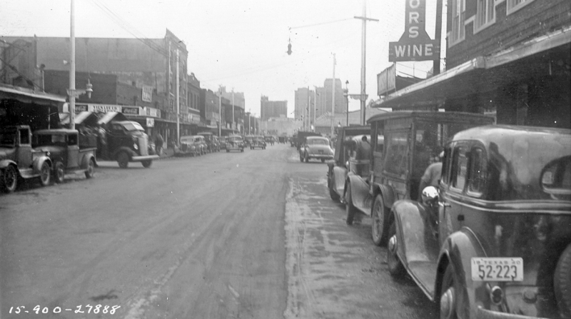
Alamo St. at Presa St. looking southwest (ca. 1940) (TxDOT) |
|
Alamo St. at Presa St. looking southwest (ca. 1940) (TxDOT) |
|
|
|
|
|
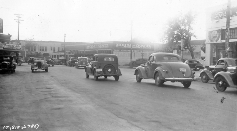
Alamo St. at St. Mary's St. looking southwest (ca. 1940) (TxDOT) |
|
Alamo St. at St. Mary's St. looking southwest (ca. 1940) (TxDOT) |
|
|
|
|
|
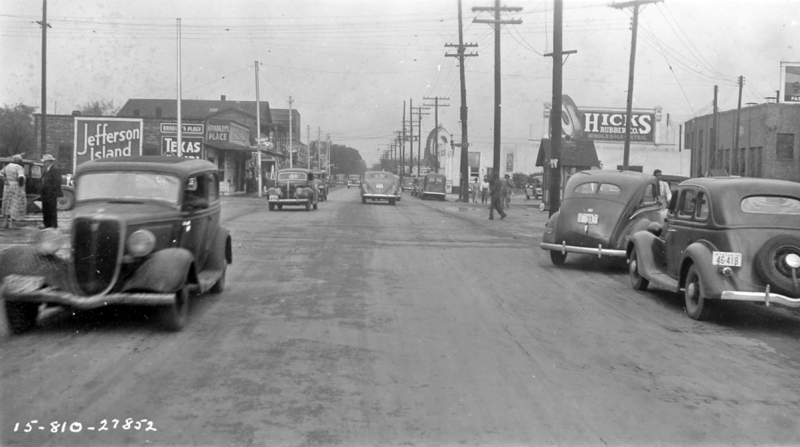
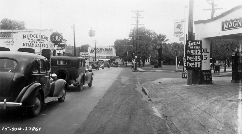
Flores St. at Cevallos St./Nogalitos St. looking south (ca. 1940) The Texaco station building was gutted by a fire in February 2020. (TxDOT) |
|
Flores St. at Cevallos St./Nogalitos St. looking south (ca. 1940) The Texaco station building was gutted by a fire in February 2020. (TxDOT) |
|
|
|
|
|
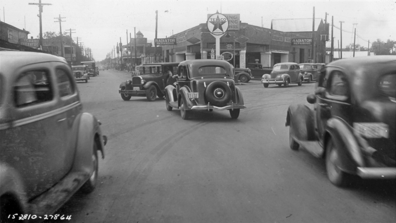
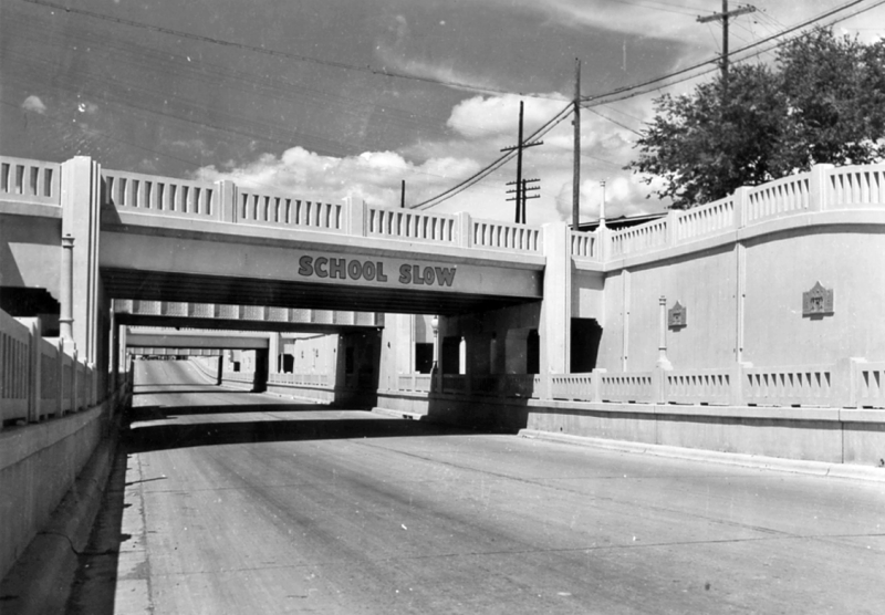
Quadruple underpass on Nogalitos St. looking northeast (ca. 1940) (TxDOT) |
|
Quadruple underpass on Nogalitos St. looking northeast (ca. 1940) (TxDOT) |
|
|
|
|
|
Presa St. at Carolina St. looking north (ca. 1940) (TxDOT) |
|
Presa St. at Carolina St. looking north (ca. 1940) (TxDOT) |
|
|
|
|
|
Presa St. at Boyer St. looking north (ca. 1940) (TxDOT) |
|
Presa St. at Boyer St. looking north (ca. 1940) (TxDOT) |
|
|
|
|