|
|
|
|
|
This page last updated March 5, 2024 |
Below are historical photos of Bandera Road and Culebra Road along with a brief history of the route. The photos were sourced from the TxDOT photo library and the San Antonio TxDOT district office.
Locations are given using the present-day roadway names. The photos are arranged generally from east to west. Click on each photo for an enlarged view.
Click here to return to the historical photo galleries page.
|
ADVERTISEMENT |
Route history


The route to Bandera went through numerous changes in the first fifty years of the state highway system. When first designated around 1919, it was numbered State Highway 27. By the mid '20s, it had been renumbered as SH 81. In 1938, it was changed yet again, this time to SH 16; this was likely done to avoid confusion with US 81, which also ran through San Antonio.
The path this route took through the area also changed several times. It appears the original route may have used Fredericksburg Rd. to Cincinnati Ave., then south on Zarzamora St. to Culebra Ave. and onto Bandera Rd. By 1927, the route looks to have been changed to use N Laredo St. to Poplar (then named Castro St.), then north on Zarzamora St. and west on Culebra Ave. to Bandera Rd.
In the early '30s, the route appears to have gone back to Fredericksburg Rd., then across Woodlawn Ave. to Bandera Rd. By 1936 or so, the route was changed yet again, this time using Cincinnati Ave. to connect from Fredericksburg Rd. to Bandera Rd. It continued to use this route until the early '50s, when it was moved back to an improved Culebra Ave. to connect it to the new US 87 expressway (today's I‑10.)
Today's stretch of Bandera Rd. between Wurzbach Rd. and Evers Rd. did not originally exist. Instead, Bandera Rd. followed what's now Evers Rd. between Benrus Dr. and Daughtry Dr., then along Daughtry and onto today's Loop 410 right-of-way westward, going just past today's Bandera Rd. before turning northwest behind the properties that today front the west side of Bandera between Loop 410 and Wurzbach. It then merged onto today's right-of-way at Wurzbach. The more direct route connecting Evers and Wurzbach was built around 1950.
The route through Helotes also saw several changes over the years. The original route went west for a short distance on today's FM 1560 and curved onto today's Riggs Rd. before following today's Old Bandera Rd. through Helotes, rejoining today's Bandera Rd. north of Scenic Loop Rd. at the El Chaparral restaurant. Riggs Rd. was bypassed around 1950, and Old Bandera Rd. was bypassed in the mid '70s.
A more detailed route history is available here.
|
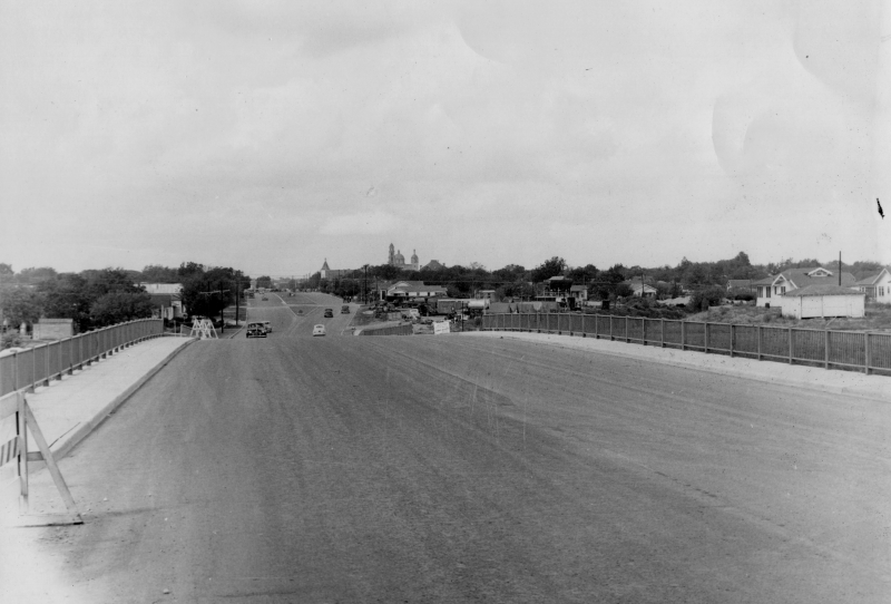
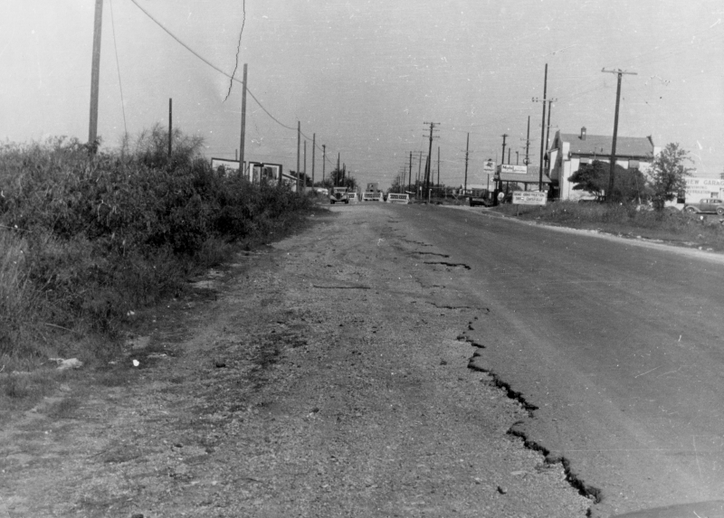
Culebra Rd. at I‑10 looking west (ca. 1948) This is looking across the overpass over the future US 87 expressway. In the distance, you can see a recently-widened section of Culebra Rd. which was being upgraded to provide a high-capacity connection to the new expressway from the northwest side. (TxDOT) |
|
|
|
|
|
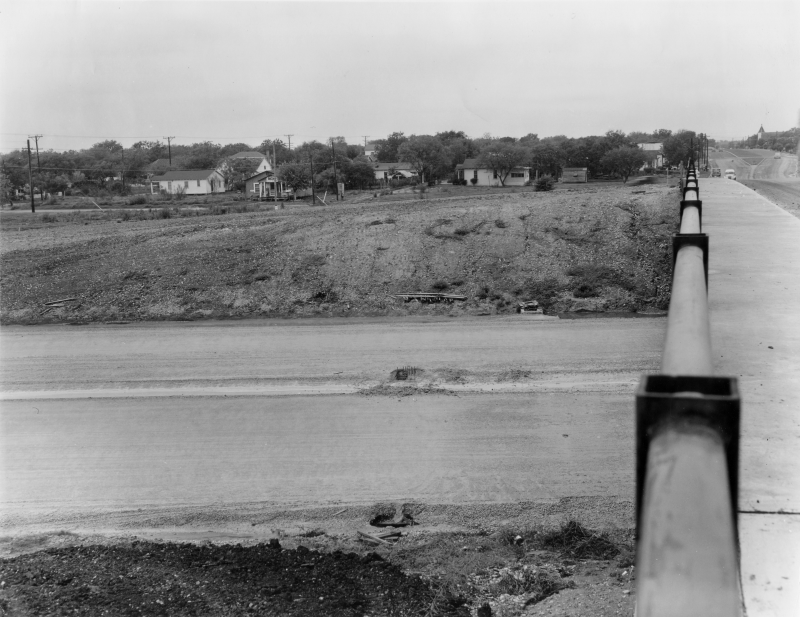
Culebra Rd. at I‑10 looking west (ca. 1948) Same location at the photo above but looking over the bridge rail at the expressway that's still under construction at this time. (TxDOT) |
|
Culebra Rd. at I‑10 looking west (ca. 1948) Same location at the photo above but looking over the bridge rail at the expressway that's still under construction at this time. (TxDOT) |
|
|
|
|
|
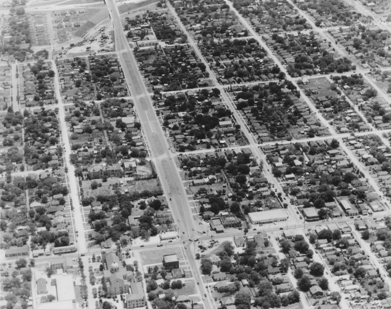
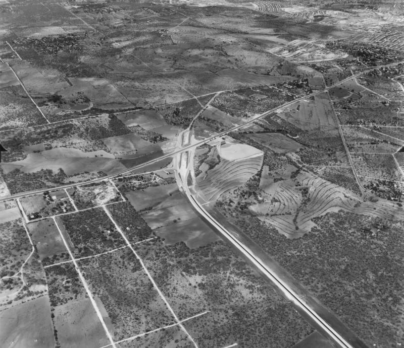
Culebra Rd. and Zarzamora St. looking southeast (ca. 1948) You can see the widened section of Culebra Rd. between Zarzamora St. (at the bottom of the photo) and the new expressway (at the top of the photo). Culebra west of Zarzamora would be widened in the early '50s. (TxDOT/Ralph N Miller Aerial Industrial Photos) |
|
|
|
|
|
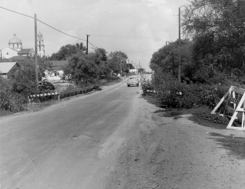
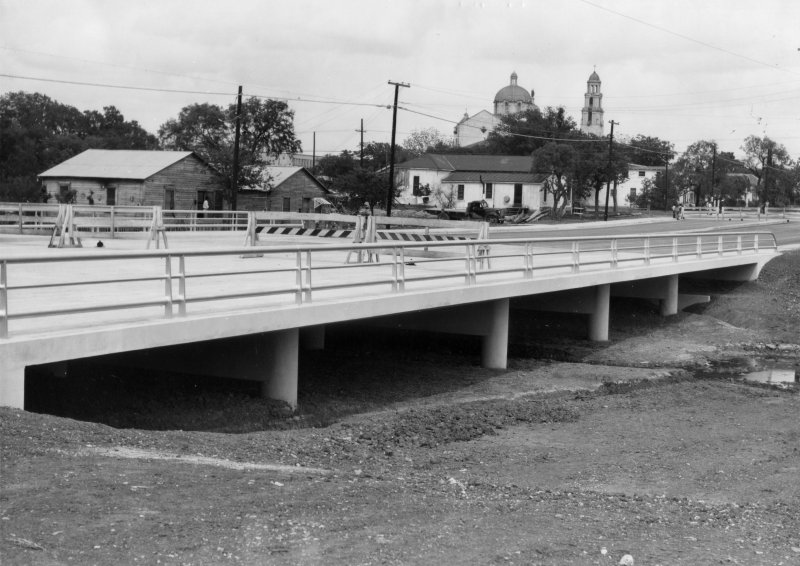
Culebra Rd. at Alazan Creek looking east (ca. 1950) This is the original, narrow bridge on Culebra Rd. over the creek. To the left, you can see the Basilica of the National Shrine of the Little Flower. (TxDOT) |
|
Culebra Rd. at Alazan Creek looking east (ca. 1950) This is the original, narrow bridge on Culebra Rd. over the creek. To the left, you can see the Basilica of the National Shrine of the Little Flower. (TxDOT) |
|
|
|
|
|
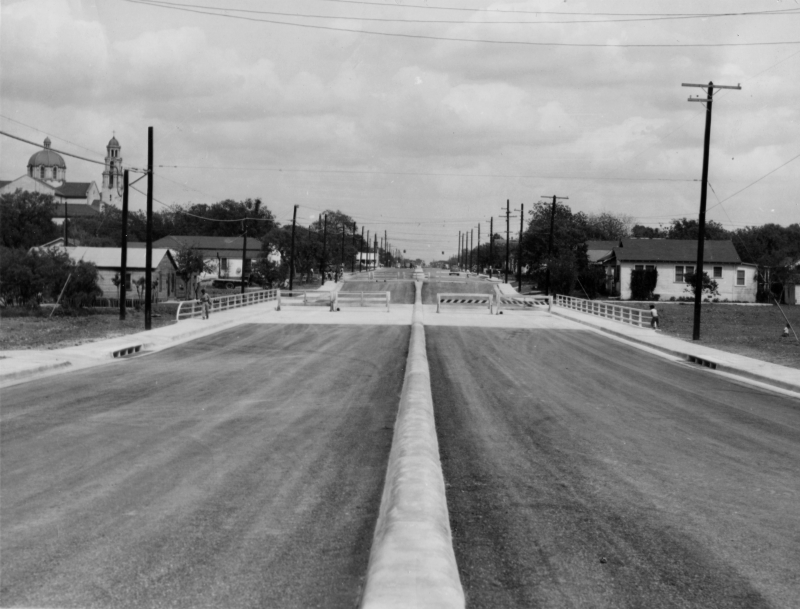
Culebra Rd. at Alazan Creek looking east (ca. 1955) This is the widened bridge and road. (TxDOT) |
|
Culebra Rd. at Alazan Creek looking east (ca. 1955) This is the widened bridge and road. (TxDOT) |
|
|
|
|
|
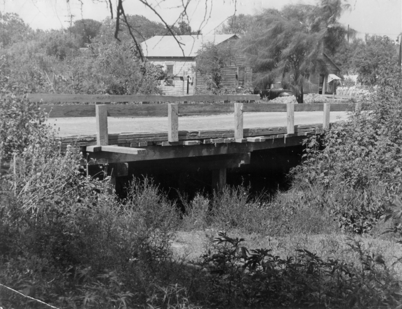
Culebra Rd. bridge over Alazan Creek looking northeast (ca. 1950) A side view of the old bridge showing how primitive it was. (TxDOT) |
|
Culebra Rd. bridge over Alazan Creek looking northeast (ca. 1950) A side view of the old bridge showing how primitive it was. (TxDOT) |
|
|
|
|
|
Culebra Rd. bridge over Alazan Creek looking northeast (ca. 1955) A side view of the new bridge. (TxDOT) |
|
Culebra Rd. bridge over Alazan Creek looking northeast (ca. 1955) A side view of the new bridge. (TxDOT) |
|
|
|
|
|
Culebra Rd. at Neff St. looking east (ca. 1955) A view of the widened Culebra Rd. from near 24th St. (TxDOT) |
|
Culebra Rd. at Neff St. looking east (ca. 1955) A view of the widened Culebra Rd. from near 24th St. (TxDOT) |
|
|
|
|
|
Culebra Rd. at Bandera Rd. looking east (ca. 1950) Culebra Rd. just west of its junction with Bandera Rd. before improvements. (TxDOT) |
|
Culebra Rd. at Bandera Rd. looking east (ca. 1950) Culebra Rd. just west of its junction with Bandera Rd. before improvements. (TxDOT) |
|
|
|
|
|
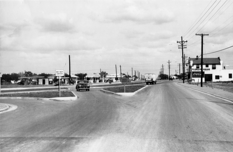
Culebra Rd. at Bandera Rd. looking east (ca. 1955) The same location as above after the intersection was upgraded. (TxDOT) |
|
Culebra Rd. at Bandera Rd. looking east (ca. 1955) The same location as above after the intersection was upgraded. (TxDOT) |
|
|
|
|

|
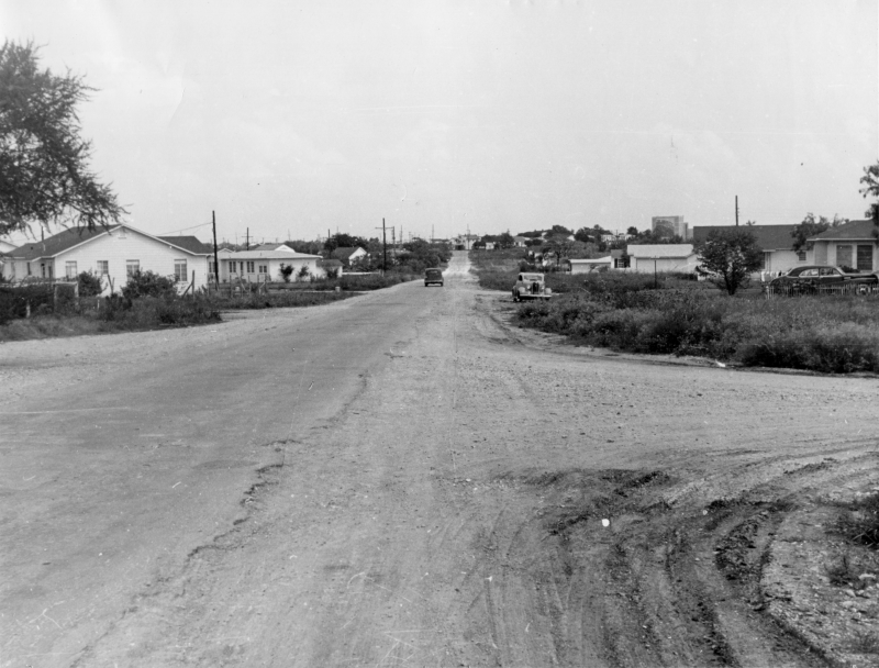
Bandera Rd. at Culebra Rd. looking southeast (ca. 1950) The same intersection as above but looking from Bandera Rd. before improvements. (TxDOT) |
|
Bandera Rd. at Culebra Rd. looking southeast (ca. 1950) The same intersection as above but looking from Bandera Rd. before improvements. (TxDOT) |
|
|
|
|
|
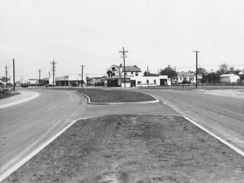
Bandera Rd. at Culebra Rd. looking southeast (ca. 1955) The same location as above after the intersection was upgraded. (TxDOT) |
|
Bandera Rd. at Culebra Rd. looking southeast (ca. 1955) The same location as above after the intersection was upgraded. (TxDOT) |
|
|
|
|
|
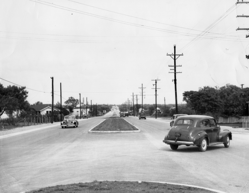
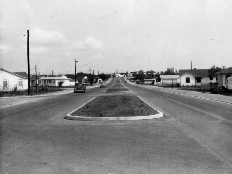
Bandera Rd. at Texas Ave. looking southeast (ca. 1950) Bandera Rd. near Cincinnati Ave. before widening. If you look closely at the right, you can see the screen for the old Varsity Drive-In; it was located where the HEB is today. (TxDOT) |
|
Bandera Rd. at Texas Ave. looking southeast (ca. 1950) Bandera Rd. near Cincinnati Ave. before widening. If you look closely at the right, you can see the screen for the old Varsity Drive-In; it was located where the HEB is today. (TxDOT) |
|
|
|
|
|
Bandera Rd. at Texas Ave. looking southeast (ca. 1955) The same location as above after Bandera Rd. was widened. (TxDOT) |
|
Bandera Rd. at Texas Ave. looking southeast (ca. 1955) The same location as above after Bandera Rd. was widened. (TxDOT) |
|
|
|
|
|
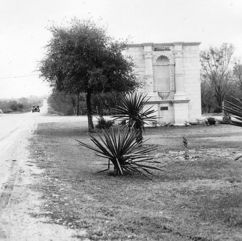
San Antonio city limits welcome monument (ca. 1930) This is on Bandera Rd. at Cincinnati Ave. looking southeast. (TxDOT) |
|
San Antonio city limits welcome monument (ca. 1930) This is on Bandera Rd. at Cincinnati Ave. looking southeast. (TxDOT) |
|
|
|
|
|
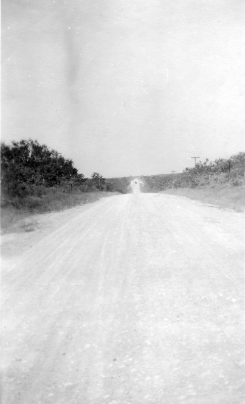
Bandera Rd. at Sunshine Dr. looking northwest (1919) (TxDOT) |
|
Bandera Rd. at Sunshine Dr. looking northwest (1919) (TxDOT) |
|
|
|
|
|
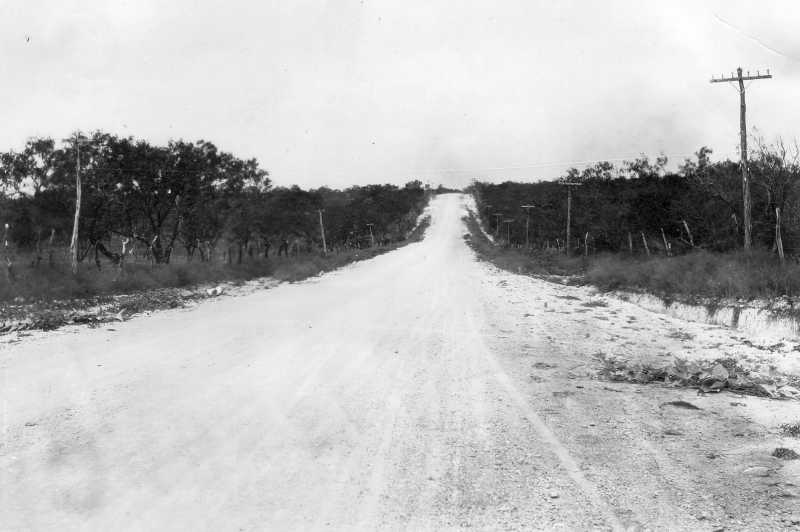
Bandera Rd. at Sunshine Dr. looking northwest (1921) This is slightly further northwest than the previous photo. (TxDOT) |
|
Bandera Rd. at Sunshine Dr. looking northwest (1921) This is slightly further northwest than the previous photo. (TxDOT) |
|
|
|
|
|
Loop 410 at Bandera Rd. looking northeast (1956) An aerial view showing construction of Loop 13 (now Loop 410) at Bandera Rd. Bandera is the road running from left to right near the center of the photo. In the middle of the photo is construction of the Loop 13/Bandera interchange with Loop 13 then continuing to the southwest; work had not yet started to continue it to the northeast. The old Bandera Drive-In is visible just to the right of the interchange. The short stretch of road from the interchange to the northeast is today's Daughtry Dr., which at one time was actually part of Bandera Rd. (TxDOT/Jack Amman Photogrammetric Engineers) |
|
|
|
|
|
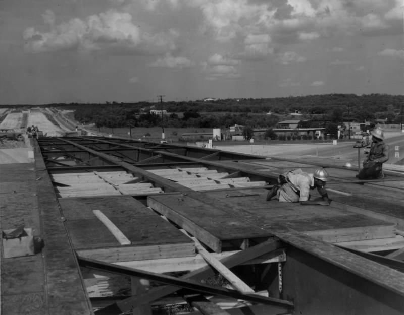
Loop 410 at Bandera Rd. looking east (ca. 1958) Construction of the Loop 13 (now Loop 410) overpass at Bandera Rd. (TxDOT/Les Guthrie) |
|
Loop 410 at Bandera Rd. looking east (ca. 1958) Construction of the Loop 13 (now Loop 410) overpass at Bandera Rd. (TxDOT/Les Guthrie) |
|
|
|
|
|
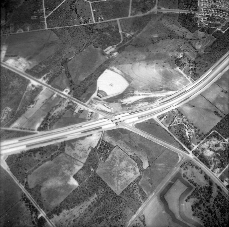
Loop 410 at Bandera Rd. (1961) Another aerial view of the Bandera Rd./Loop 410 intersection. This photo is oriented with north at the bottom. Again, you can see the Bandera Drive-In near the center of the photo. The road that branches off of Bandera at Wurzbach (lower right side of the photo) and connects to Loop 410 was the original path of Bandera Rd. (TxDOT) |
|
|
|
|
|
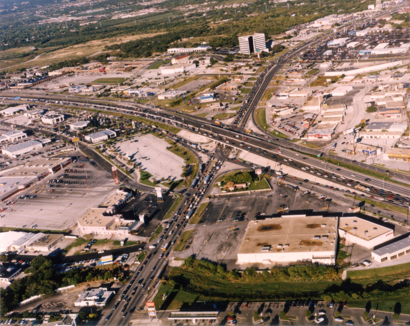
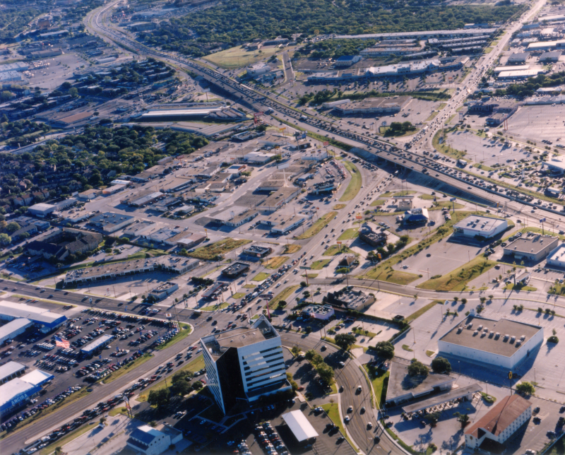
Bandera Rd. at Loop 410 looking west (ca. 1998) Notice the old Target store at the left. The large parking lot just to the left of the center of the photo is a former VIA Park & Ride. (TxDOT) |
|
Bandera Rd. at Loop 410 looking west (ca. 1998) Notice the old Target store at the left. The large parking lot just to the left of the center of the photo is a former VIA Park & Ride. (TxDOT) |
|
|
|
|
|
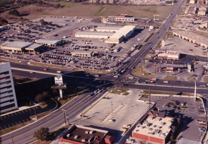
Bandera Rd. at Loop 410 looking southeast (ca. 1998) This is looking back the other direction from the photo above. (TxDOT) |
|
Bandera Rd. at Loop 410 looking southeast (ca. 1998) This is looking back the other direction from the photo above. (TxDOT) |
|
|
|
|
|
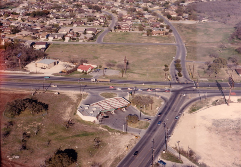
Bandera Rd. at Wurzbach Rd. looking northeast (ca. 1988) (TxDOT) |
|
Bandera Rd. at Wurzbach Rd. looking northeast (ca. 1988) (TxDOT) |
|
|
|
|
|
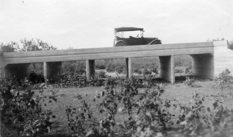
Bandera Rd. at Huebner Creek (ca. 1920) Early bridge over Huebner Creek in Leon Valley. (TxDOT) |
|
Bandera Rd. at Huebner Creek (ca. 1920) Early bridge over Huebner Creek in Leon Valley. (TxDOT) |
|
|
|
|
|
Bandera Rd. at Eckhert Rd. looking northeast (ca. 1988) Eckhert Rd. was still two lanes at this time and the Leon Valley neighborhood at the upper right was still mostly undeveloped. (TxDOT) |
|
Bandera Rd. at Eckhert Rd. looking northeast (ca. 1988) Eckhert Rd. was still two lanes at this time and the Leon Valley neighborhood at the upper right was still mostly undeveloped. (TxDOT) |
|
|
|
|
|
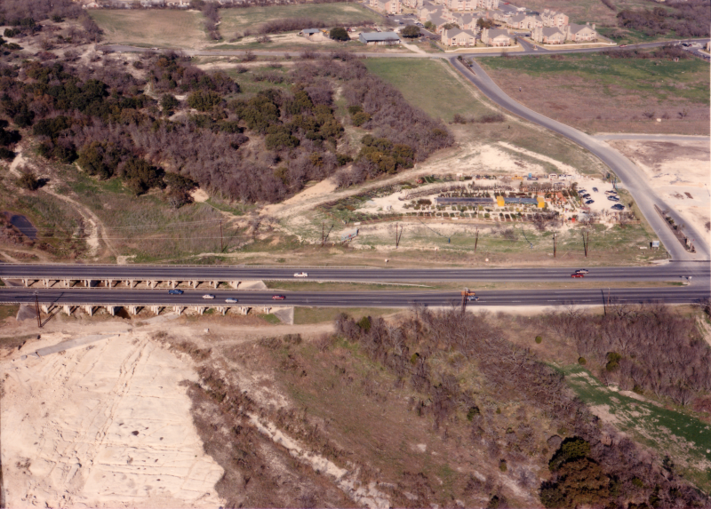
Bandera Rd. at Leon Creek looking northeast (ca. 1988) If you look closely, you can see a diagonal concrete slab in the creek bottom just in front of the bridges — this was the original Bandera Rd. route across the creek. At that time, the road made a sweeping S-curve in order to cross the creek at a right angle. The road was straightened and the creek bridged in 1948. (TxDOT) |
|
|
|
|
|
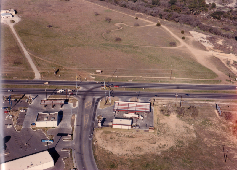
Bandera Rd. at Mainland Dr. looking northeast (ca. 1988) This is long before the Wal-Mart was built. (TxDOT) |
|
Bandera Rd. at Mainland Dr. looking northeast (ca. 1988) This is long before the Wal-Mart was built. (TxDOT) |
|
|
|
|
|
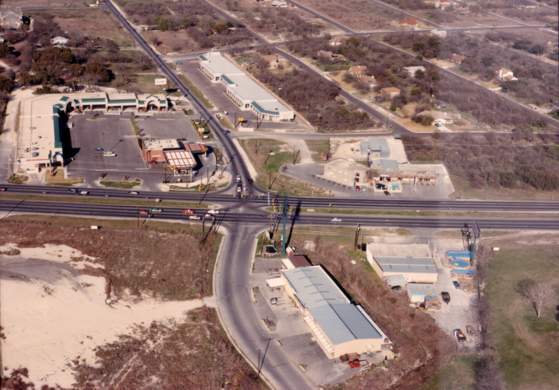
Bandera Rd. at Guilbeau Rd. looking northeast (ca. 1988) (TxDOT) |
|
Bandera Rd. at Guilbeau Rd. looking northeast (ca. 1988) (TxDOT) |
|
|
|
|
|
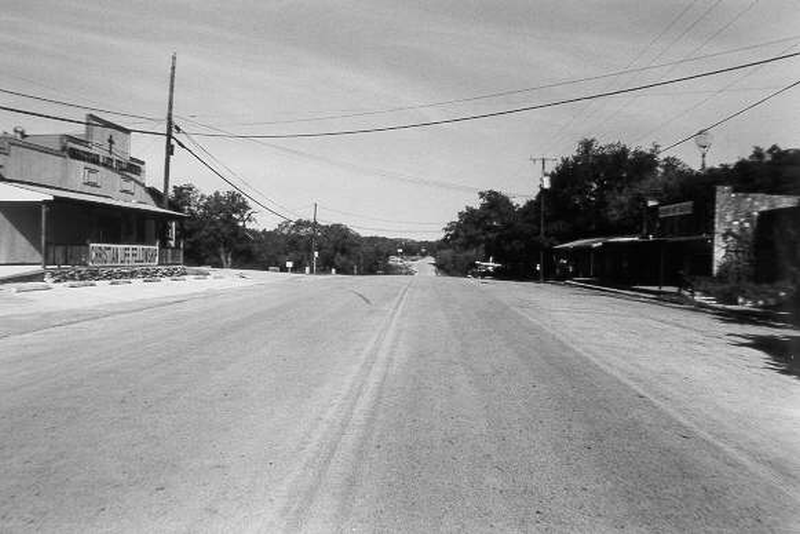
Old Bandera Rd. at Riggs Rd. in Helotes looking northwest (Date unknown) Not having any photos of Bandera Rd. in the Helotes area, I found this one at the site listed below. This is on what is now Old Bandera Rd. in Old Town Helotes and was the original route for Bandera (SH 16 nee SH 81 nee SH 27) before a bypass was built ca. 1970. (Palo Alto College Small Town Texas Projects) |
|
|
|
|