|
|
|
|
|
This page last updated March 8, 2024 |
Below are historical photos of the Fratt Interchange (I‑35 and Loop 410 North) along with a brief history of the interchange. The photos were sourced from the TxDOT photo library and the San Antonio TxDOT district office.
Locations are given using the present-day roadway names. The photos are generally arranged chronologically. Click on each photo for an enlarged view.
Click here to return to the historical photo galleries page.
|
ADVERTISEMENT |
Interchange history
The Fratt Interchange is so-named because it was adjacent to the former community of Fratt which was located in the area where Cowboys Dance Hall is today. The town was settled around 1900 and hit its heyday around 1930 before declining. The remaining structures were torn-down in the early 1980s to make way for the business park.
Until the early 1950s, Fratt was just a wide spot on the road to New Braunfels where US 81 (and SH 2 prior to that) passed under the railroad. It wasn't until the arrival of Loop 13 that Fratt became a major crossroads, first when Loop 13 was extended from the west around 1950, and then in 1952 when Loop 13 was extended from the south. The two intersections of Loop 13 with US 81 east and west of Fratt influenced the layout of the interchange that exists today.
The first proposal for an interchange was around 1954 in conjunction with the planning for what would become I‑35. That initial plan showed the new expressway using Randolph Blvd. instead of today's alignment. That was apparently short-lived as a new interchange plan in 1955 showed it connecting to today's routing to the north. That plan also introduced the long hairpin connector from northbound I‑35 to westbound Loop 410 that is still in use today.
From 1980 to 1983, the interchange was upgraded to its current form in a project that was, at the time, the largest single project ever undertaken by the Texas Highway Department.

|
First Fratt Interchange proposal (ca. 1954) Note that the eastern leg of US 81 is still shown using Randolph Blvd. (TxDOT) |
|
First Fratt Interchange proposal (ca. 1954) Note that the eastern leg of US 81 is still shown using Randolph Blvd. (TxDOT) |
|
|
|
|
|
Fratt Interchange plan (1955) This plan shows the eventual route for I‑35 north of the interchange as well as the first appearance of the hairpin ramp from northbound I‑35 to westbound Loop 410. (TxDOT) |
|
Fratt Interchange plan (1955) This plan shows the eventual route for I‑35 north of the interchange as well as the first appearance of the hairpin ramp from northbound I‑35 to westbound Loop 410. (TxDOT) |
|
|
|
|
|
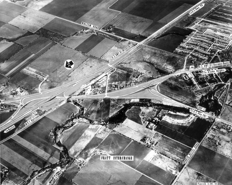
Fratt Interchange looking northwest (ca. 1955) An overview of the interchange area prior to construction. Especially note the long Y intersection where Loop 13 headed to the south splits from US 81; this influenced the future layout of the interchange. The black square was hand-drawn to indicate the desired cropping of the photo. (TxDOT) |
|
|
|
|
|
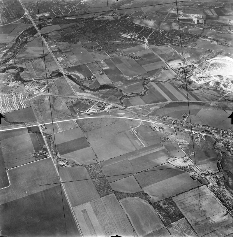
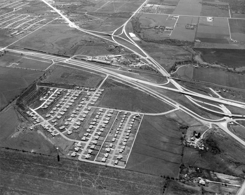
Fratt Interchange looking southeast (1956) Construction is underway on the interchange. Note the single residential street at the top left; this is Weathercock Lane and was the first street in Windcrest. (TxDOT/Jack Ammann Photogrammetric Engineers) |
|
Fratt Interchange looking southeast (1956) Construction is underway on the interchange. Note the single residential street at the top left; this is Weathercock Lane and was the first street in Windcrest. (TxDOT/Jack Ammann Photogrammetric Engineers) |
|
|
|
|
|
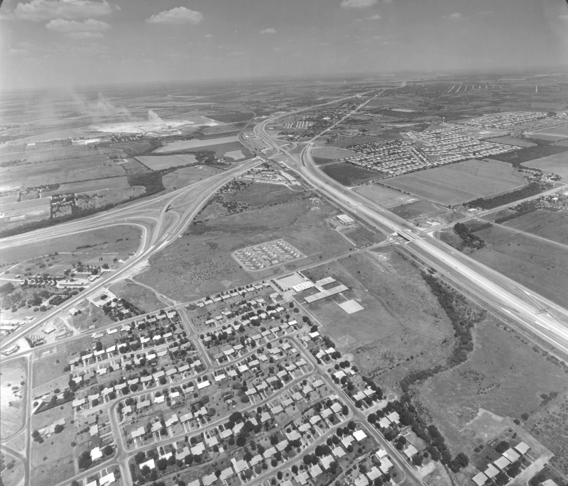
Fratt Interchange looking southwest (ca. 1958) This is shortly after completion of the interchange. The community of Fratt is clearly seen here. (TxDOT) |
|
Fratt Interchange looking southwest (ca. 1958) This is shortly after completion of the interchange. The community of Fratt is clearly seen here. (TxDOT) |
|
|
|
|
|
Fratt Interchange looking east-northeast (ca. 1958) Another view of the completed interchange. Fratt is to the right. (TxDOT) |
|
Fratt Interchange looking east-northeast (ca. 1958) Another view of the completed interchange. Fratt is to the right. (TxDOT) |
|
|
|
|
|
Fratt Interchange looking northeast (ca. 1963) In the foreground is an artist's overlay of proposed improvements (access roads, ramps, and an overpass) for Loop 13 between the railroad tracks and Austin Highway. (TxDOT) |
|
Fratt Interchange looking northeast (ca. 1963) In the foreground is an artist's overlay of proposed improvements (access roads, ramps, and an overpass) for Loop 13 between the railroad tracks and Austin Highway. (TxDOT) |
|
|
|
|
|
Fratt Interchange looking southwest (ca. 1963) This is looking toward the west from the I‑35 overpass. (TxDOT) |
|
Fratt Interchange looking southwest (ca. 1963) This is looking toward the west from the I‑35 overpass. (TxDOT) |
|
|
|
|
|
Fratt Interchange looking southwest (ca. 1963) This is looking west at the I‑35 overpass. (TxDOT) |
|
Fratt Interchange looking southwest (ca. 1963) This is looking west at the I‑35 overpass. (TxDOT) |
|
|
|
|
|
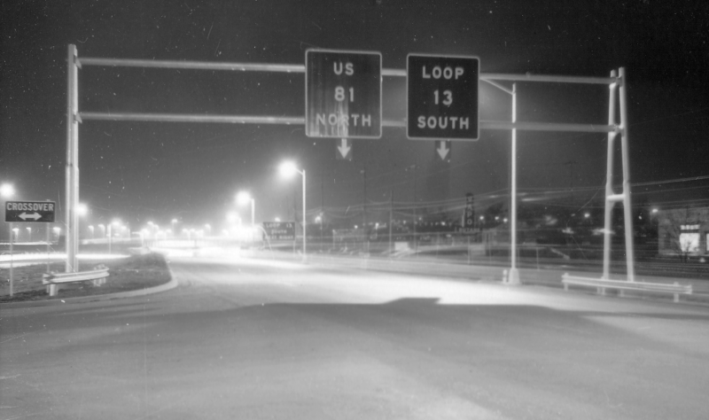
Overhead signs at Fratt Interchange looking east (ca. 1963) Note the lack of route shields and the attached arrows at the bottom. (TxDOT) |
|
Overhead signs at Fratt Interchange looking east (ca. 1963) Note the lack of route shields and the attached arrows at the bottom. (TxDOT) |
|
|
|
|
|
Fratt Interchange looking southwest (ca. 1963) (TxDOT) |
|
Fratt Interchange looking southwest (ca. 1963) (TxDOT) |
|
|
|
|
|
Fratt Interchange looking northeast (1965) (TxDOT) |
|
Fratt Interchange looking northeast (1965) (TxDOT) |
|
|
|
|

|
Fratt Interchange looking northeast (ca. 1980) (TxDOT) |
|
Fratt Interchange looking northeast (ca. 1980) (TxDOT) |
|
|
|
|
|
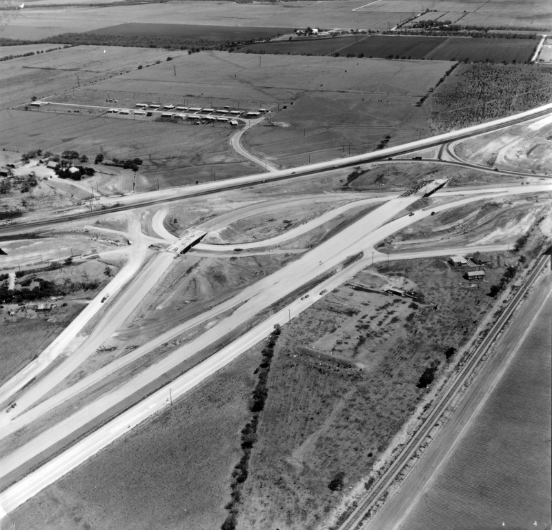
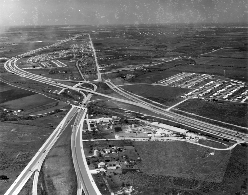
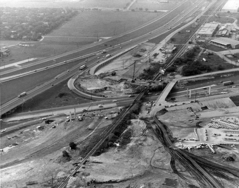
Fratt Interchange looking south (ca. 1980) This is shortly after construction began to upgrade the interchange. (TxDOT) |
|
Fratt Interchange looking south (ca. 1980) This is shortly after construction began to upgrade the interchange. (TxDOT) |
|
|
|
|
|
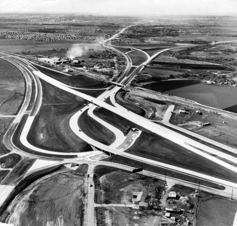
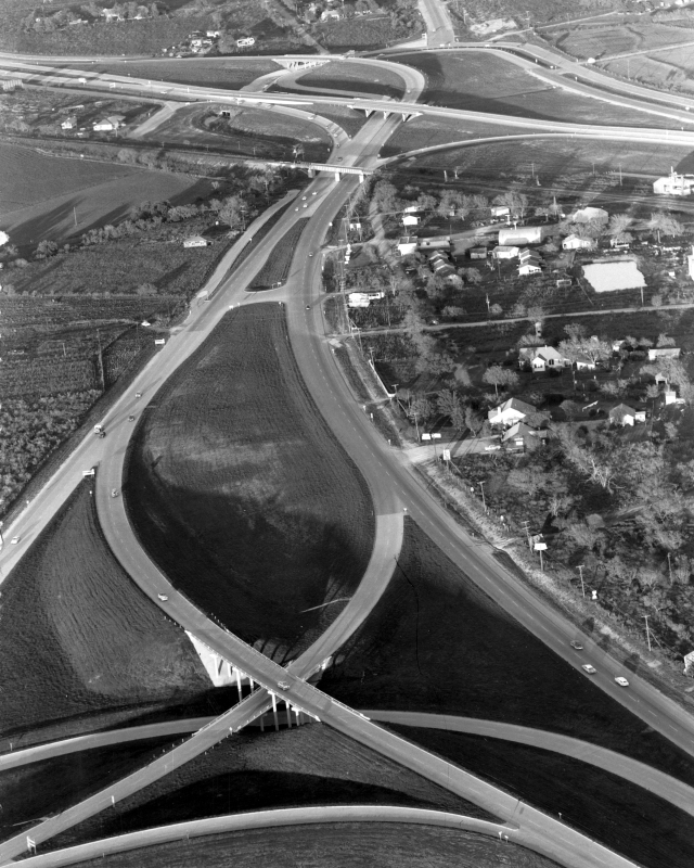
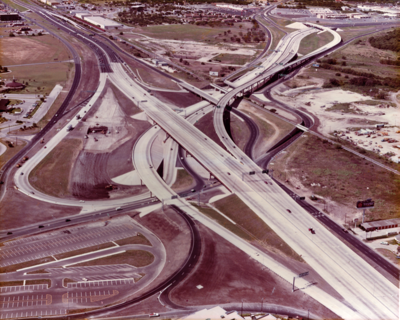
Fratt Interchange looking southwest (1983) This was as work was nearing completion on the upgraded interchange. In the foreground you can see the VIA Park & Ride. (TxDOT/Clint Oehler) |
|
Fratt Interchange looking southwest (1983) This was as work was nearing completion on the upgraded interchange. In the foreground you can see the VIA Park & Ride. (TxDOT/Clint Oehler) |
|
|
|
|
|
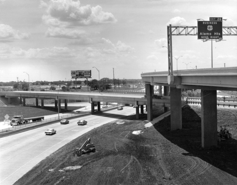
Fratt Interchange looking southwest (ca. 1983) (TxDOT) |
|
Fratt Interchange looking southwest (ca. 1983) (TxDOT) |
|
|
|
|