|
|
|
|
|
This page last updated December 30, 2024 |
Below are historical photos of Fredericksburg Road — including the old highway to Boerne and Comfort — along with a brief history of the route. The photos were sourced from the TxDOT photo library, the San Antonio TxDOT district office, the Texas Transportation Museum, and an anonymous contributor.
Locations are given using the present-day roadway names. The photos are arranged generally from south to north. Click on each photo for an enlarged view.
Click here to return to the historical photo galleries page.
|
ADVERTISEMENT |
Route history


This road was part of the Old Spanish Trail, or OST, which was a transcontinental auto trail that had its headquarters in San Antonio. The section of road between San Antonio and Boerne was known as the "Headquarters Section" and was used to test various enhancements such as beautification and architectural features as well as road and safety improvements that could become a model for other localities to emulate.
When the state highway system was first developed in 1917, this road was designated State Highway 9. By the early 1920s, it also became part of SH 27 to Kerrville.
When the US Highway System was first designated in 1925, this road was numbered US 290, which ran via Comfort to Kerrville and points west. Meanwhile, the road from Comfort to Fredericksburg (SH 9) was numbered US 385. Initially, these routes met in Comfort, but by the late '20s, it appears the route for US 385 was rerouted away from Comfort and instead ran through Waring and Welfare to meet US 290 at Nelson City (where PoPo's is), likely to facilitate a more direct route to San Antonio. Although the official southern terminus for US 385 was listed as being at its junction with US 290, it appears that by 1932, US 385 was co-signed with US 290 along the Fredericksburg Road into San Antonio, likely to provide a more logical terminus for the route in San Antonio.
In a 1935 revision of the system, US 87 was extended south from Wyoming into Texas and supplanted US 385. At the same time, US 290 was rerouted east from north of Mountain Home through Fredericksburg, Austin, and on to Houston, leaving the segment from Comfort through Kerrville and Mountain Home as SH 27. Finally, a new road for US 87 from Fredericksburg to Comfort was also completed around that time.
In Bexar County, the route has been fairly stable, running along Fredericksburg Road in San Antonio. Around today's Loop 1604, the route initially used what's now Old Fredericksburg Road; this was bypassed by the current route in the mid '30s. Between Leon Springs and Boerne, the route initially ran along today's Boerne Stage Rd.; that section was bypassed by a new more direct road (now I‑10) in the mid '30.
The city's first expressway opened in 1949 to bypass the chronically congested Five Points area and funnel US 87 traffic directly between downtown and Fredericksburg Rd. at Woodlawn Ave. The remainder of Fredericksburg Rd. was bypassed by today's I‑10 in 1960 and '61, and Fredericksburg Road west of I‑10 was then redesignated as Loop 345 but was signed as Business US 87 until the early '90s. The rest of the route north to Boerne was upgraded to I‑10 in 1966 and '68.
A more detailed route history is available here.
|
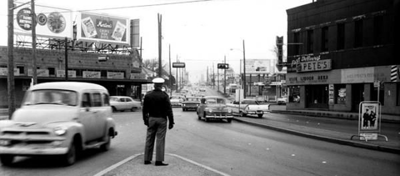
Fredericksburg Rd. at Five Points looking northwest (ca. 1958) (Texas Transportation Museum) |
|
Fredericksburg Rd. at Five Points looking northwest (ca. 1958) (Texas Transportation Museum) |
|
|
|
|
|
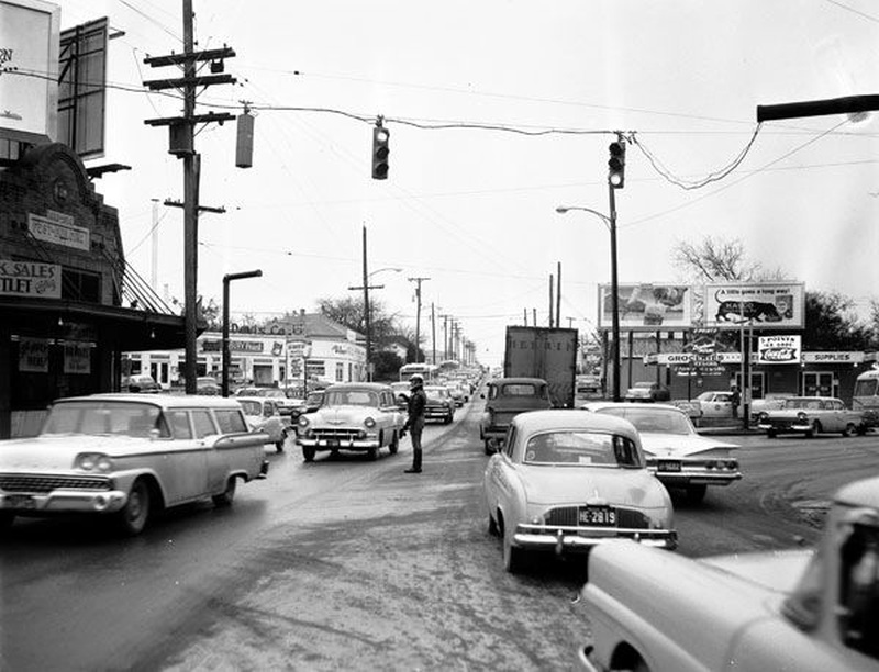
Fredericksburg Rd. at Five Points looking northwest (1961) (Texas Transportation Museum) |
|
Fredericksburg Rd. at Five Points looking northwest (1961) (Texas Transportation Museum) |
|
|
|
|
|
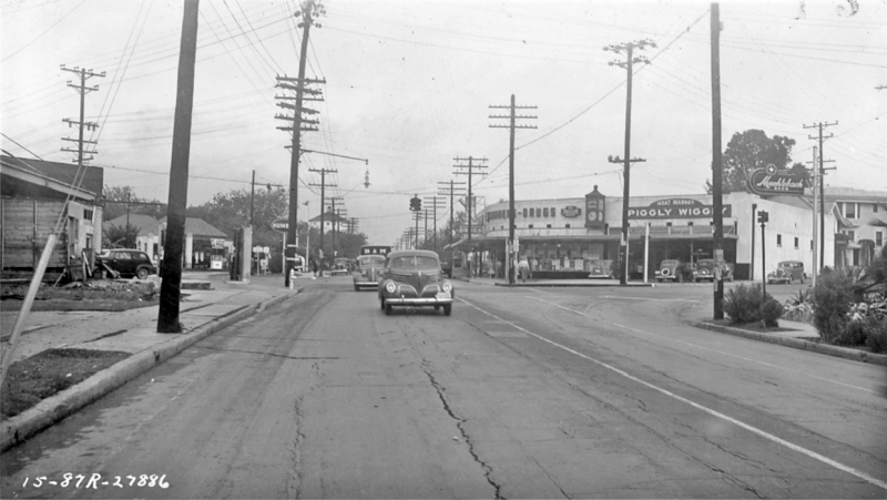
Fredericksburg Rd. at Cincinnati Ave. looking northwest (ca. 1940) (TxDOT) |
|
Fredericksburg Rd. at Cincinnati Ave. looking northwest (ca. 1940) (TxDOT) |
|
|
|
|
|
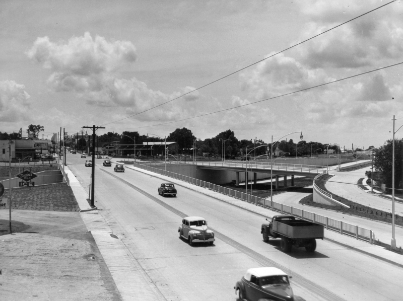
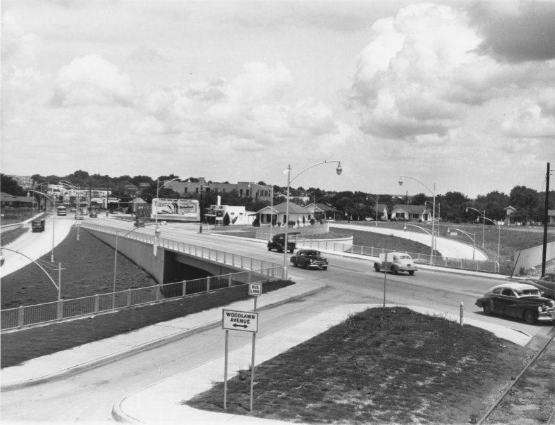
Fredericksburg Rd. at I-10 looking southeast (ca. 1949) This was shortly after the expressway opened. (TxDOT) |
|
Fredericksburg Rd. at I-10 looking southeast (ca. 1949) This was shortly after the expressway opened. (TxDOT) |
|
|
|
|
|
Fredericksburg Rd. at I-10 looking northwest (ca. 1950) The US 87 expressway ended here at this time. To the right, you can see a ramp curving up from the underpass-- the carried traffic from the expressway onto northbound Fredericksburg Rd. at Magnolia Ave. (TxDOT) |
|
Fredericksburg Rd. at I-10 looking northwest (ca. 1950) The US 87 expressway ended here at this time. To the right, you can see a ramp curving up from the underpass-- the carried traffic from the expressway onto northbound Fredericksburg Rd. at Magnolia Ave. (TxDOT) |
|
|
|
|
|
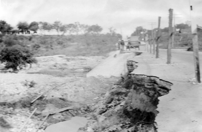
Fredericksburg Rd. probably at Martinez Creek looking northwest (1921) This photo shows flood damage. (TxDOT) |
|
Fredericksburg Rd. probably at Martinez Creek looking northwest (1921) This photo shows flood damage. (TxDOT) |
|
|
|
|
|
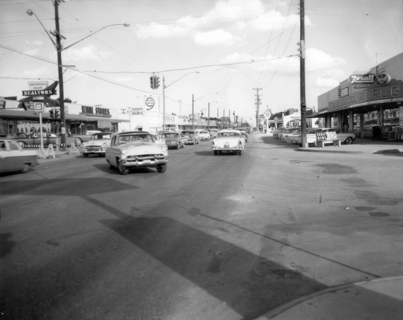
Fredericksburg Rd. at Donaldson Ave. looking southeast (ca. 1959) (TxDOT) |
|
Fredericksburg Rd. at Donaldson Ave. looking southeast (ca. 1959) (TxDOT) |
|
|
|
|
|
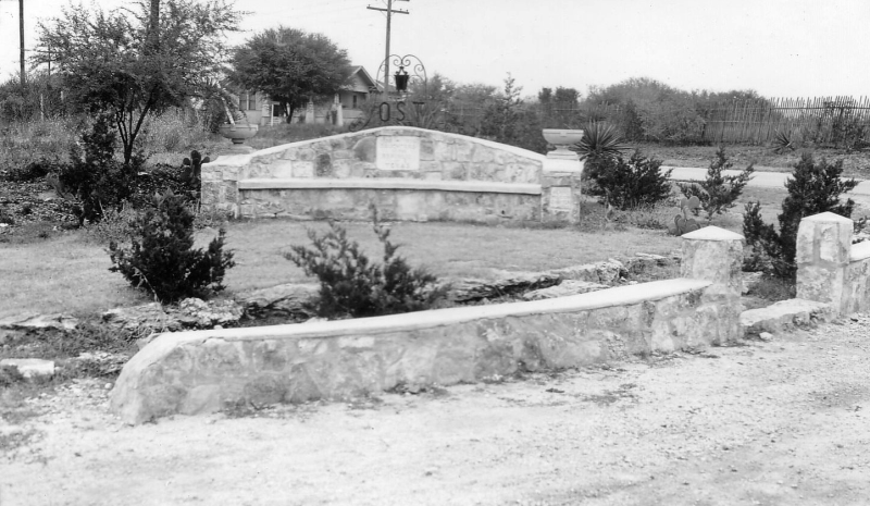
Old Spanish Trail monument at Fredericksburg Rd. and Vance Jackson Rd. (ca. 1936) This monument was placed by the Daughters of the Republic of Texas to commemorate the OST and is still there today! (TxDOT) |
|
Old Spanish Trail monument at Fredericksburg Rd. and Vance Jackson Rd. (ca. 1936) This monument was placed by the Daughters of the Republic of Texas to commemorate the OST and is still there today! (TxDOT) |
|
|
|
|
|
Fredericksburg Rd. at Vance Jackson Rd. looking northwest (1959) The monument in the photo above is near the center of this photo. (TxDOT) |
|
Fredericksburg Rd. at Vance Jackson Rd. looking northwest (1959) The monument in the photo above is near the center of this photo. (TxDOT) |
|
|
|
|
|
Fredericksburg Rd. at Vance Jackson Rd. looking southeast (1959) (TxDOT) |
|
Fredericksburg Rd. at Vance Jackson Rd. looking southeast (1959) (TxDOT) |
|
|
|
|
|
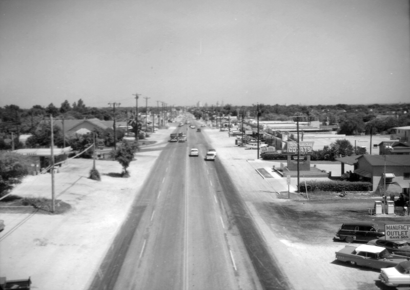
Fredericksburg Rd. at Gardina St. looking northwest (1959) (TxDOT) |
|
Fredericksburg Rd. at Gardina St. looking northwest (1959) (TxDOT) |
|
|
|
|
|
Fredericksburg Rd. at Gardina St. looking southeast (1959) (TxDOT) |
|
Fredericksburg Rd. at Gardina St. looking southeast (1959) (TxDOT) |
|
|
|
|
|
Fredericksburg Rd. at Williamsburg Pl. looking southeast (1959) (TxDOT) |
|
Fredericksburg Rd. at Williamsburg Pl. looking southeast (1959) (TxDOT) |
|
|
|
|

|
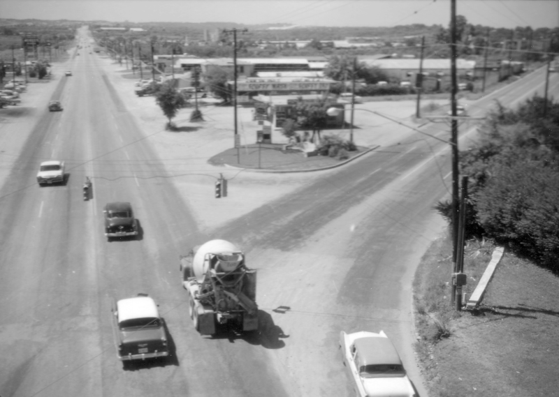
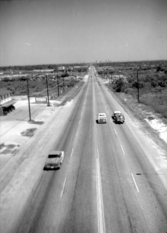
Fredericksburg Rd. at Balcones Dr./Spencer Ln. looking northwest (1959) (TxDOT) |
|
Fredericksburg Rd. at Balcones Dr./Spencer Ln. looking northwest (1959) (TxDOT) |
|
|
|
|
|
Fredericksburg Rd. near Oaklawn Dr. looking northwest (1921) Today's Callaghan Rd. crosses near the middle of this photo. (TxDOT) |
|
Fredericksburg Rd. near Oaklawn Dr. looking northwest (1921) Today's Callaghan Rd. crosses near the middle of this photo. (TxDOT) |
|
|
|
|
|
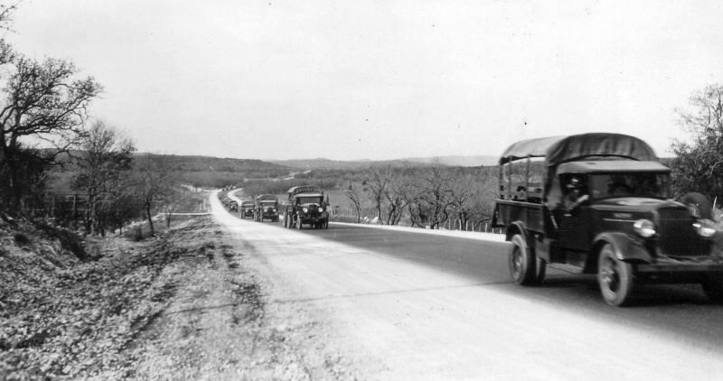
Fredericksburg Rd. (today's I-10) near UTSA Blvd. looking north (ca. 1935) View of an Army convoy heading back to San Antonio from Camp Bullis. (TxDOT) |
|
Fredericksburg Rd. (today's I-10) near UTSA Blvd. looking north (ca. 1935) View of an Army convoy heading back to San Antonio from Camp Bullis. (TxDOT) |
|
|
|
|
|
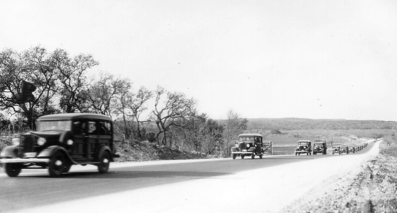
Fredericksburg Rd. (today's I-10) near UTSA Blvd. looking north (ca. 1935) Another view of an Army convoy heading back to San Antonio from Camp Bullis (TxDOT) |
|
Fredericksburg Rd. (today's I-10) near UTSA Blvd. looking north (ca. 1935) Another view of an Army convoy heading back to San Antonio from Camp Bullis (TxDOT) |
|
|
|
|
|
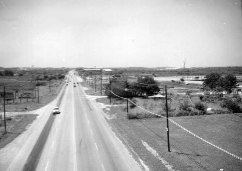
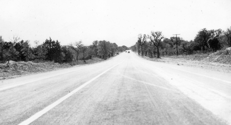
Fredericksburg Rd. - Location unknown (ca. 1935) This is the highway somewhere between San Antonio and Boerne, possibly in the Leon Springs area. (TxDOT) |
|
Fredericksburg Rd. - Location unknown (ca. 1935) This is the highway somewhere between San Antonio and Boerne, possibly in the Leon Springs area. (TxDOT) |
|
|
|
|
|
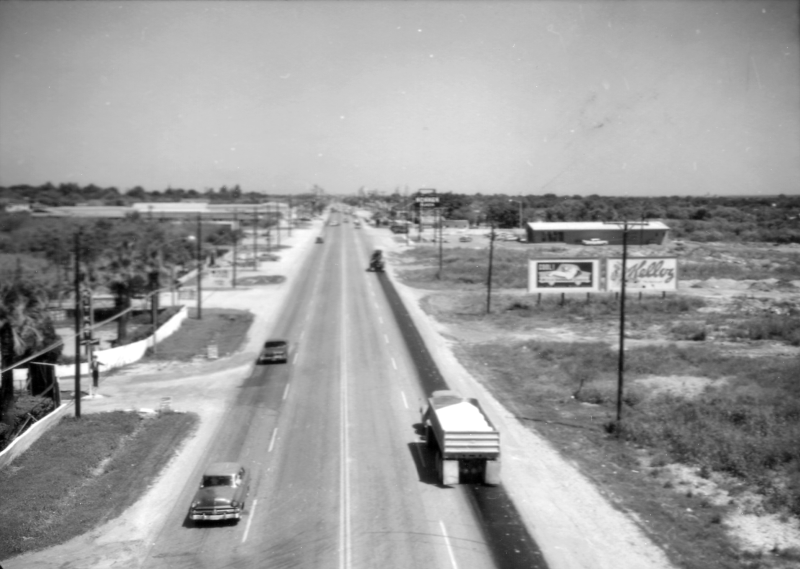
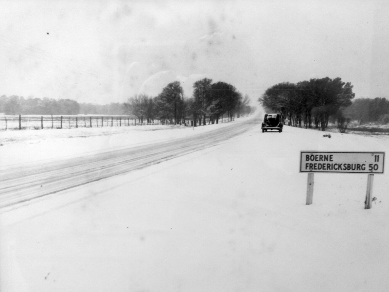
US 87 in Leon Springs looking northwest (1940) This is on today's westbound I-10 access road just north of Boerne Stage Rd. (Anonymous contributor) |
|
US 87 in Leon Springs looking northwest (1940) This is on today's westbound I-10 access road just north of Boerne Stage Rd. (Anonymous contributor) |
|
|
|
|
|
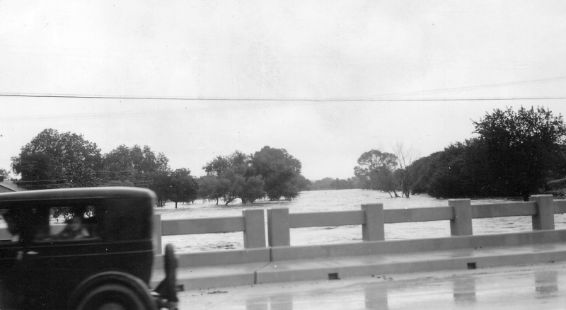
Main St. bridge in Boerne probably looking east (ca. 1935) Photo shows flooding in progress on Cibolo Creek. (TxDOT) |
|
Main St. bridge in Boerne probably looking east (ca. 1935) Photo shows flooding in progress on Cibolo Creek. (TxDOT) |
|
|
|
|
|
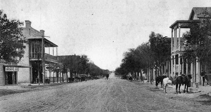
Main St. at James St. in Boerne looking north (ca. 1900) (Wikipedia Commons/Public domain) |
|
Main St. at James St. in Boerne looking north (ca. 1900) (Wikipedia Commons/Public domain) |
|
|
|
|
|
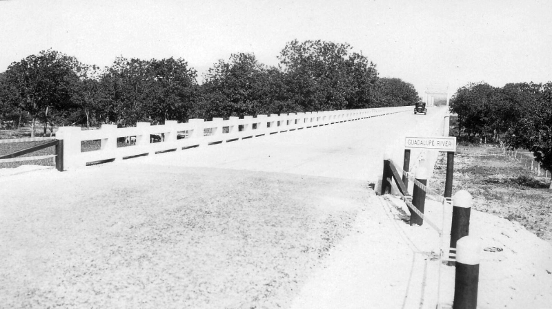
US 87 bridge over Guadalupe River south of Comfort probably looking northwest (ca. 1935) This bridge has since been replaced. (TxDOT) |
|
US 87 bridge over Guadalupe River south of Comfort probably looking northwest (ca. 1935) This bridge has since been replaced. (TxDOT) |
|
|
|
|
|
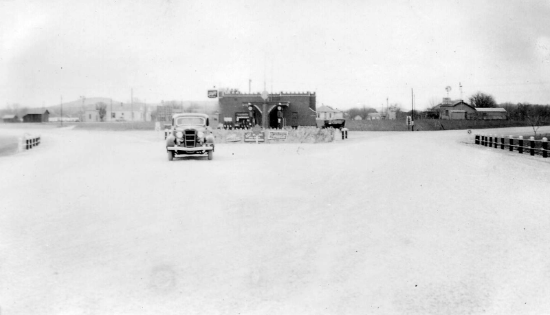
Business US 87 and Ave. A in Comfort looking south (ca. 1935) At this time, this was the junction of US 87, SH 9, and SH 27. The right fork was SH 27 to Kerrville while the left fork was US 87 and SH 9 to San Antonio. The building in the middle was a gas station and still exists today. (TxDOT) |
|
Business US 87 and Ave. A in Comfort looking south (ca. 1935) At this time, this was the junction of US 87, SH 9, and SH 27. The right fork was SH 27 to Kerrville while the left fork was US 87 and SH 9 to San Antonio. The building in the middle was a gas station and still exists today. (TxDOT) |
|
|
|
|
|
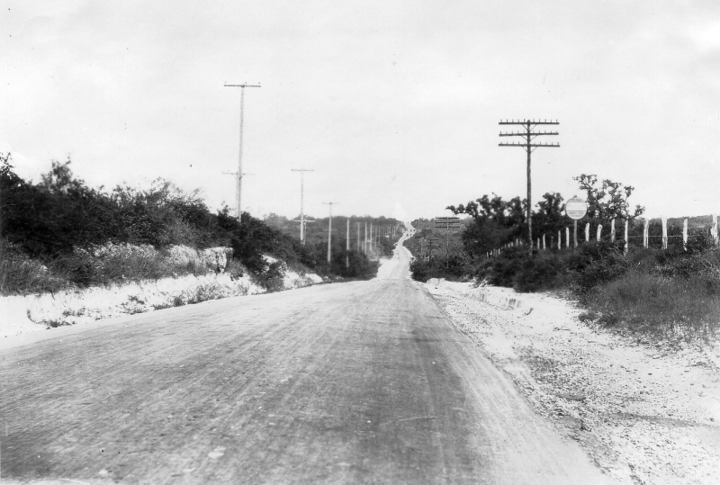
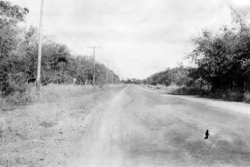
Fredericksburg Rd. - Location unknown (1921) This is somewhere in Bexar County. (TxDOT) |
|
Fredericksburg Rd. - Location unknown (1921) This is somewhere in Bexar County. (TxDOT) |
|
|
|
|
|
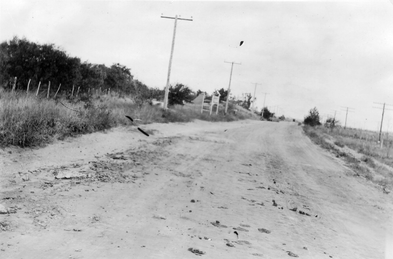
Fredericksburg Rd. - Location unknown (1921) This is somewhere in Bexar County. (TxDOT) |
|
Fredericksburg Rd. - Location unknown (1921) This is somewhere in Bexar County. (TxDOT) |
|
|
|
|