|
|
|
|
|
This page last updated March 5, 2024 |
Below are historical photos of Interstate 10 East along with a brief history of the route. The photos were sourced from the TxDOT photo library and the San Antonio TxDOT district office.
Locations are given using the present-day roadway names. The photos are arranged generally from west to east. Click on each photo for an enlarged view.
Click here to return to the historical photo galleries page.
|
ADVERTISEMENT |
Route history


The stretch of today's I‑10 east of Commerce St. was first built in 1932 as a two-lane highway to replace the previous route to Seguin via today's FM 78. The city's early expressway plans called for it to be upgraded to an expressway that connected to today's I‑35 near Frost Bank Center Dr. However, in the early '50s, that was dropped and a few different proposals to route it through the East Side were proposed until the final route was settled around 1959.
That same year, the first section to be upgraded to a freeway was completed from just inside today's Loop 410 to near FM 1516. The segment from there to the county line was upgraded in 1962, and the first rest area on an Interstate Highway in Texas opened near FM 1518 the following year. In 1964, the section from Commerce St. east to Loop 410 was completed along with the Loop 410 cloverleaf. 1967 saw the opening of the section between I‑35 and I37, and finally in 1968 the remainder of the route from I‑37 to Commerce St. opened.
More details on the history of I‑10 is available here.
|
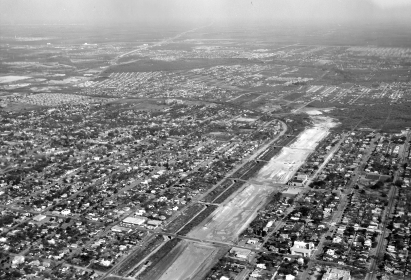
I-10 at New Braunfels Ave. looking northeast (ca. 1967) (TxDOT) |
|
I-10 at New Braunfels Ave. looking northeast (ca. 1967) (TxDOT) |
|
|
|
|
|
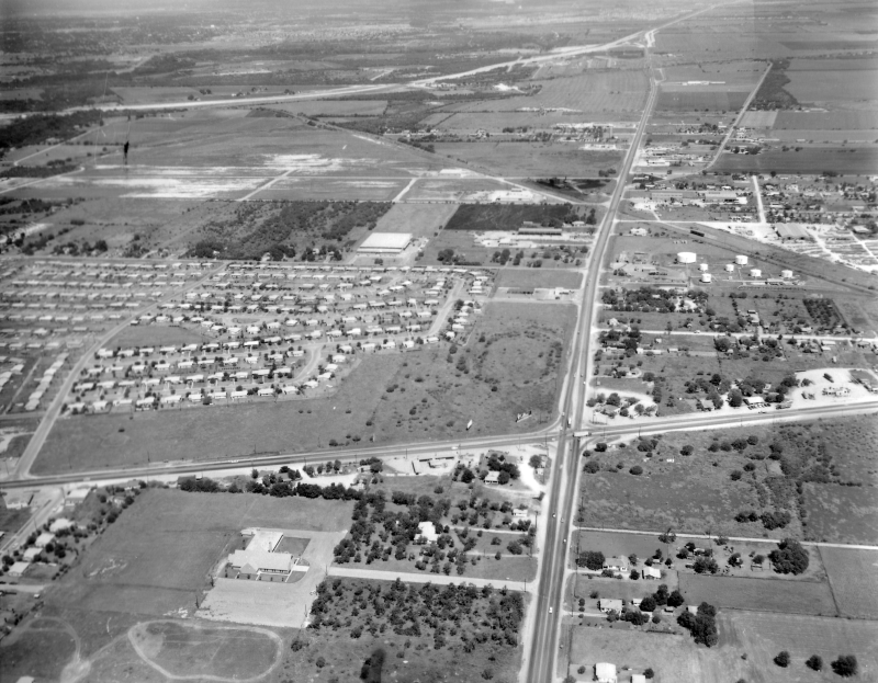
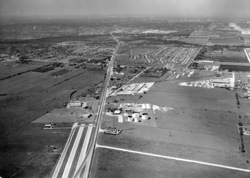
I-10 at WW White Rd. looking north (ca. 1962) Today's I-10 is where the the road running left to right in the foreground is which, at the time, was US 90. You can see I-35 curving from west to north in the distance. (TxDOT) |
|
I-10 at WW White Rd. looking north (ca. 1962) Today's I-10 is where the the road running left to right in the foreground is which, at the time, was US 90. You can see I-35 curving from west to north in the distance. (TxDOT) |
|
|
|
|
|
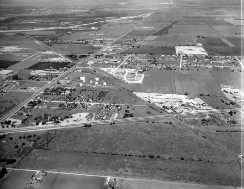
I-10 near WW White Rd. looking northwest (ca. 1962) (TxDOT) |
|
I-10 near WW White Rd. looking northwest (ca. 1962) (TxDOT) |
|
|
|
|
|
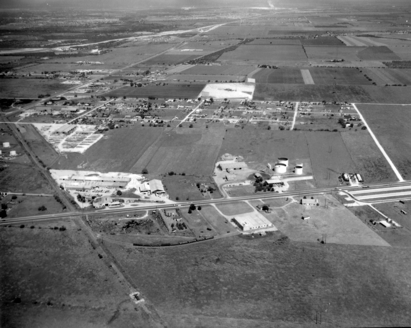
I-10 near WW White Rd. looking north (ca. 1962) Notice the truncated section of freeway at the very right. (TxDOT) |
|
I-10 near WW White Rd. looking north (ca. 1962) Notice the truncated section of freeway at the very right. (TxDOT) |
|
|
|
|
|
I-10 at Loop 410 looking southwest (ca. 1962) Notice the end of the freeway in the foreground. (TxDOT) |
|
I-10 at Loop 410 looking southwest (ca. 1962) Notice the end of the freeway in the foreground. (TxDOT) |
|
|
|
|
|
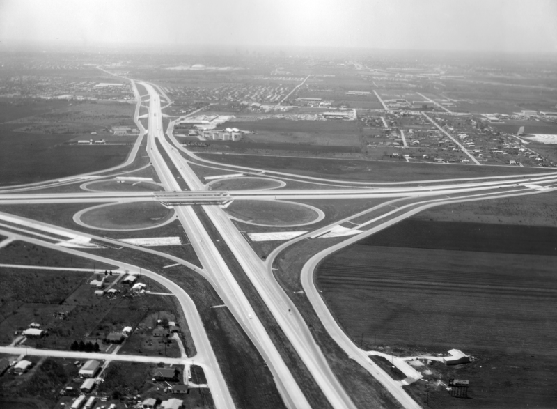
I-10 at Loop 410 looking southwest (ca. 1965) This was just after the interchange was completed. Notice in the distance that the freeway ends and merges onto Commerce St. (TxDOT) |
|
I-10 at Loop 410 looking southwest (ca. 1965) This was just after the interchange was completed. Notice in the distance that the freeway ends and merges onto Commerce St. (TxDOT) |
|
|
|
|
|
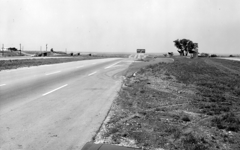
I-10 at rest area near FM 1518 looking west (ca. 1965) This was the first Interstate rest area to open in Texas. It was removed sometime around 2006. (TxDOT) |
|
I-10 at rest area near FM 1518 looking west (ca. 1965) This was the first Interstate rest area to open in Texas. It was removed sometime around 2006. (TxDOT) |
|
|
|
|