|
|
|
|
|
This page last updated March 8, 2024 |
Below are historical photos of Texas road signs. The photos were sourced from the TxDOT photo library, the San Antonio TxDOT district office, Texas Highways magazine, and a couple of federal government sources.
Click on each photo for an enlarged view.
Click here to return to the historical photo galleries page.
|
ADVERTISEMENT |
|
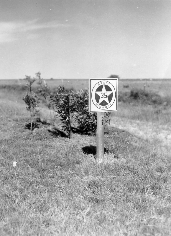
SH 35 route marker (ca. 1930) This was the original Texas State Highway shield. This one was probably between Houston and Corpus Christi. (TxDOT) |
|
SH 35 route marker (ca. 1930) This was the original Texas State Highway shield. This one was probably between Houston and Corpus Christi. (TxDOT) |
|
|
|
|
|
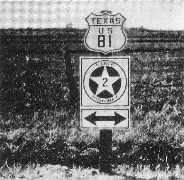
US 81/SH 2 route markers (ca. 1930) This shows the first version of the US Highway route shield. (TxDOT) |
|
US 81/SH 2 route markers (ca. 1930) This shows the first version of the US Highway route shield. (TxDOT) |
|
|
|
|
|
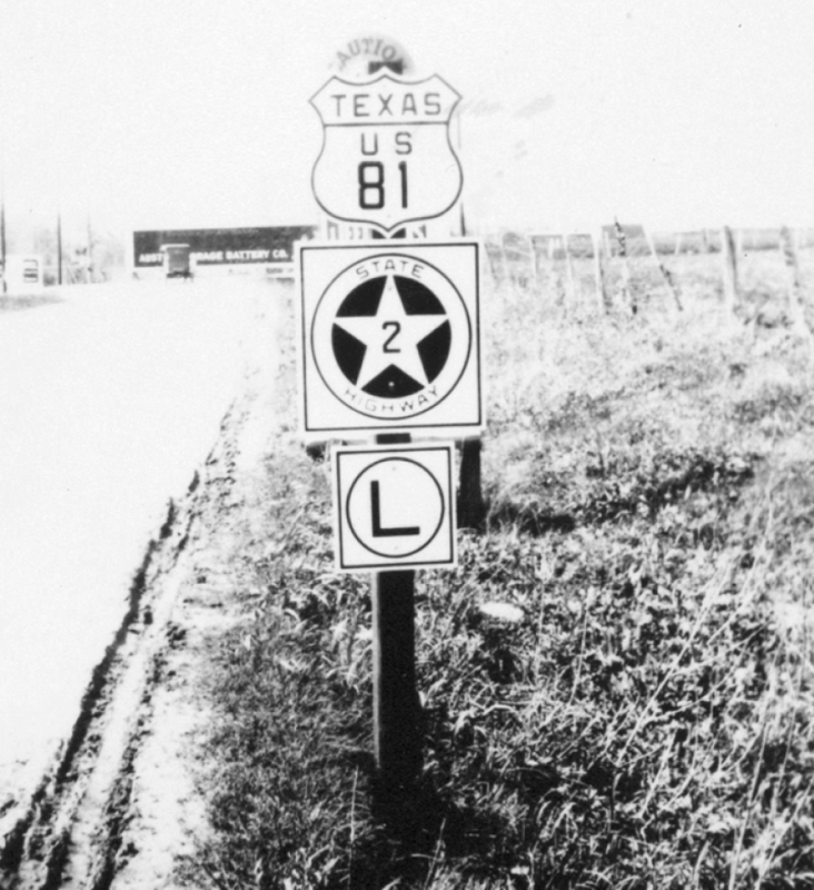
US 81/SH 2 route markers (ca. 1930) The "L" sign at the bottom indicated that these routes turned left at the intersection ahead. (TxDOT) |
|
US 81/SH 2 route markers (ca. 1930) The "L" sign at the bottom indicated that these routes turned left at the intersection ahead. (TxDOT) |
|
|
|
|
|
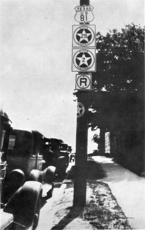
US 81/SH 2/SH 29 route markers in Austin (ca. 1930) Like the one above, the "R" sign indicated that the routes turned right at the intersection ahead. Also note the state highway shield wrapped around the pole — route markings were often stenciled on poles and bridge rails during this time. (TxDOT) |
|
|
|
|
|
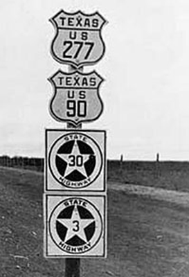
US 277/US 90/SH 30/SH 3 route markers near Del Rio (ca. 1930) (Source unknown) |
|
US 277/US 90/SH 30/SH 3 route markers near Del Rio (ca. 1930) (Source unknown) |
|
|
|
|
|
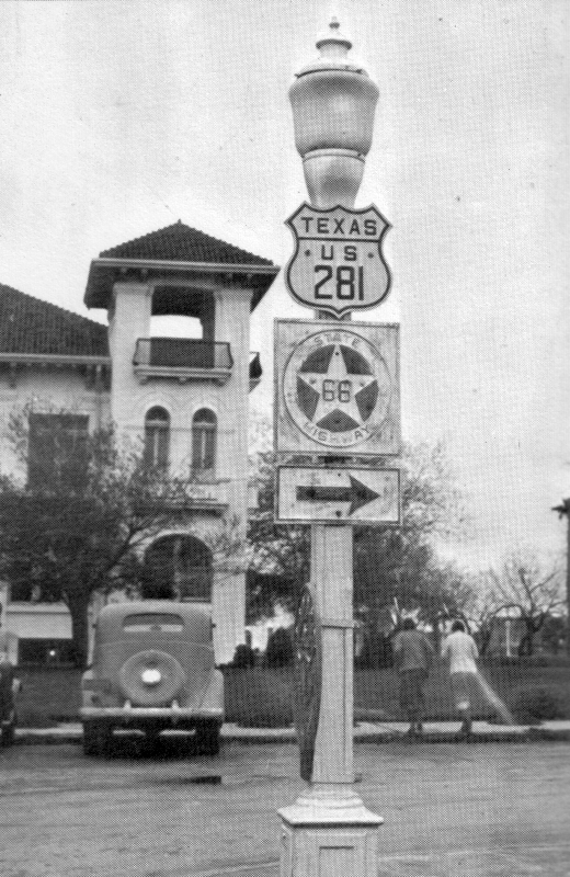
US 281/SH 66 route markers in Harlingen (ca. 1935) (Texas Highways) |
|
US 281/SH 66 route markers in Harlingen (ca. 1935) (Texas Highways) |
|
|
|
|
|
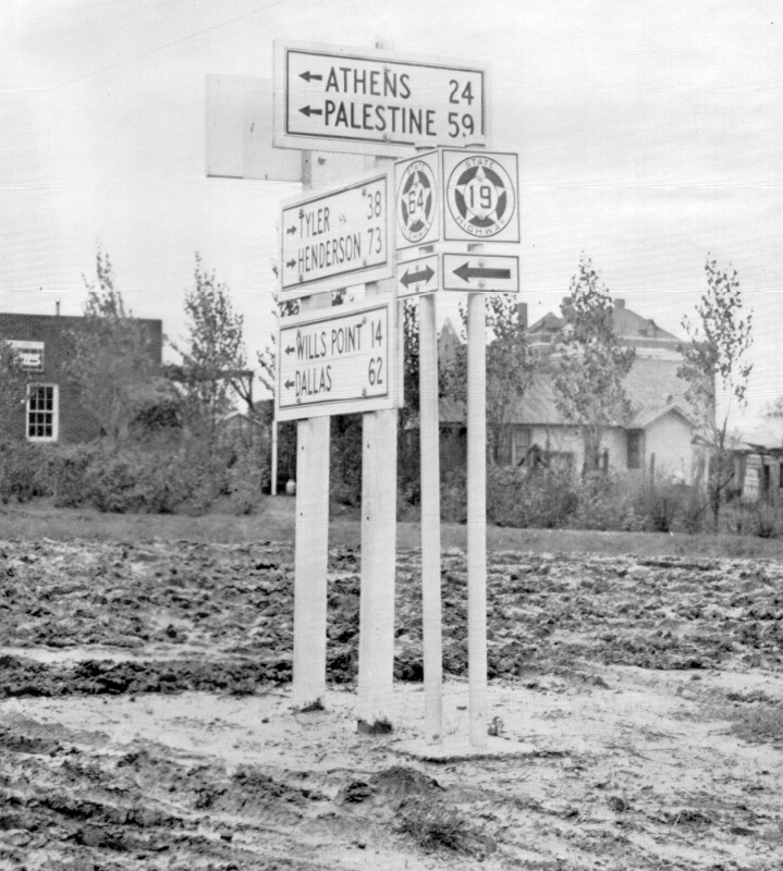
Route markers in Canton (ca. 1935) Of note is the larger area in the middle of the state highway shield for the number, and the black-and-white guide signs. But perhaps even more noteworthy is the extreme condition of the roads. (Texas Highways) |
|
Route markers in Canton (ca. 1935) Of note is the larger area in the middle of the state highway shield for the number, and the black-and-white guide signs. But perhaps even more noteworthy is the extreme condition of the roads. (Texas Highways) |
|
|
|
|
|
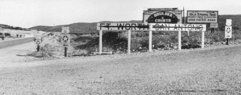
Route markers at US 80/US 290 intersection (ca. 1935) This is today's intersection of I‑10 and I‑20 in West Texas. Note the oversized guide signs. Also note the sign for the Old Spanish Trail. (Texas Highways) |
|
Route markers at US 80/US 290 intersection (ca. 1935) This is today's intersection of I‑10 and I‑20 in West Texas. Note the oversized guide signs. Also note the sign for the Old Spanish Trail. (Texas Highways) |
|
|
|
|
|
Route markers in Waco (1939) This photo shows the second-generation state highway shields. (Farm Security Administration) |
|
Route markers in Waco (1939) This photo shows the second-generation state highway shields. (Farm Security Administration) |
|
|
|
|
|
Route markers in Waco (ca. 1940) Another second-generation state highway shield, but also note the omission of "Texas" on the US highway shields — this was an alternate form of the US Highway shield that seemed to be more favored around this time. (Library of Congress) |
|
Route markers in Waco (ca. 1940) Another second-generation state highway shield, but also note the omission of "Texas" on the US highway shields — it seems this became more common starting around this time. (Library of Congress) |
|
|
|
|
|
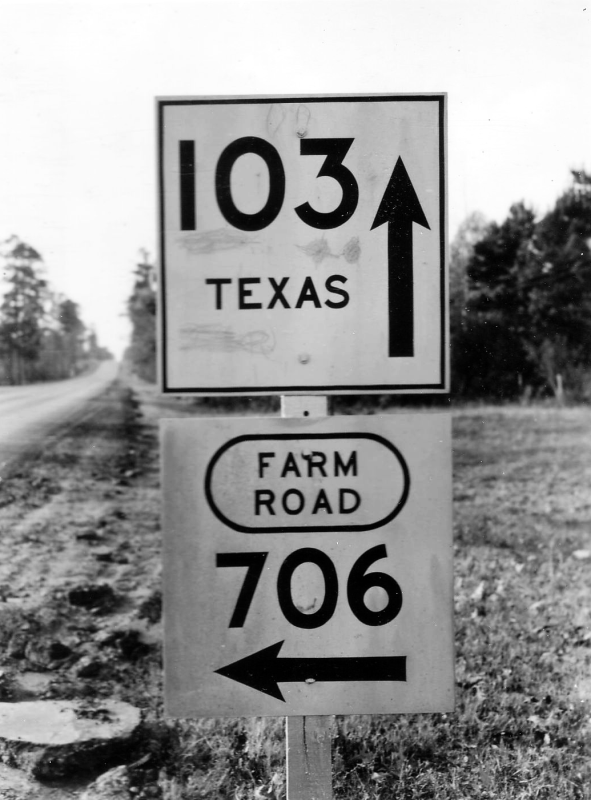
SH 103 at FM 706, Angelina County west of Lufkin (1945) An early version of the Farm-to-Market road sign and yet another version of the state highway marker. Note the integrated arrows on the route signs. (TxDOT) |
|
SH 103 at FM 706, Angelina County west of Lufkin (1945) An early version of the Farm-to-Market road sign and yet another version of the state highway marker. Note the integrated arrows on the route signs. (TxDOT) |
|
|
|
|
|
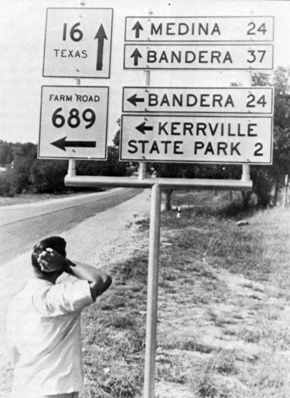
SH 16 and FM 689 (today's SH 173) in Kerrville (1955) Another early version of the Farm-to-Market sign (bottom left). (Texas Highways) |
|
SH 16 and FM 689 (today's SH 173) in Kerrville (1955) Another early version of the Farm-to-Market sign (bottom left). (Texas Highways) |
|
|
|
|
|
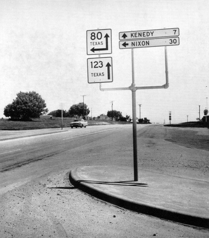
SH 80/SH 123 route markers (1960) This picture was printed in Texas Highways with a caption regarding the Highway Department not being involved in politics. (Texas Highways) |
|
SH 80/SH 123 route markers (1960) This picture was printed in Texas Highways with a caption regarding the Highway Department not being involved in politics. (Texas Highways) |
|
|
|
|
|
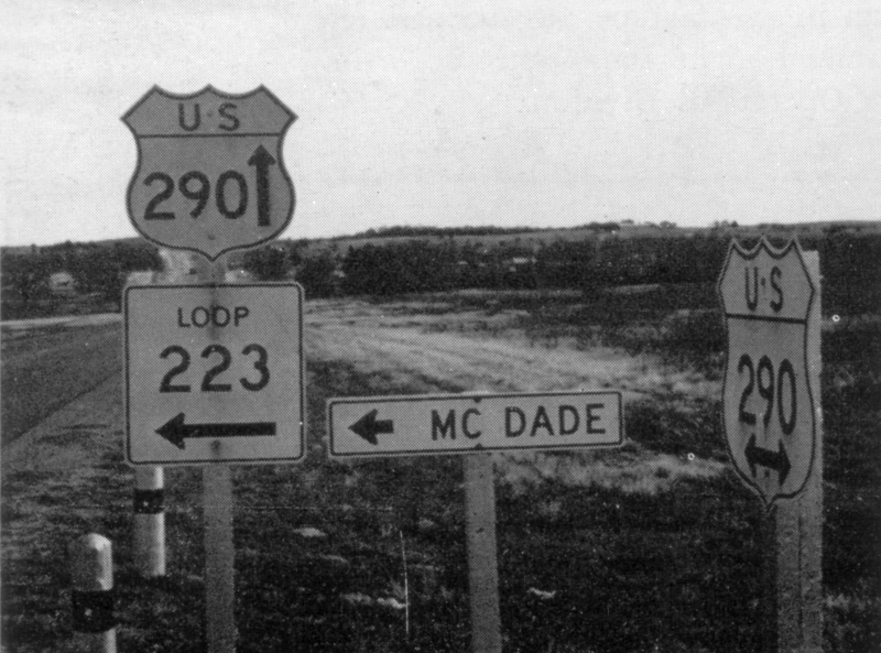
Route markers near McDade (1960) (Texas Highways) |
|
Route markers near McDade (1960) (Texas Highways) |
|
|
|
|
|
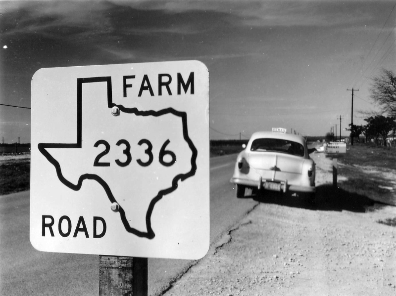
FM 2336 in Bastrop County (1959) First version of the contemporary Farm-to-Market sign. (TxDOT) |
|
FM 2336 in Bastrop County (1959) First version of the contemporary Farm-to-Market sign. (TxDOT) |
|
|
|
|
|
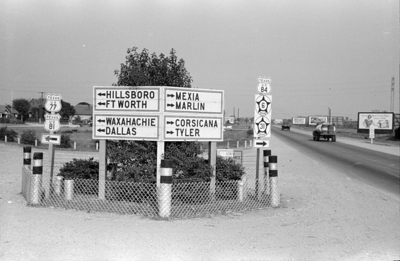
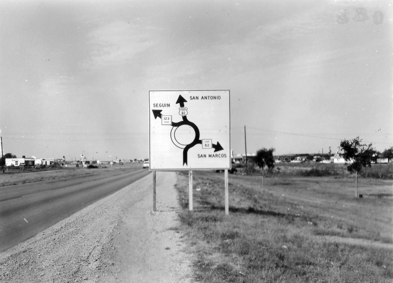
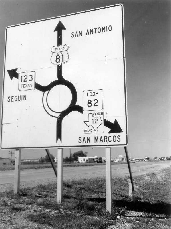
US 81 at SH 123 in San Marcos looking south (1955) This is today's intersection of I‑35 and SH 123. As you can see from the sign, this intersection was a traffic circle before I‑35 was built. Note that guide signs were still black-and-white. (TxDOT) |
|
US 81 at SH 123 in San Marcos looking south (1955) This is today's intersection of I‑35 and SH 123. As you can see from the sign, this intersection was a traffic circle before I‑35 was built. Note that guide signs were still black-and-white. (TxDOT) |
|
|
|
|
|
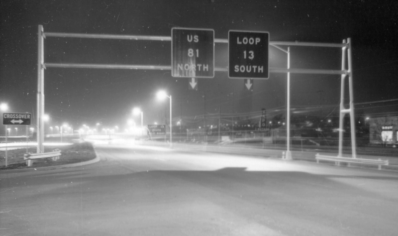
US 81 at SH 123 in San Marcos looking south (1961) A later version of the sign above. (TxDOT) |
|
US 81 at SH 123 in San Marcos looking south (1961) A later version of the sign above. (TxDOT) |
|
|
|
|
|
Overhead signs at Fratt Interchange in San Antonio (ca. 1963) Note the lack of route shields and the attached arrows at the bottom. (TxDOT) |
|
Overhead signs at Fratt Interchange in San Antonio (ca. 1963) Note the lack of route shields and the attached arrows at the bottom. (TxDOT) |
|
|
|
|
|
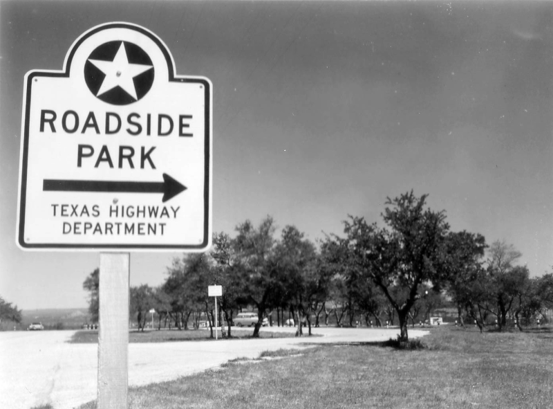
Roadside Park sign, RM 12 on Devil's Backbone near Wimberly (1961) (TxDOT) |
|
Roadside Park sign, RM 12 on Devil's Backbone near Wimberly (1961) (TxDOT) |
|
|
|
|
|
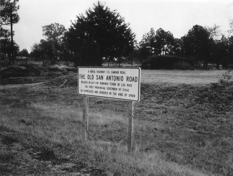
Old San Antonio Road historical information sign (1955) (TxDOT) |
|
Old San Antonio Road historical information sign (1955) (TxDOT) |
|
|
|
|
|
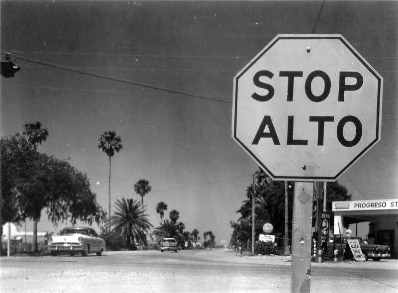
Bilingual stop sign in Progresso (1958) (TxDOT) |
|
Bilingual stop sign in Progresso (1958) (TxDOT) |
|
|
|
|
|
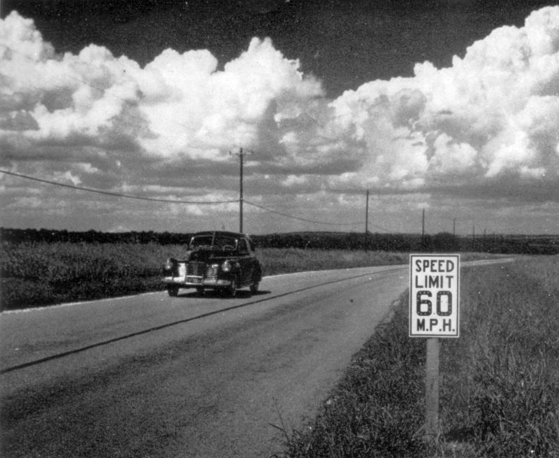
Early speed limit sign (ca. 1941) It's hard to see, but there are reflective buttons overlaid on the "60" that show the nighttime speed limit of "55". (Texas Highways) |
|
Early speed limit sign (ca. 1941) It's hard to see, but there are reflective buttons overlaid on the "60" that show the nighttime speed limit of "55". (Texas Highways) |
|
|
|
|
|
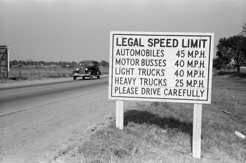
Speed limits board near Waco (1939) (Farm Security Administration) |
|
Speed limits board near Waco (1939) (Farm Security Administration) |
|
|
|
|
|
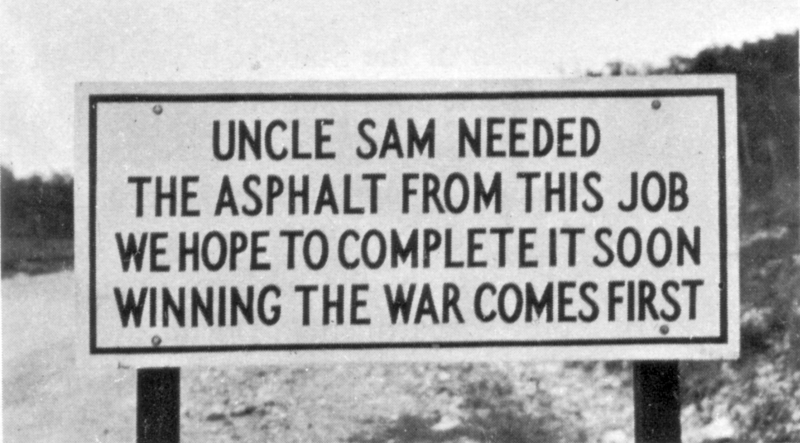
Sign posted during WWII material shortages (ca. 1944) (Texas Highways) |
|
Sign posted during WWII material shortages (ca. 1944) (Texas Highways) |
|
|
|
|
|
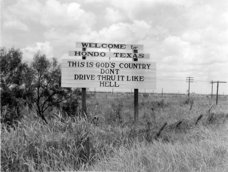
An early incarnation of the famous sign in Hondo (1955) (TxDOT) |
|
An early incarnation of the famous sign in Hondo (1955) (TxDOT) |
|
|
|
|
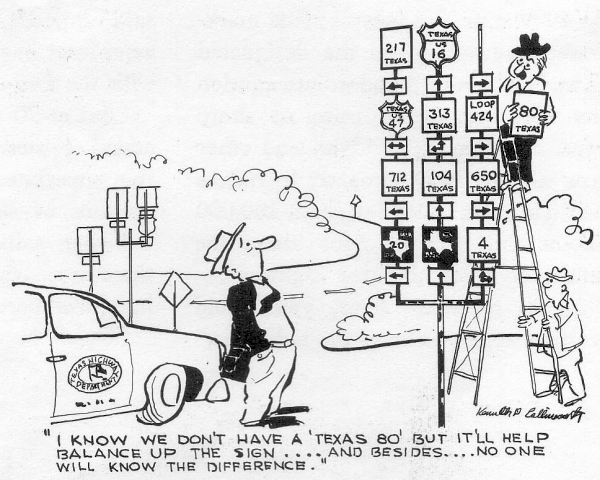
Humourous take on Texas' signing practices
(Texas Highways)