|
|
|
|
|
This page last updated March 3, 2026 |
Below are historical photos of US 90 West along with a brief history of the route. The photos were sourced from the Texas Highway Department files at the Texas State Archives and Library.
Locations are given using the present-day roadway names. The photos are arranged generally from east to west. Click on each photo for an enlarged view.
Click here to return to the historical photo galleries page.
|
ADVERTISEMENT |
Route history


The route to the west from San Antonio started off along what is now Castroville Road, part of which is now the US 90 freeway between Old Highway 90 and Acme Road. When the state highway system was first developed in 1917, this route was designated as part of State Highway 3. With the implementation of the US Highway System in 1927, it was numbered US 90.
In the mid-1930s, a replacement road was built to streamline the route immediately west of San Antonio; that road is now Historic Old Highway 90. It was replaced by the US 90 freeway in 1968.
A more detailed route history is available here.
|
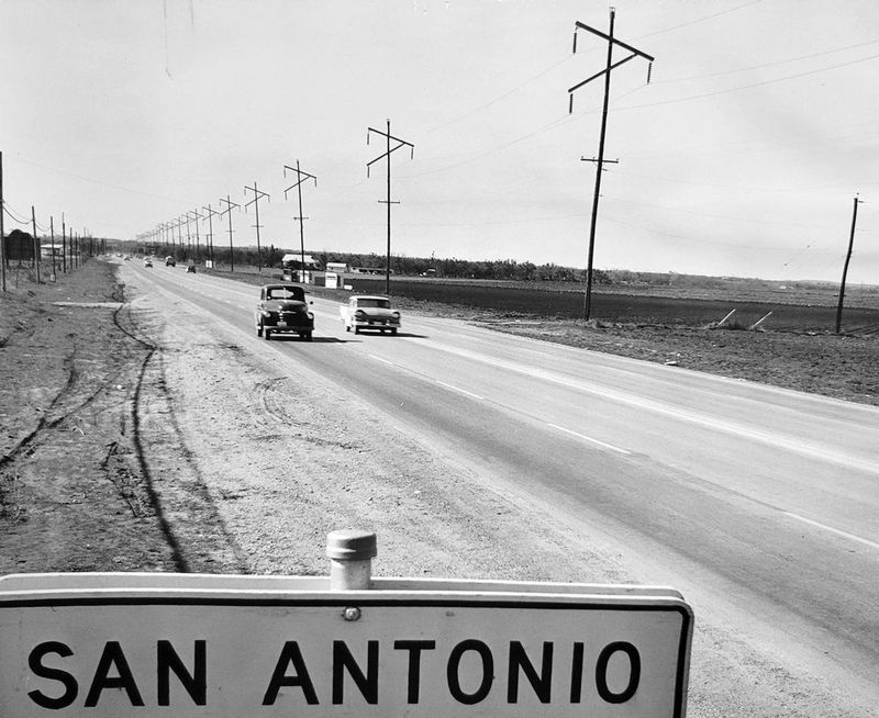
US 90 (now Old Highway 90) at Acme Rd. looking westbound (ca. 1958) This was the San Antonio city limits at the time. (Texas Highway Dept. files at the Texas State Archives and Library) |
|
US 90 (now Old Highway 90) at Acme Rd. looking westbound (ca. 1958) This was the San Antonio city limits at the time. (Texas Highway Dept. files at the Texas State Archives and Library) |
|
|
|
|
|
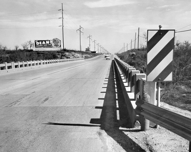
US 90 (now Old Highway 90) at Leon Creek looking eastbound (ca. 1958) (Texas Highway Dept. files at the Texas State Archives and Library) |
|
US 90 (now Old Highway 90) at Leon Creek looking eastbound (ca. 1958) (Texas Highway Dept. files at the Texas State Archives and Library) |
|
|
|
|
|
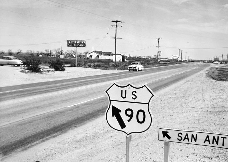
US 90 at Old Highway 90 looking east-northeast (ca. 1958) This is where Highway 90 intersected the old Castroville Road, which is now the route of the US 90 freeway headed east. (Texas Highway Dept. files at the Texas State Archives and Library) |
|
US 90 at Old Highway 90 looking east-northeast (ca. 1958) This is where Highway 90 intersected the old Castroville Road, which is now the route of the US 90 freeway headed east. (Texas Highway Dept. files at the Texas State Archives and Library) |
|
|
|
|
|
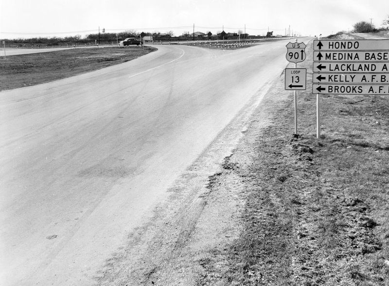
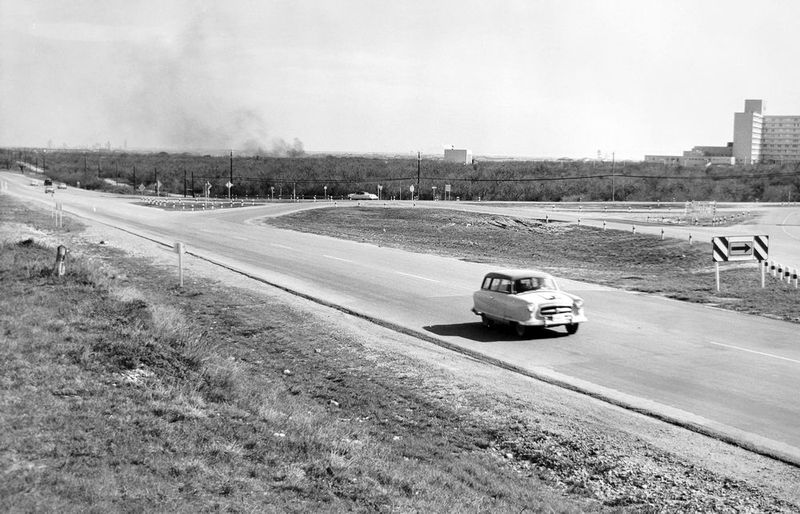
US 90 at Loop 13 (Military Dr.) looking eastbound (ca. 1958) That's the old Wilford Hall hospital at the right; it had recently opened at this time. (Texas Highway Dept. files at the Texas State Archives and Library) |
|
US 90 at Loop 13 (Military Dr.) looking eastbound (ca. 1958) That's the old Wilford Hall hospital at the right; it had recently opened at this time. (Texas Highway Dept. files at the Texas State Archives and Library) |
|
|
|
|
|
US 90 at Loop 13 (Military Dr.) looking westbound (ca. 1958) (Texas Highway Dept. files at the Texas State Archives and Library) |
|
US 90 at Loop 13 (Military Dr.) looking westbound (ca. 1958) (Texas Highway Dept. files at the Texas State Archives and Library) |
|
|
|
|
|
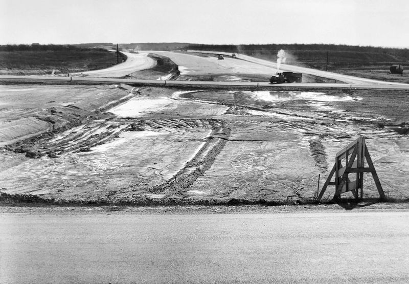
US 90 looking to the south along Loop 410 (ca. 1958) Loop 410 and the cloverleaf interchange were under construction at this time. (Texas Highway Dept. files at the Texas State Archives and Library) |
|
US 90 looking to the south along Loop 410 (ca. 1958) Loop 410 and the cloverleaf interchange were under construction at this time. (Texas Highway Dept. files at the Texas State Archives and Library) |
|
|
|
|
|
US 90 west of Kriewald Rd. looking eastbound (ca. 1958) Kriewald Rd. is the road running just above the car in the foreground. (Texas Highway Dept. files at the Texas State Archives and Library) |
|
US 90 west of Kriewald Rd. looking eastbound (ca. 1958) Kriewald Rd. is the road running just above the car in the foreground. (Texas Highway Dept. files at the Texas State Archives and Library) |
|
|
|
|
|
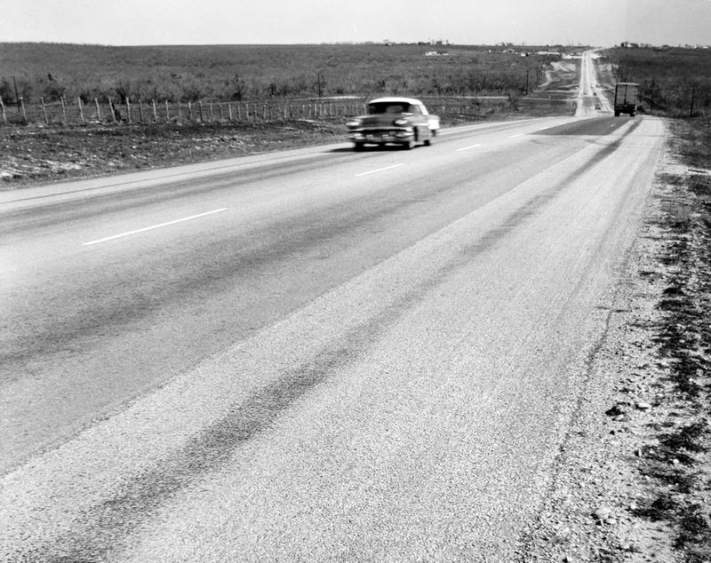
US 90 in the vicinity of Loop 1604 looking eastbound (ca. 1958) Loop 1604 didn't exist at this time. The old Wilford Hall hospital is visible on the horizon. (Texas Highway Dept. files at the Texas State Archives and Library) |
|
US 90 in the vicinity of Loop 1604 looking eastbound (ca. 1958) Loop 1604 didn't exist at this time. The old Wilford Hall hospital is visible on the horizon. (Texas Highway Dept. files at the Texas State Archives and Library) |
|
|
|
|
|
US 90 in the vicinity of Loop 1604 looking westbound (ca. 1958) Loop 1604 didn't exist at this time. The road at the left just past the parked car is Cagnon Rd. (Texas Highway Dept. files at the Texas State Archives and Library) |
|
US 90 in the vicinity of Loop 1604 looking westbound (ca. 1958) Loop 1604 didn't exist at this time. The road at the left just past the parked car is Cagnon Rd. (Texas Highway Dept. files at the Texas State Archives and Library) |
|
|
|
|
|
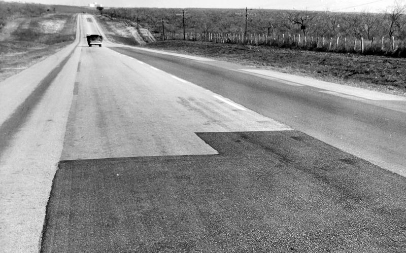
US 90 just west of Montgomery Rd. looking eastbound (ca. 1958) The road briefly widened to four lanes with a center island here as it passed the intersection with Montgomery. (Texas Highway Dept. files at the Texas State Archives and Library) |
|
US 90 just west of Montgomery Rd. looking eastbound (ca. 1958) The road briefly widened to four lanes with a center island here as it passed the intersection with Montgomery. (Texas Highway Dept. files at the Texas State Archives and Library) |
|
|
|
|
|
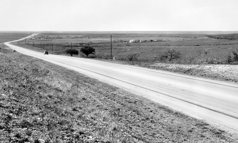
US 90 at the Bexar/Medina county line looking eastbound (ca. 1958) (Texas Highway Dept. files at the Texas State Archives and Library) |
|
US 90 at the Bexar/Medina county line looking eastbound (ca. 1958) (Texas Highway Dept. files at the Texas State Archives and Library) |
|
|
|
|