|
||
|
|
||
This page last updated April 10, 2026 |

|
|
|
|
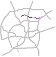
This page covers the Wurzbach Parkway in North San Antonio. Length: 12 miles |
|
ADVERTISEMENT |
On this page:


Overview
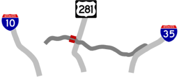
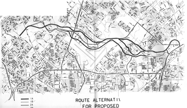
The Wurzbach Parkway is an east-west "super-arterial" across northern San Antonio connecting I‑35 to I‑10. Prior to its completion, there were no true east-west arterials between Loop 410 and Loop 1604 across the North Side. As a result, Loop 410, Loop 1604, and many of the zig-zagged arterials in the area were overburdened trying to facilitate shorter-distance east-west traffic. Wurzbach Parkway was built to facilitate many of those shorter east-west trips across the North Side, although it can and often is used for longer through-traffic journeys.
The parkway was developed under the short-lived Principal Arterial Street System (PASS) program and carries a TxDOT route number of PA 1502. Prior to 2014, this route number was not signed, and it seems to be the only PASS route in the state to be signed as such. (Technically, the "PA" in the route number is short for Principal Arterial, not Parkway, although that also works.)
The route passes through a variety of urban land uses. The eastern end of the route passes through a light commercial and industrial area before entering the former Longhorn Quarry, which has been redeveloped as an entertainment district with an amusement park, high school football stadium, and soccer complex including the home stadium for San Antonio's professional team. The parkway then passes through the commercial, residential, and light industrial areas around Perrin-Beitel and Nacogdoches roads before passing over an active quarry near Wetmore Rd.
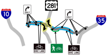
Continuing west, the parkway passes through mostly undeveloped land and parkland near the airport before passing into a light industrial and commercial area. Approaching US 281, the parkway passes over the wooded Salado Creek for a short distance. West of US 281, the route continues through a mostly undeveloped area before passing over a flood control basin. Near Blanco Rd., the route traverses residential areas before bisecting Hardberger Park where a land bridge connecting the two sides of the park opened in late 2020. Commercial and residential development line the route at the far western end where it merges into the pre-existing Wurzbach Road.
Roadway details
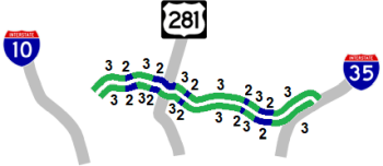
The parkway features four and six lanes with a concrete divider. Along the original sections, a raised island separated the opposing flows; the concrete divider was added atop the island in 2010 after a series of head-on crashes. (A safety improvement project now underway is removing the raised island, leaving just the concrete divider.)
- The western end meets NW Military Hwy. and Lockhill-Selma Rd. at signalized, at-grade intersections before tying-into the pre-existing Wurzbach Rd. where through traffic can continue west to I‑10 and beyond. Improvements were made to that section of Wurzbach to support the anticipated increases in traffic from the completed parkway, and additional improvements are being considered.
- At the far eastern end, the parkway crosses Weidner Rd. at a signalized, at-grade intersection and then ends at a signalized intersection where it merges with the pre-existing O'Connor Rd. that was re-aligned to provide a straight-through connection to Wurzbach. Through traffic can then continue east on O'Connor the short distance to I‑35.
| ACCESS ROADS | |
|
|
|
|
 Alon Loop
 FM 1535/NW Military Hwy.
 FM 2696/Blanco Rd.
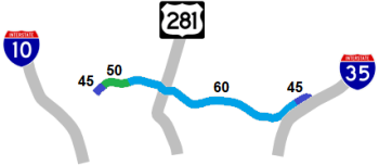
| AVERAGE DAILY TRAFFIC | |||||||
| LOCATION | 2002 | 2012 | 2017 | 2019 | 2021 | 2022 | '12-'22 % CHG |
| E of Weidner Rd. | 6,700 | 15,800 | 25,465 | 25,332 | 20,168 | 23,436 | +48.33% |
| E of Perrin-Beitel Rd. | 20,000 | 26,000 | 40,769 | 53,821 | 38,522 | 37,424 | +43.94% |
| E of Wetmore Rd. | 26,000 | 20,000 | 41,685 | 49,197 | 37,636 | 44,641 | +123.21% |
| E of Starcrest Blvd. | 29,000 | 23,000 | 45,588 | 52,790 | 40,385 | 50,736 | +120.59% |
| E of US 281N | 44,542 | 34,075 | 43,699 | N/A | |||
| W of US 281N | 53,403 | 64,456 | N/A | ||||
| W of West Ave. | 47,117 | 42,004 | 46,601 | N/A | |||
| E of NW Military Hwy. | 40,741 | 20,715 | 42,784 | N/A | |||
(NOTE: In 2021, TxDOT changed the location of several traffic counting stations. New stations will show no history prior to 2021, and discontinued stations will show no history for 2021 and thereafter.)
|
ADVERTISEMENT |
Media gallery
Click here for video of this roadway.
Construction projects
- NW Military Hwy. to O'Connor Rd.: This safety project is removing the existing raised center island and portable center barrier where it currently exists and replacing them with a permanent concrete barrier flush with the pavement. The project will also improve drainage, improve the pavement to reduce skidding, upgrade crash barriers and guardrails, install wrong-way driver deterrence and detection systems, upgrade or replace illumination and signage, and install TransGuide cameras and a couple of dynamic message signs.
Future plans
TxDOT and the City of San Antonio are studying additional improvements along Wurzbach Rd. from the western end of the parkway to I‑10.
History
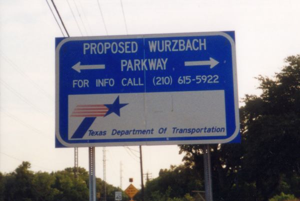
This route was originally proposed in the late '80s as the aptly-named "East-West Parkway" and was eventually named Wurzbach Parkway because it connects to Wurzbach Road in northwestern San Antonio. William Wurzbach owned a ranch around what is now I‑10 and Wurzbach; the road he built through his property was eventually deeded to the county and named for him. Wurzbach also served as a county judge and county attorney.
The original sections of the parkway were designed and posted for a 45 mph speed limit. After public complaints about this being too low, a speed study was conducted and the speed limit subsequently raised on the original segments to 60 mph circa 2000. When the final segments were opened in 2014 and 2015, they, too, were posted at 45 mph as per design policies. A speed study conducted shortly after the final section opened supported an increase to 60 mph.
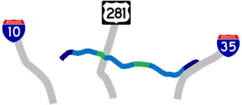
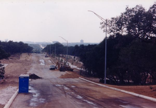
The first sections of the parkway only had a raised center island between the opposing traffic. After a spate of head-on collisions caused by drivers jumping the island, a concrete center barrier was installed atop the island in early 2010 between Wetmore Rd. and Weidner Rd. Sections of the parkway built thereafter included a center barrier instead of raised island.
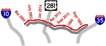
- 1996: The first section, from Nacogdoches Rd. to Wetmore Rd., completed.
- September 1999: The segment from O'Connor Rd. to Nacogdoches Rd. completed.
- March 2000: The section between NW Military Hwy. to Lockhill-Selma Rd. completed.
- July 2002: The segment from Blanco Rd. to NW Military Hwy. completed. Further work stalled due to a statewide funding shortage.
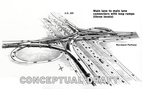
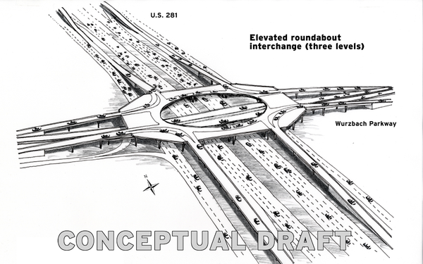
- 2007: The missing section of the parkway from Blanco Rd. to Wetmore Rd. and an interchange at US 281 was considered for a possible tollway project; however it was determined that this was not feasible.
- Late 2009: The Texas Transportation Commission allocates funding to complete the missing middle section.
- January 2014: The segment from West Ave. to Blanco Rd. opens although a pavement issue delays the opening of the overpass at Blanco Rd. until April.
- April 2015: The section from Starcrest Dr. to Jones-Maltsberger Rd. completed.
- September 2015: The final segment, from Jones-Maltsberger Rd. to West Ave., opened to traffic.
- October 2022: The intersection at NW Military Hwy. was reconfigured, and the section from there to Lockhill-Selma Rd. was widened.
|
More historical photos of Wurzbach Parkway are available here. |