|
||
|
|
||
This page last updated December 15, 2025 |

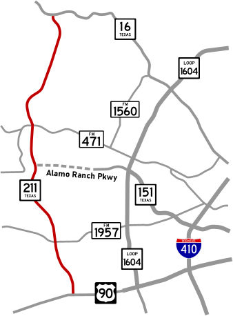
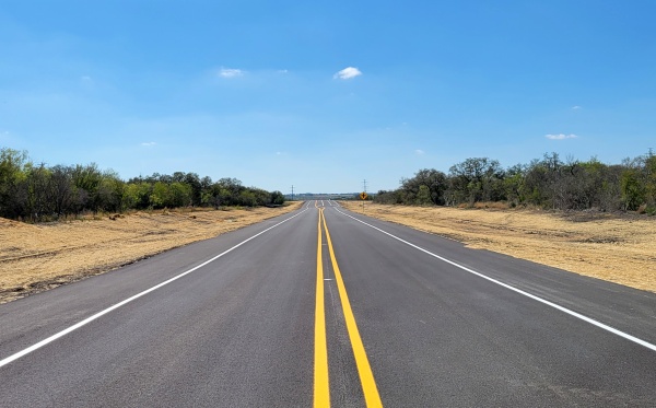
SH 211 is a mostly two-lane rural arterial in far western Bexar County. Initially conceived in 1986 to provide access to the now-defunct Texas Research Park on Potranco Rd., this road today is fast becoming a partial outer beltline/
While the first two segments at the southern and northern ends were able to be quickly built around 1990, the middle segment languished for three decades due to right-of-way acquisition issues, then later due to environmental constraints, before finally opening in November 2022.
This page discusses the future plans for the route as well as its complicated history.
|
ADVERTISEMENT |
Future plans
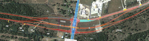
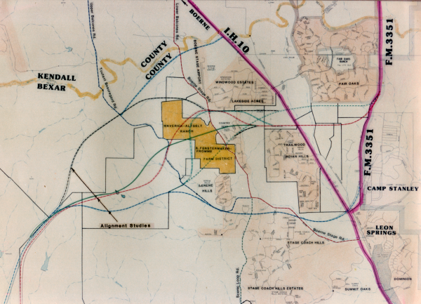
At Potranco, a future underpass for SH 211 is currently being investigated.
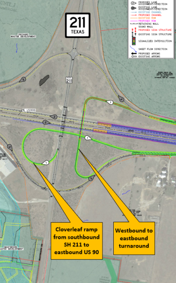
At US 90, a project was completed in mid 2025 to build a westbound to eastbound turnaround, and the planned US 90 expansion project is expected to add a southbound 211 to eastbound 90 cloverleaf ramp (see schematic below).
History
Taking their cue from the then recently-built SH 151 where the land for the road was entirely donated, officials lined-up donated land to build a road from US 90 to Potranco Rd. The State Dept. of Highways and Public Transportation (now TxDOT) accepted the land and, recognizing the likely future need for a longer tangential in the area, a route from US 90 all the way to SH 16 (Bandera Rd.) was proposed. It was approved in 1986 and designated as SH 211.
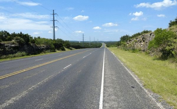
The segment from US 90 to Potranco opened in 1990 as a two-lane rural highway, but enough right-of-way was acquired to eventually widen it to a full freeway if and when needed.
Development of the middle segment between Culebra Rd. and Potranco Rd., however, came to a grinding halt when some land owners opted not to donate their land. Per the agreement with the state, land for the project was required to either be donated or purchased by Bexar and Medina counties, neither of which had the funds to do so. And given that there was no significant need for the route at that time, there was no political will to allocate that funding nor engage in the eminent domain process that would be needed to force the acquisition. This resulted in efforts to acquire the right-of-way for that section to stall, leaving a gap in the route. However, that section remained in the City of San Antonio's major thoroughfare plan to preserve the corridor for the route, and TxDOT periodically updated the environmental clearances to keep it "shovel-ready".
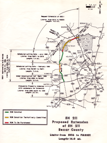
Other property owners in the area along the various alternate routes then joined in opposing the plan. During the fracas, the owner of the property just north of SH 16 that was to have been donated passed away, and the subsequent inheritor of the property then withdrew the offer to donate it for the project.
Given all of these factors, as well as the political fallout from the publication of a clearly-biased piece in Texas Monthly on the drama, the proposal for that extension was shelved in 1992, and there have been no plans to resurrect it.
Recently, the "Save Scenic Loop Alliance" briefly indicated it may support revisiting a SH 211 extension as one option to reduce traffic on Scenic Loop Road, although there appears to be no active discussions on this currently.
It's worth noting that despite what was alleged three decades ago, virtually no development occurred along SH 211 itself until recently. Instead, as is typical, development has marched outward along US 90, Potranco Rd., Culebra Rd., and Bandera Rd., with development then filling-in the areas between. As a result, SH 211 is becoming the efficacious lateral connector it was envisioned to be. Indeed, the need for SH 211 — and the wisdom of its existence — is becoming acutely more evident every day as traffic counts on 211 at Potranco nearly doubled from 2015 to 2021, and the count on 211 at Bandera is up over 50% the last decade.
While planning was underway for the middle segment, several protected karst habitat areas in the planned corridor the were added or expanded. This required an expanded environmental study and a realignment of portions of the route to avoid those features. That expanded study and the required engineering associated with the route adjustments, along with renewed difficulties in obtaining right-of-way, caused the planned start date to slip several times, and also resulted in a narrower right-of-way being acquired for most of this segment than initially planned.
But the stars eventually aligned, and finally, on November 10th, 2020, a construction contract for the middle segment was awarded by Bexar County. Work began in early 2021, and the road opened to traffic on November 14th, 2022.
The second consideration was projected traffic. Unlike with road expansions where sizing is driven by projected future traffic volumes, for a new road, the expected initial traffic volumes are generally what are used to size the inaugural road. Based on those projections, a two-lane road was stipulated by city and state standards.
Finally, as mentioned above, several environmental constraints were identified along this segment. In order to fit within those constraints and within the available budget, a smaller footprint was required.
Yes, planners understand that a two-lane roadway will likely (although not certainly) be inadequate in the not-too-distant future, but getting a corridor built and open is the first step. Then, when traffic volumes and patterns begin to materialize that can be quantified and analyzed, appropriate improvements and expansions can then be undertaken. Fortunately, after recent substantial increases in funding, TxDOT should have the resources to address those future needs.
Also, by not overbuilding the starter road, this means that as new development comes online, developers will be required to shoulder some of the costs for future improvements.
Using this approach, planners don't have to guess at what might be needed and possibly waste money to build something unnecessary. Transportation planning is a bit of a chicken-and-egg exercise, and state and federal requirements to empirically justify the need for expenditures will always result in incremental and sometimes disjointed improvements. While not always ideal, this approach is necessary to safeguard appropriate stewardship of public funds and ensure a balanced approach to address the plethora of needs.
So let's look at Potranco first — how many people living in that area are going to want to go north on 211? Probably not very many because, other than Harlan High School, there's really nothing to the north for them to want or need to go to — no major employers, shopping, colleges, medical facilities, etc.
So then we look at how many people living in the Culebra area will want to go south. Until the HEB at Culebra and 211 is opened, there may be a few who decide to go to the one at Potranco and 211 since it may be faster to get there (and maybe less crowded) than the one at Culebra and 1604 or the one in Alamo Ranch. But is that enough traffic to warrant additional lanes on 211? Almost certainly not.
There may also be some folks living along Culebra (or further north) who work in the Potranco area, such as at the Citibank facility, and will use 211 to get there. Again, probably not enough commuters to need more lanes.
The biggest cohort is probably people along Culebra (or further north) who will opt to use 211 to get to 90 to go to Lackland or downtown. But, there's no way to really know how many people will do that — only time will tell, so they have to wait it out and see what materializes.
Finally, yes, there are some new subdivisions now under construction along 211 south of Culebra, but they are still a few years from having the level of build-out that would appreciably impact traffic on 211. And, it's helpful from an engineering standpoint to wait to see the traffic patterns the emerge from those new developments so improvements can be planned accordingly.
It's worth noting that over three years after opening, there are still no significant traffic issues along the new segment to speak of, despite the predictions of some cynical prognosticators that it would be congested within a year.
So would it have been nice to have four lanes along here? Absolutely. Would it have been nice to have a six-lane freeway? Of course. Is what was built better than nothing? I guess you can decide for yourself, but in the opinion of the author of this page, this adage sums it up best: "Don't let the perfect be the enemy of the good."