|
|
|
|
|
This page last updated March 5, 2024 |
Below are historical photos of Interstate 35 South along with a brief history of the route. The photos were sourced from the TxDOT photo library, the San Antonio TxDOT district office, San Antonio-Bexar County Urban Transportation Study (SABCUTS) planning documents, and the author of this website.
Locations are given using the present-day roadway names. The photos are arranged generally from north to south. Click on each photo for an enlarged view.
Photos of the I‑10/I‑35 "Downtown Y" interchange are on a separate page here.
Click here to return to the historical photo galleries page.
|
ADVERTISEMENT |
Route history


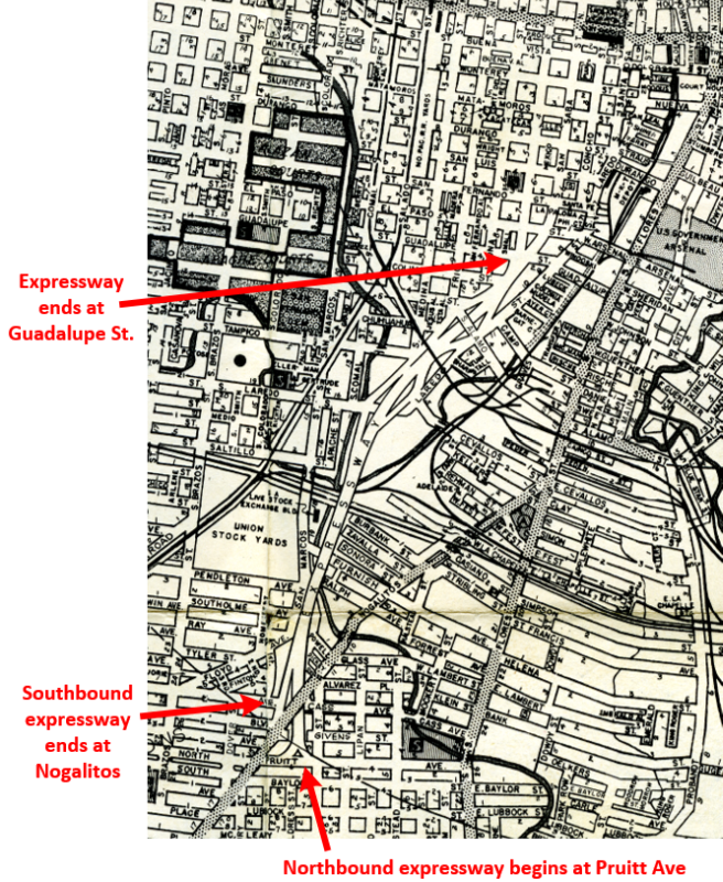
The section of today's I‑35 from Nogalitos St. to Broadway was included as part of the original three-legged expressway plan for San Antonio that was first laid-out around 1940 and was designed to provide bypass routes around the increasingly congested downtown core for through traffic on the various US and state highways that converged there. The United States' entrance into World War II delayed these plans.
The plan was revived after the war, and the section from Guadalupe St. to Pruitt Ave. (just south of Nogalitos St.) was completed in 1952 as part of a bypass for US 81 around downtown. Southbound traffic exited at Nogalitos St. to continue on US 81, but northbound traffic from US 81 had to enter via a ramp from Pruitt Ave. just east of Nogalitos. Between Guadalupe St. and Martin St., motorists used Pecos and San Saba streets along the west side of downtown to reach another section of expressway running from Martin St. to Broadway that was completed in 1954. The gap was closed with the completion of the elevated expressway there in 1957, which also included the construction of the "Downtown Y" interchange.
After several proposals for the route from Nogalitos St. to Loop 410 were floated, an alignment was finalized in 1955 and the access roads for the first section opened between SW Military Dr. and New Laredo Hwy. in 1956. The following year, the stretch of existing US 81 south from there to the Atascosa county line was upgraded to a "semi-expressway" consisting of mainlanes and access roads but no overpasses at intersections.
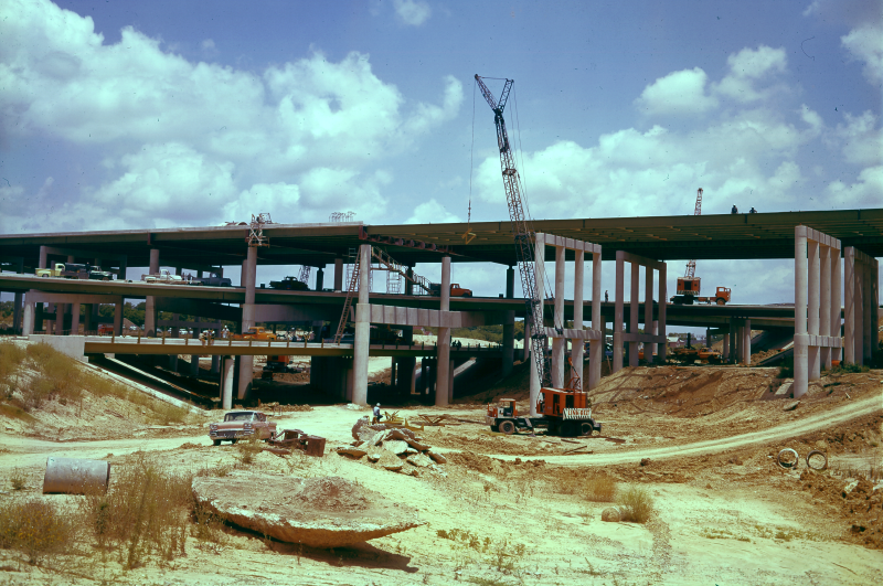
The freeway from Nogalitos St. to Division Ave. opened in 1958. In 1960, the freeway from Division Ave. to Fischer Rd. was completed including the interchange at Loop 410. The interchange at US 90 was completed in 1967, and the "semi-expressway" south of Fischer Rd. was upgraded to full Interstate standards in 1974.
More details on the history of I‑35 is available here.
|
1953 Ferguson map showing I‑35/US 81 South expressway (Brian Purcell) |
|
|
1953 Ferguson map showing I‑35/US 81 South expressway (Brian Purcell) |
||
|
|
||
|
||
|
|
||
|
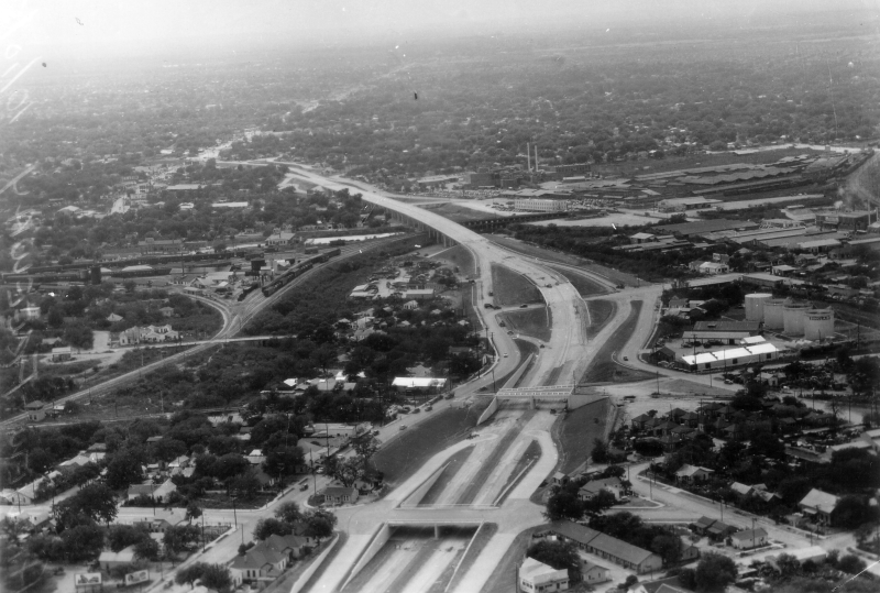
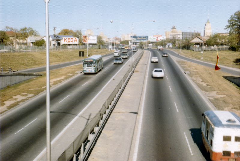
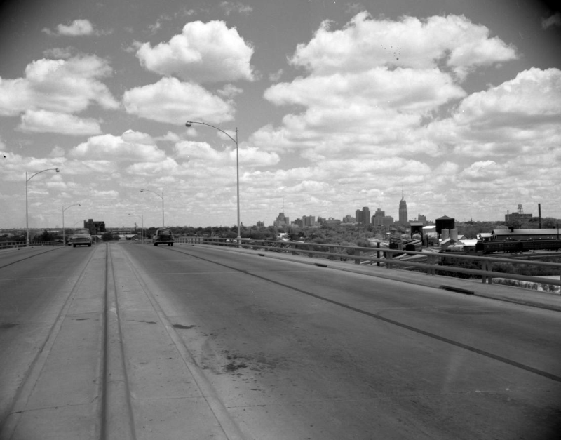
I‑35 at I‑10 West looking south (1960) (TxDOT) |
|
|
I‑35 at I‑10 West looking south (1960) (TxDOT) |
||
|
|
||
|
I‑35 at Commerce St. looking east (ca. 1970) Commerce and Buena Vista overpasses are at the bottom center. (TxDOT) |
|
|
I‑35 at Commerce St. looking east (ca. 1970) Commerce and Buena Vista overpasses are at the bottom center. (TxDOT) |
||
|
|
||
|
I‑35 at Guadalupe St. looking south (1957) (TxDOT) |
|
|
I‑35 at Guadalupe St. looking south (1957) (TxDOT) |
||
|
|
||
|
I‑35 at Alamo St. looking southwest (ca. 1952) (TxDOT) |
|
|
I‑35 at Alamo St. looking southwest (ca. 1952) (TxDOT) |
||
|
|
||
|
I‑35 at Alamo St. looking northeast (1967) (SABCUTS) |
|
|
I‑35 at Alamo St. looking northeast (1967) (SABCUTS) |
||
|
|
||
|
I‑35 at Alamo St. looking northeast (1971) (TxDOT) |
|
|
I‑35 at Alamo St. looking northeast (1971) (TxDOT) |
||
|
|
||
|
I‑35 at Alamo St. looking northeast (1971) (TxDOT) |
|
|
I‑35 at Alamo St. looking northeast (1971) (TxDOT) |
||
|
|
||
|
I‑35 at Alamo St. looking northeast (1971) (TxDOT) |
|
|
I‑35 at Alamo St. looking northeast (1971) (TxDOT) |
||
|
|
||
|
I‑35 at Laredo St. looking east (1955) Cevallos St. did not line-up with Laredo St. at this time. (TxDOT) |
|
|
I‑35 at Laredo St. looking east (1955) Cevallos St. did not line-up with Laredo St. at this time. (TxDOT) |
||
|
|
||
|
I‑35 at Laredo St. looking east (ca. 1970) Cevallos St. had been realigned to meet Laredo St. (TxDOT) |
|
|
I‑35 at Laredo St. looking east (ca. 1970) Cevallos St. had been realigned to meet Laredo St. (TxDOT) |
||
|
|
||
|
I‑35 at San Marcos St. looking north (ca. 1955) (TxDOT) |
|
|
I‑35 at San Marcos St. looking north (ca. 1955) (TxDOT) |
||
|
|
||

|
I‑35 at Nogalitos St. looking south (ca. 1952) This was the start of the northbound expressway at this time. Traffic entered the ramp from Pruitt Ave., which crosses left to right at the top of the ramp. (TxDOT) |
|
|
I‑35 at Nogalitos St. looking south (ca. 1952) This was the start of the northbound expressway at this time. Traffic entered the ramp from Pruitt Ave., which crosses left to right at the top of the ramp. (TxDOT) |
||
|
|
||
|
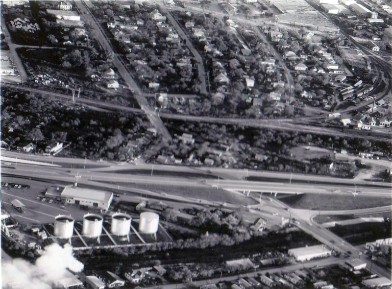
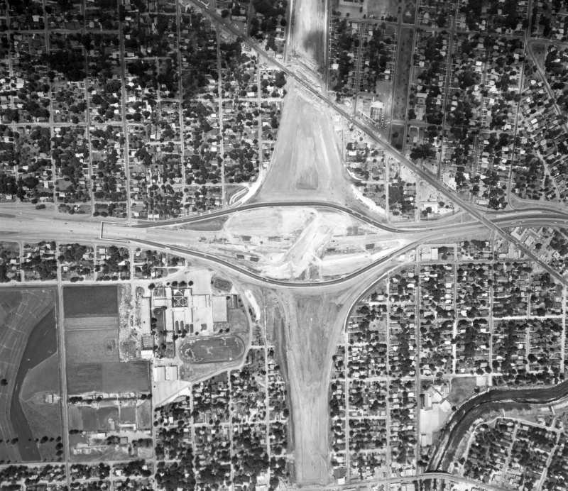
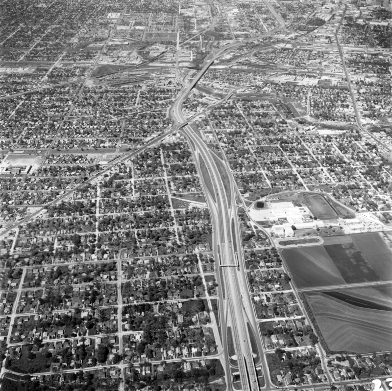
I‑35 at US 90 (1965) North is to the right. This is an aerial view during construction of the interchange. (TxDOT) |
|
|
I‑35 at US 90 (1965) North is to the right. This is an aerial view during construction of the interchange. (TxDOT) |
||
|
|
||
|
I‑35 at US 90 looking either northwest or southeast (1966) (TxDOT) |
|
|
I‑35 at US 90 looking either northwest or southeast (1966) (TxDOT) |
||
|
|
||
|
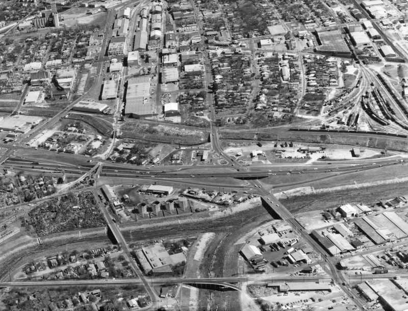
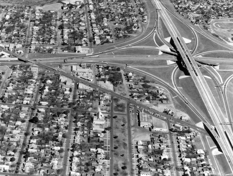
I‑35 at US 90 looking south (ca. 1967) This picture is taken from the northeast corner, with I‑35 northbound just to our right. In the foreground is the ramp from I‑10/US 90 to I‑35 northbound. (SABCUTS) |
|
|
I‑35 at US 90 looking south (ca. 1967) This picture is taken from the northeast corner, with I‑35 northbound just to our right. In the foreground is the ramp from I‑10/US 90 to I‑35 northbound. (SABCUTS) |
||
|
|
||
|
I‑35 at US 90 looking east (ca. 1970) (TxDOT) |
|
|
I‑35 at US 90 looking east (ca. 1970) (TxDOT) |
||
|
|
||
|
I‑35 at Theo Ave. looking north (1961) Burbank High School is at the right. This was before the US 90 freeway was built. (TxDOT) |
|
|
I‑35 at Theo Ave. looking north (1961) Burbank High School is at the right. This was before the US 90 freeway was built. (TxDOT) |
||
|
|
||
|
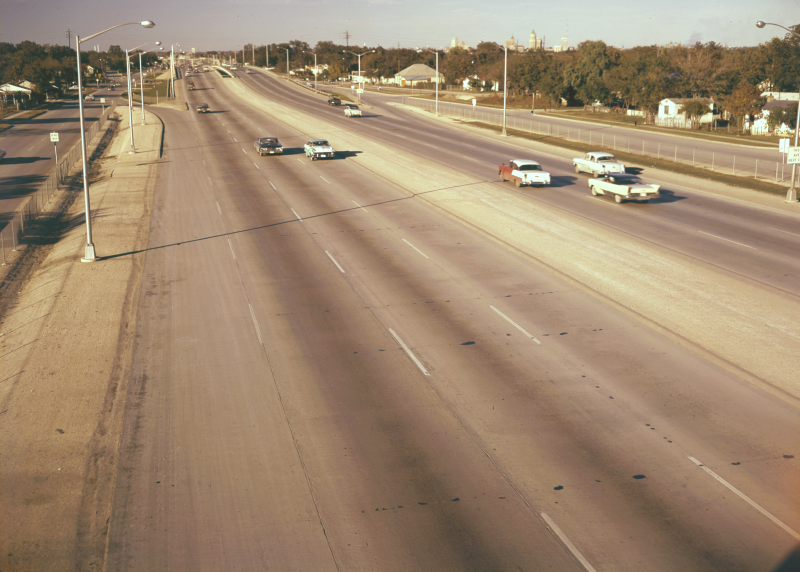
I‑35 at Theo Ave. looking north (1961) Note the lack of a center barrier. This was common at this time. (TxDOT) |
|
|
I‑35 at Theo Ave. looking north (1961) Note the lack of a center barrier. This was common at this time. (TxDOT) |
||
|
|
||
|
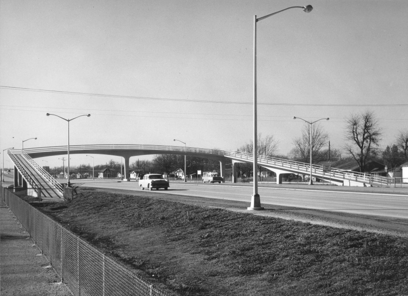
I‑35 at Stonewall St. looking north (ca. 1960) This pedestrian overpass was removed around 2007. (TxDOT) |
|
|
I‑35 at Stonewall St. looking north (ca. 1960) This pedestrian overpass was removed around 2007. (TxDOT) |
||
|
|
||
|
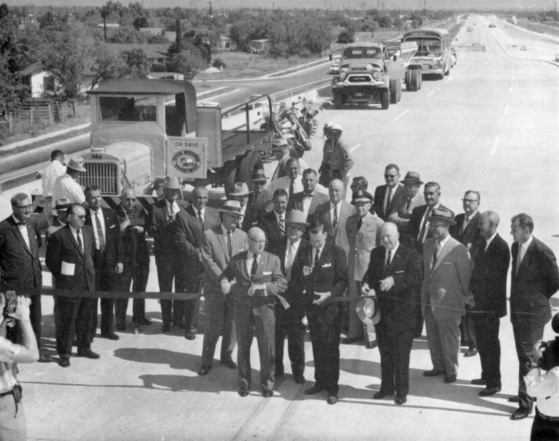
I‑35 at SW Military Dr. looking north (1960) Ribbon-cutting for I‑35 South. The truck to the left was a 1917 US Army "Liberty Truck" that the Highway Department had acquired as surplus when the department was created. It was used by the local TxDOT office for groundbreaking and ribbon-cutting ceremonies until the 1990s. (TxDOT) |
|
|
I‑35 at SW Military Dr. looking north (1960) Ribbon-cutting for I‑35 South. The truck to the left was a 1917 US Army "Liberty Truck" that the Highway Department had acquired as surplus when the department was created. It was used by the local TxDOT office for groundbreaking and ribbon-cutting ceremonies until the 1990s. (TxDOT) |
||
|
|
||
|
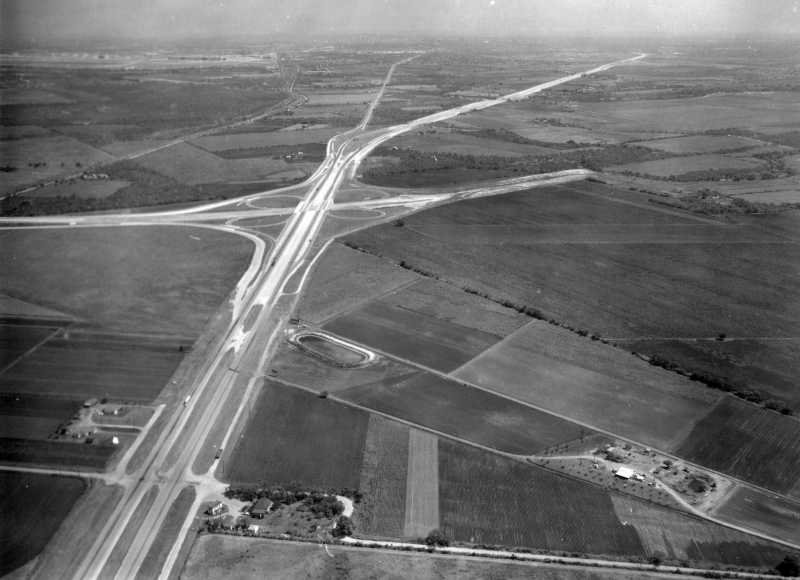
I‑35 at SW Military Dr. looking west (1966) (TxDOT) |
|
|
I‑35 at SW Military Dr. looking west (1966) (TxDOT) |
||
|
|
||
|
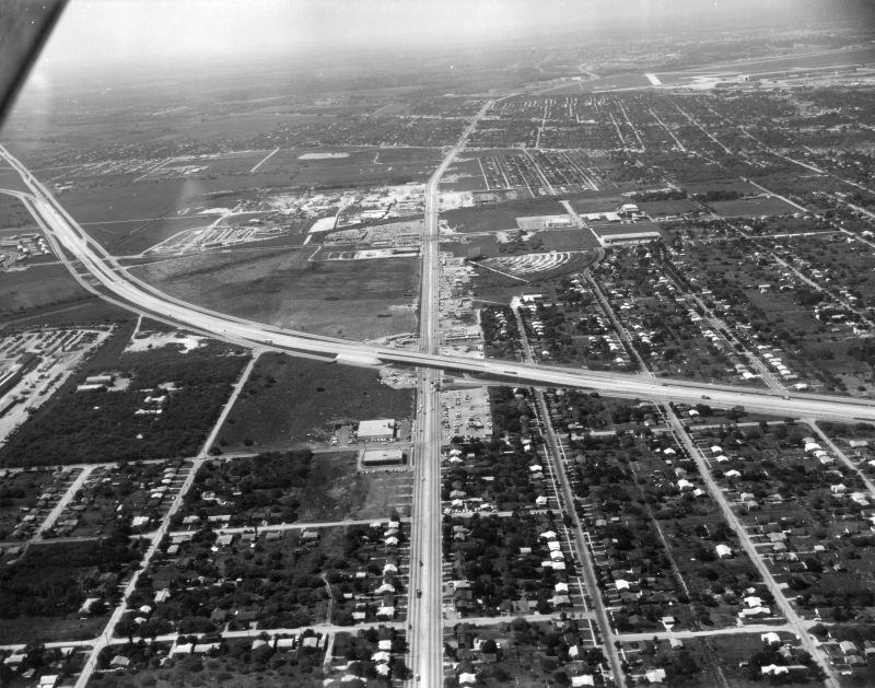
I‑35 at Loop 410 looking northwest (ca. 1966) I‑35 runs left to right. (TxDOT) |
|
|
I‑35 at Loop 410 looking northwest (ca. 1966) I‑35 runs left to right. (TxDOT) |
||
|
|
||
|
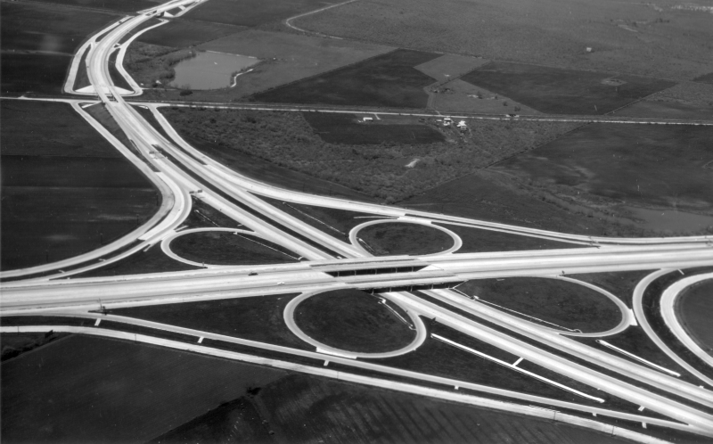
I‑35 at Fischer Rd. looking northeast (ca. 1960) Note the "semi-expressway" configuration at the bottom — access roads and mainlanes with an at-grade intersection (no overpass) — at Fischer Rd. Also note the stub for Loop 410 east of the cloverleaf. (TxDOT) |
|
|
I‑35 at Fischer Rd. looking northeast (ca. 1960) Note the "semi-expressway" configuration at the bottom — access roads and mainlanes with an at-grade intersection (no overpass) — at Fischer Rd. Also note the stub for Loop 410 east of the cloverleaf. (TxDOT) |
||
|
|
||
|
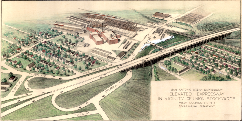
Artist rendering of planned expressway at Powell St. looking northwest (1949) (TxDOT/Zoe Davis) |
|
|
Artist rendering of planned expressway at Powell St. looking northwest (1949) (TxDOT/Zoe Davis) |
||
|
|
||
|
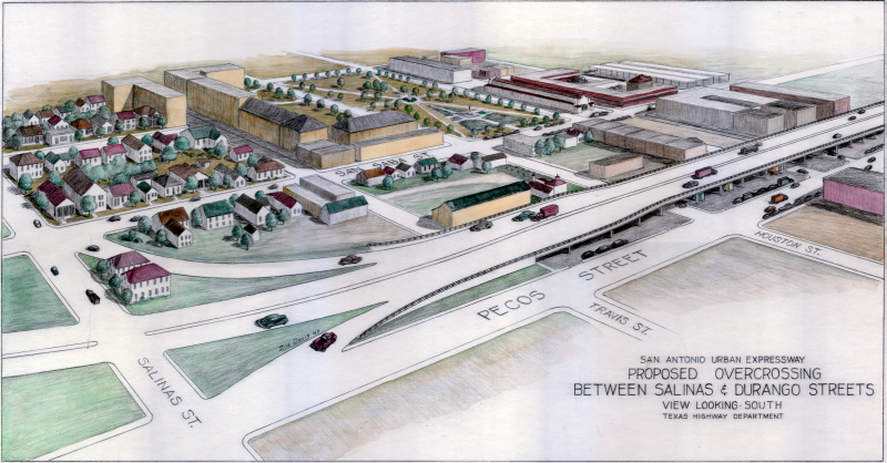
Artist rendering of planned expressway at Salinas St. looking southeast (1949) Salinas St. was one block south of Martin St. (TxDOT/Zoe Davis) |
|
|
Artist rendering of planned expressway at Salinas St. looking southeast (1949) Salinas St. was one block south of Martin St. (TxDOT/Zoe Davis) |
||
|
|
||
|
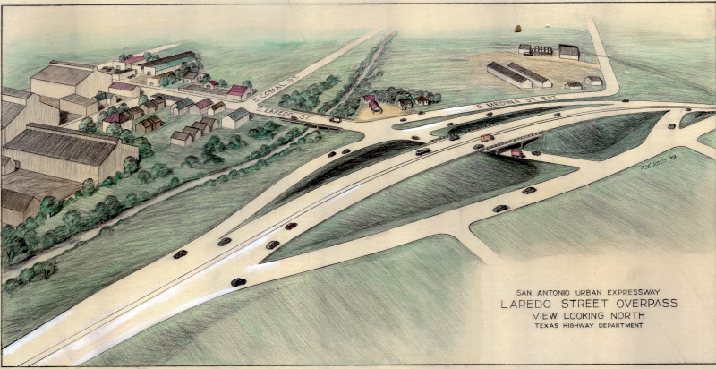
Artist rendering of planned expressway at Laredo St. looking north (1949) (TxDOT/Zoe Davis) |
|
|
Artist rendering of planned expressway at Laredo St. looking north (1949) (TxDOT/Zoe Davis) |
||
|
|
||
|
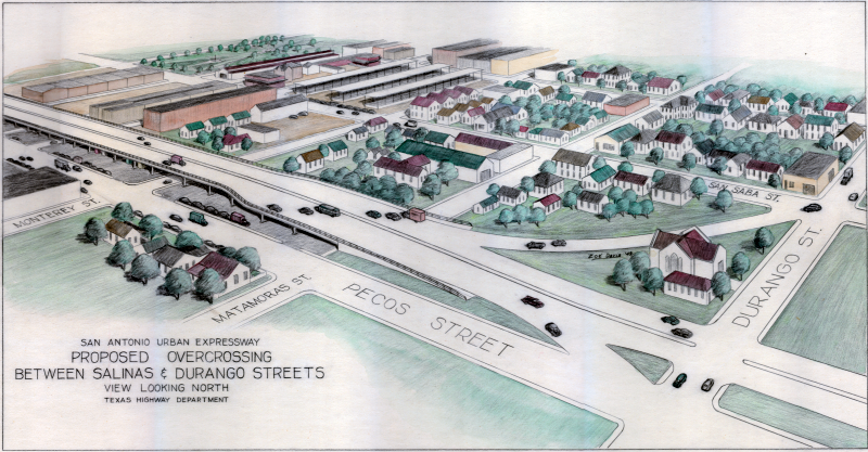
Artist rendering of planned expressway at Durango St. looking northeast (1949) (TxDOT/Zoe Davis) |
|
|
Artist rendering of planned expressway at Durango St. looking northeast (1949) (TxDOT/Zoe Davis) |
||
|
|
||