|
|
|
|
|
This page last updated March 6, 2024 |
Below are historical photos of Interstate 37 along with a brief history of the route. The photos were sourced from the TxDOT photo library, the San Antonio TxDOT district office, and San Antonio-Bexar County Urban Transportation Study (SABCUTS) planning documents.
Locations are given using the present-day roadway names. The photos are arranged generally from north to south. Click on each photo for an enlarged view.
Click here to return to the historical photo galleries page.
|
ADVERTISEMENT |
Route history

I‑37 was one of the last spokes of San Antonio's freeway system to be built. Although it was in the 1956 expressway plan, issues regarding its routing near Brooks AFB delayed construction until the mid '60s with the first segments from Carolina St. south to US 181 opening in time for HemisFair in 1968. The section adjacent to the HemisFair site downtown was paved and used for parking for the fair. The remainder of the freeway downtown from Carolina St. to I‑35 was completed by 1971.
More details on the history of I‑37 is available here.
|
I‑37/I‑35/US 281 interchange under construction (ca. 1971) The freeway being built across the center of the picture is US 281 North. (SABCUTS) |
|
I‑37/I‑35/US 281 interchange under construction (ca. 1971) The freeway being built across the center of the picture is US 281 North. (SABCUTS) |
|
|
|
|
|
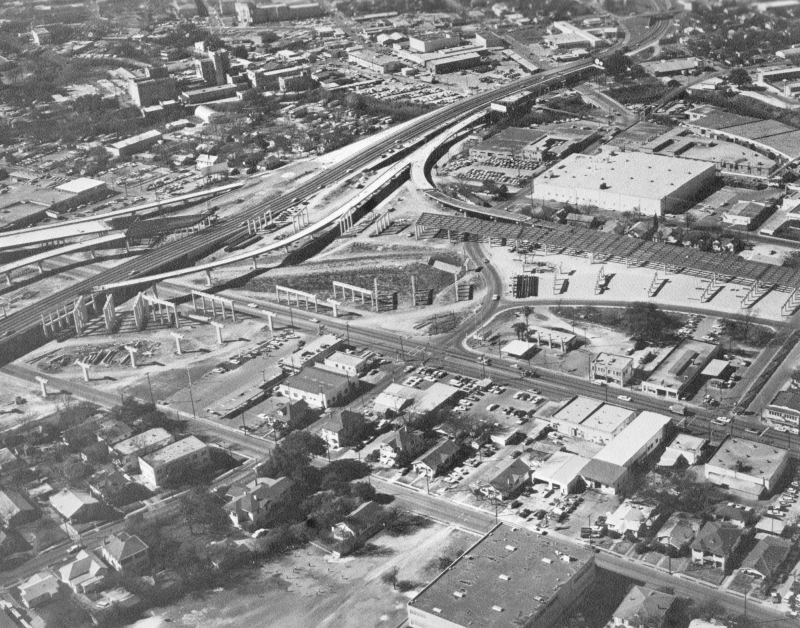
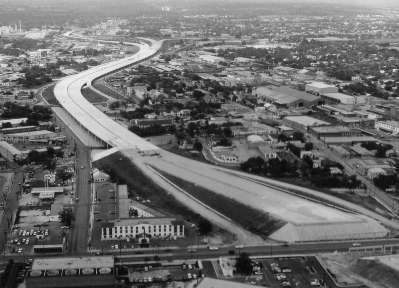
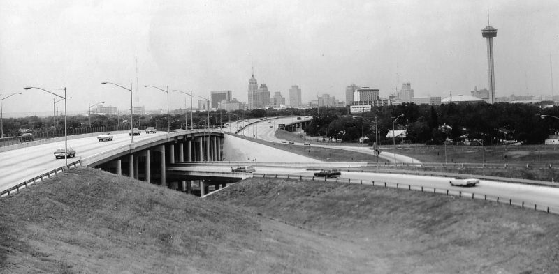
I‑37/I‑35/US 281 interchange under construction (1971) This is looking north along the northbound I‑37 overpass just south of I‑35, which you can see at the center left. Just beneath this location you can see the future ramp from southbound 281 to northbound I‑35. At the top left is the old Pearl brewery. (TxDOT) |
|
|
|
|
|
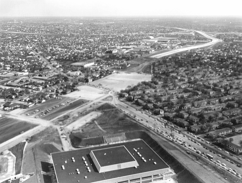
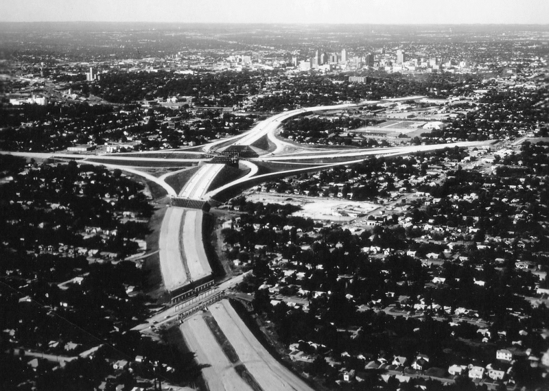
I‑37 at Nolan looking north (1971) A view of the freeway and interchange at I‑35 under construction. (TxDOT) |
|
I‑37 at Nolan looking north (1971) A view of the freeway and interchange at I‑35 under construction. (TxDOT) |
|
|
|
|
|
I‑37 at Houston St. looking north (1998) (TxDOT) |
|
I‑37 at Houston St. looking north (1998) (TxDOT) |
|
|
|
|
|
I‑37 at Commerce St. looking north (1971) (TxDOT) |
|
I‑37 at Commerce St. looking north (1971) (TxDOT) |
|
|
|
|
|
I‑37 at Cesar Chavez Blvd. looking southeast (1968) This photo was just a few days before the opening of HemisFair. To the south, you can see the freeway abruptly ends at Florida St. Notice that north of Cesar Chavez Blvd., the I‑37 right-of-way is paved to be used as a parking lot for the fair. At the bottom of the photo is what was then the fair's Texas Pavilion, which today is the Institute of Texan Cultures. (TxDOT) |
|
|
|
|

|
I‑37 at Cesar Chavez Blvd. (1971) After HemisFair, work to complete the freeway through downtown got underway. (TxDOT) |
|
I‑37 at Cesar Chavez Blvd. (1971) After HemisFair, work to complete the freeway through downtown got underway. (TxDOT) |
|
|
|
|
|
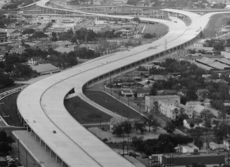
I‑37 at Cesar Chavez Blvd. looking northwest (ca. 1985) (TxDOT/Aerial Photos Weissgarber) |
|
I‑37 at Cesar Chavez Blvd. looking northwest (ca. 1985) (TxDOT/Aerial Photos Weissgarber) |
|
|
|
|
|
Over Hackberry St. and Boyer St. looking west (1961) This is just north of today's I‑37/I‑10 interchange before construction of both freeways. (TxDOT) |
|
Over Hackberry St. and Boyer St. looking west (1961) This is just north of today's I‑37/I‑10 interchange before construction of both freeways. (TxDOT) |
|
|
|
|

|
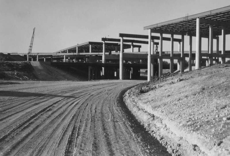
I‑37/I‑10 interchange under construction (1967) Looking north at the nearly completed freeway. (TxDOT) |
|
I‑37/I‑10 interchange under construction (1967) Looking north at the nearly completed freeway. (TxDOT) |
|
|
|
|
|
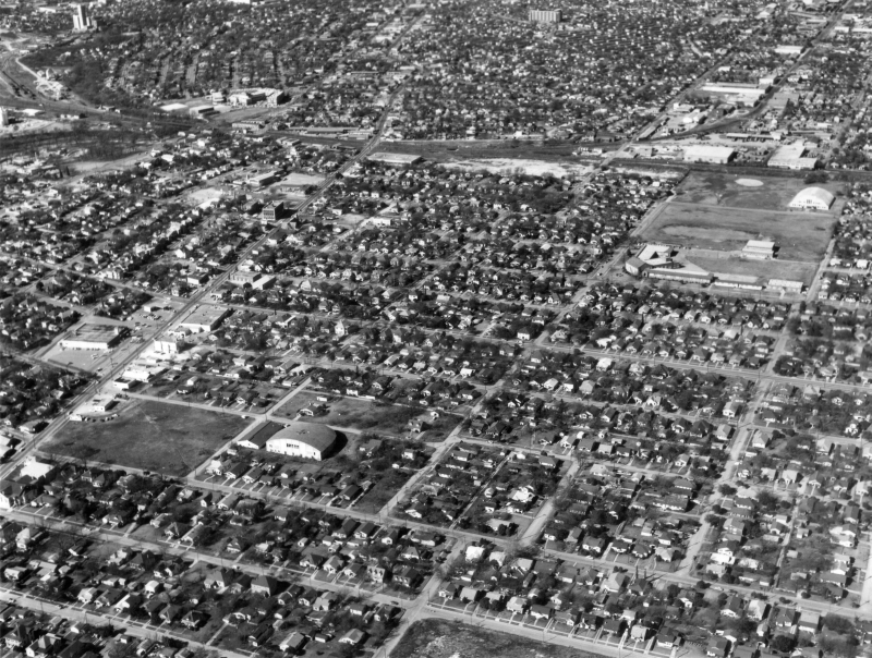
Over future I‑37/I‑10 interchange looking northwest (1961) Virtually everything in the bottom half of this picture was demolished for the interchange. The long building at the middle-right of the photo is Page Middle School, which today sits on the northeastern corner of the interchange. (TxDOT) |
|
|
|
|
|
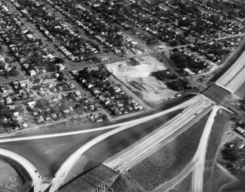
I‑37/I‑10 interchange under construction (1966) This is probably taken from the northeast corner of the interchange. (TxDOT) |
|
I‑37/I‑10 interchange under construction (1966) This is probably taken from the northeast corner of the interchange. (TxDOT) |
|
|
|
|
|
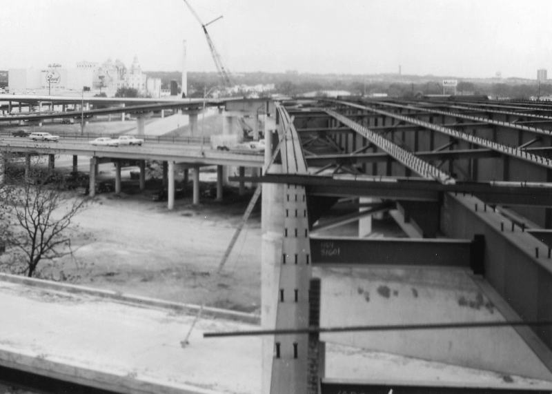
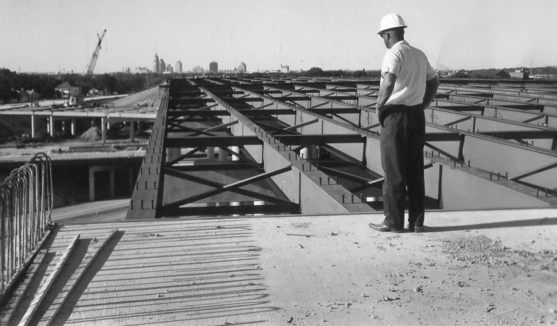
I‑37/I‑10 interchange under construction (1966) Looking north at the I‑37 bridge deck over I‑10 (TxDOT) |
|
I‑37/I‑10 interchange under construction (1966) Looking north at the I‑37 bridge deck over I‑10 (TxDOT) |
|
|
|
|
|
I‑37/I‑10 interchange under construction (1966) (TxDOT) |
|
I‑37/I‑10 interchange under construction (1966) (TxDOT) |
|
|
|
|
|
I‑37/I‑10 interchange (1975) (TxDOT) |
|
I‑37/I‑10 interchange (1975) (TxDOT) |
|
|
|
|
|
I‑37 over Fair Ave. looking north (1966) This picture shows the overpasses still under construction at Hackberry St., Steves Ave., and I‑10. (TxDOT) |
|
I‑37 over Fair Ave. looking north (1966) This picture shows the overpasses still under construction at Hackberry St., Steves Ave., and I‑10. (TxDOT) |
|
|
|
|
|
I‑37 at Steves Ave. looking southeast (1966) This photo shows the freeway in various stages of construction. (TxDOT) |
|
I‑37 at Steves Ave. looking southeast (1966) This photo shows the freeway in various stages of construction. (TxDOT) |
|
|
|
|

|
I‑37 at Fair Ave. looking southeast (1971) (TxDOT) |
|
I‑37 at Fair Ave. looking southeast (1971) (TxDOT) |
|
|
|
|
|
I‑37 at Fair Ave. looking southwest (1966) This picture shows the overpasses still under construction at Fair Ave. and Hackberry St. (TxDOT) |
|
I‑37 at Fair Ave. looking southwest (1966) This picture shows the overpasses still under construction at Fair Ave. and Hackberry St. (TxDOT) |
|
|
|
|

|
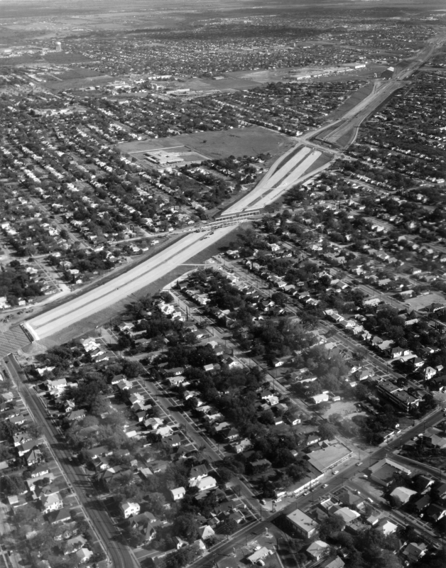
I‑37 at Southcross Blvd. looking northwest (1971) (TxDOT) |
|
I‑37 at Southcross Blvd. looking northwest (1971) (TxDOT) |
|
|
|
|
|
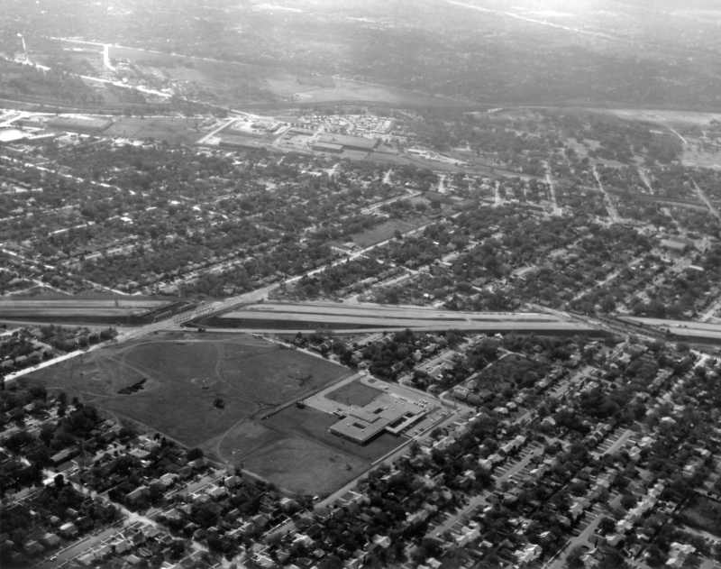
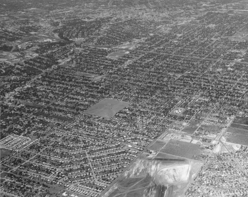
Over S New Braunfels Ave. at Southcross Blvd. looking northwest (1961) This is the future path of I‑37. Land is being cleared for McCreless Mall at the bottom of the photo. (TxDOT) |
|
Over S New Braunfels Ave. at Southcross Blvd. looking northwest (1961) This is the future path of I‑37. Land is being cleared for McCreless Mall at the bottom of the photo. (TxDOT) |
|
|
|
|
|
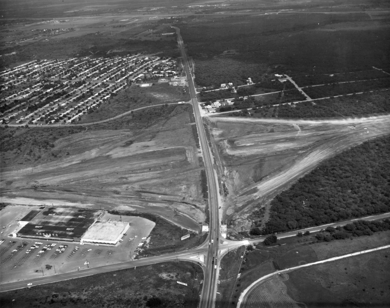
I‑37 at SE Military Dr. looking east (ca. 1967) The freeway and interchange are under construction. (TxDOT) |
|
I‑37 at SE Military Dr. looking east (ca. 1967) The freeway and interchange are under construction. (TxDOT) |
|
|
|
|
|
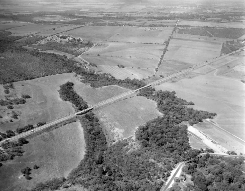
Over Old Corpus Christi Hwy. at Salado Creek looking west-southwest (1961) The road running through the middle of the photo is S Presa St. which was US 181 at this time. I‑37 would be built across the bottom of this photo. (TxDOT) |
|
Over Old Corpus Christi Hwy. at Salado Creek looking west-southwest (1961) The road running through the middle of the photo is S Presa St. which was US 181 at this time. I‑37 would be built across the bottom of this photo. (TxDOT) |
|
|
|
|