|
|
|
|
|
This page last updated January 5, 2025 |
Below are historical photos of Loop 1604 along with a brief history of the route. The photos were sourced from the TxDOT photo library, the San Antonio TxDOT district office, San Antonio-Bexar County Urban Transportation Study (SABCUTS) planning documents, and the author of this website.
Locations are given using the present-day roadway names. The photos are arranged generally clockwise starting near Potranco Rd. Click on each photo for an enlarged view.
Click here to return to the historical photo galleries page.
|
ADVERTISEMENT |
Route history


The first plans for an outer loop around San Antonio emerged in 1956. Most of the northern half was built as a new roadway completed between 1960 and 1971. The southern half was completed between 1970 and 1981 mostly by cobbling together the existing routes of FM 2173 and FM 1518. After initial plans to number it Loop 26 and Loop 334, the route was instead given a Farm-to-Market designation and numbered as FM 1604. The designation was changed to Loop 1604 in 1977.
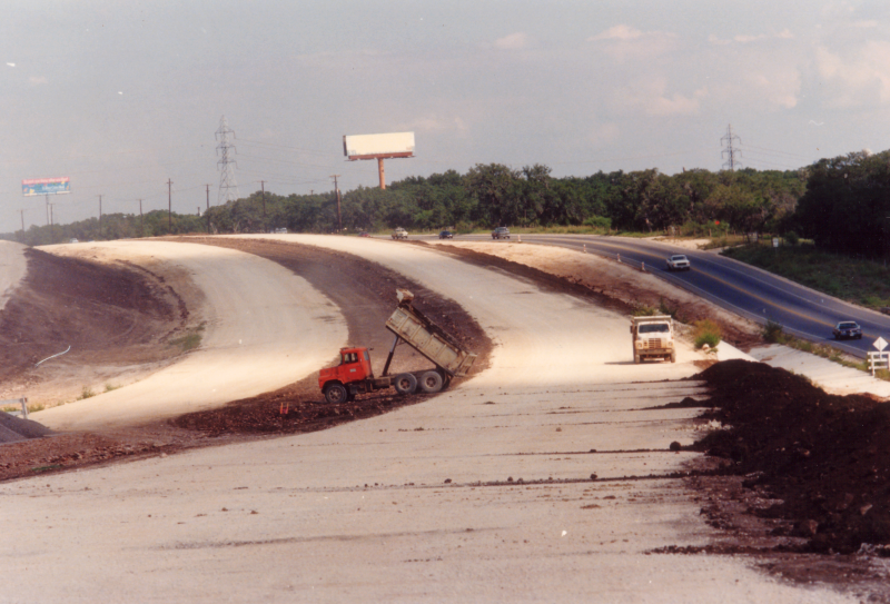
The original sections of the loop were a two-lane farm road, and during the late '70s and most of the '80s, the northern and western sections of Loop 1604 became known as "The Death Loop" due to a high number of fatal accidents.
Work to expand the northern sections to a freeway began in the mid '80s and continued through the '90s. The western segments were upgraded to a freeway in the past decade.
More details on the history of Loop 1604 is available here.
|
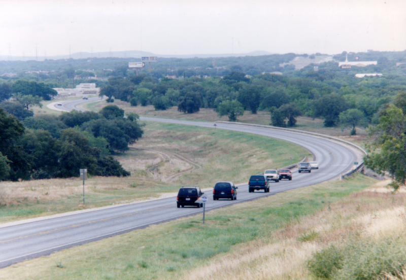
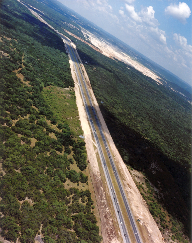
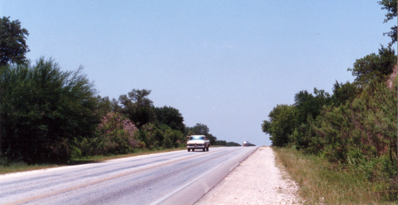
Loop 1604 at Falcon Wolf looking northwest (1998) (TxDOT) |
|
Loop 1604 at Falcon Wolf looking northwest (1998) (TxDOT) |
|
|
|
|
|
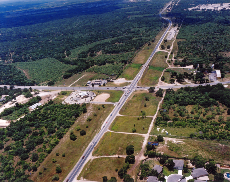
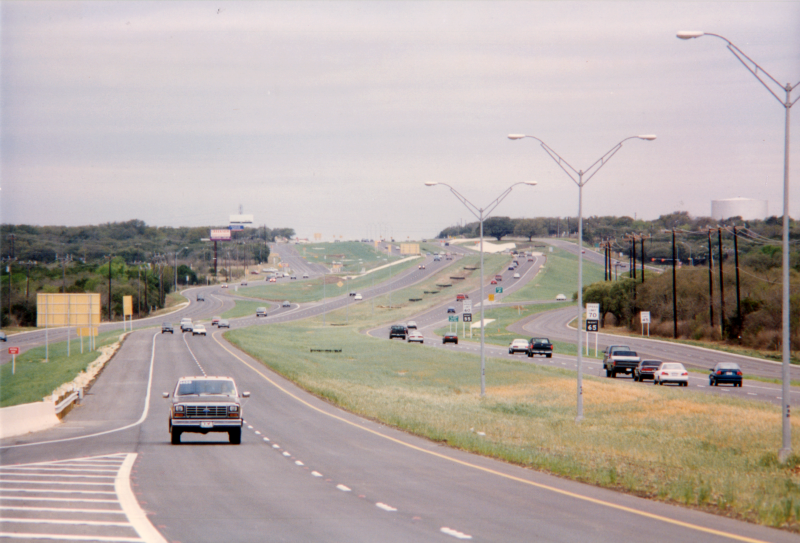
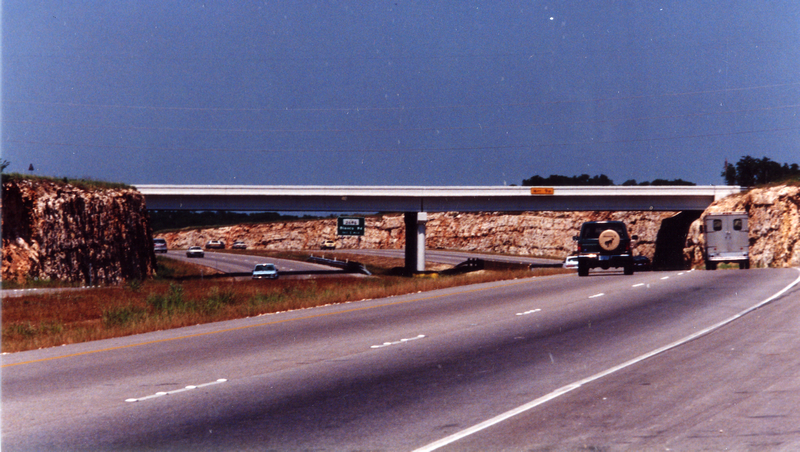
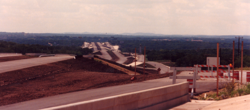
Loop 1604 at Potranco Rd. looking southeast (2001) (TxDOT) |
|
Loop 1604 at Potranco Rd. looking southeast (2001) (TxDOT) |
|
|
|
|
|
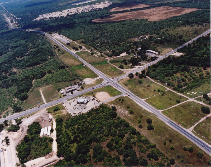
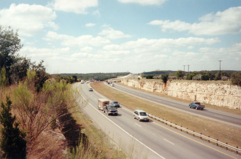
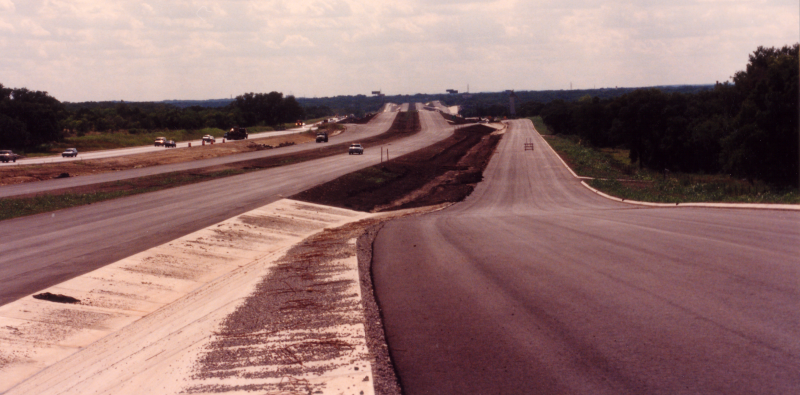
Loop 1604 at Potranco Rd. looking southwest (2001) (TxDOT) |
|
Loop 1604 at Potranco Rd. looking southwest (2001) (TxDOT) |
|
|
|
|

|
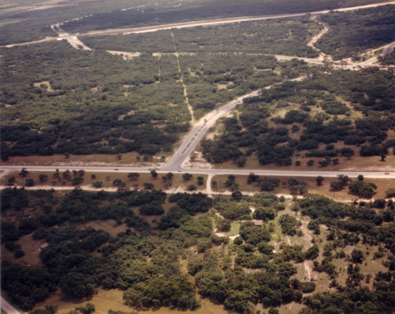
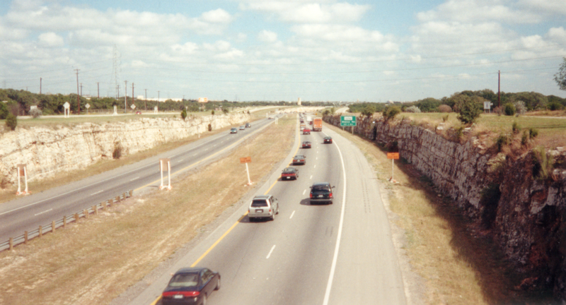
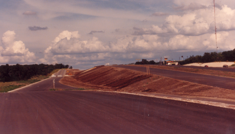
Loop 1604 at Military Dr. West looking northeast (2001) (TxDOT) |
|
Loop 1604 at Military Dr. West looking northeast (2001) (TxDOT) |
|
|
|
|
|
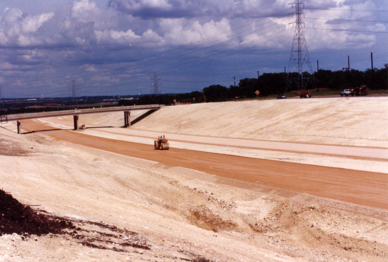
Loop 1604 at Ellison Dr. looking east (ca. 1987) (TxDOT) |
|
Loop 1604 at Ellison Dr. looking east (ca. 1987) (TxDOT) |
|
|
|
|
|
Loop 1604 at SH 151 looking southeast (ca. 1987) (TxDOT) |
|
Loop 1604 at SH 151 looking southeast (ca. 1987) (TxDOT) |
|
|
|
|
|
Loop 1604 at Culebra Rd. looking east-southeast (ca. 1987) (TxDOT) |
|
Loop 1604 at Culebra Rd. looking east-southeast (ca. 1987) (TxDOT) |
|
|
|
|
|
Loop 1604 at Culebra Rd. looking northwest (ca. 1998) (TxDOT) |
|
Loop 1604 at Culebra Rd. looking northwest (ca. 1998) (TxDOT) |
|
|
|
|
|
Loop 1604 at Culebra Rd. looking west (ca. 1998) (TxDOT) |
|
Loop 1604 at Culebra Rd. looking west (ca. 1998) (TxDOT) |
|
|
|
|
|
Loop 1604 at Culebra Rd. looking east (ca. 2000) (TxDOT) |
|
Loop 1604 at Culebra Rd. looking east (ca. 2000) (TxDOT) |
|
|
|
|
|
Loop 1604 at Culebra Rd. looking north (ca. 2000) (TxDOT) |
|
Loop 1604 at Culebra Rd. looking north (ca. 2000) (TxDOT) |
|
|
|
|
|
Loop 1604 at Culebra Rd. looking east (2001) (TxDOT) |
|
Loop 1604 at Culebra Rd. looking east (2001) (TxDOT) |
|
|
|
|
|
Loop 1604 at Culebra Rd. looking southwest (2001) (TxDOT) |
|
Loop 1604 at Culebra Rd. looking southwest (2001) (TxDOT) |
|
|
|
|
|
Loop 1604 at Culebra Rd. looking southeast (2001) (TxDOT) |
|
Loop 1604 at Culebra Rd. looking southeast (2001) (TxDOT) |
|
|
|
|
|
Loop 1604 near Culebra Rd. looking south (1988) This is a half mile or so north of Culebra Rd. (TxDOT) |
|
Loop 1604 near Culebra Rd. looking south (1988) This is a half mile or so north of Culebra Rd. (TxDOT) |
|
|
|
|
|
Loop 1604 near Bandera Rd. looking southwest (1988) This is a half mile or so south of Bandera Rd. (TxDOT) |
|
Loop 1604 near Bandera Rd. looking southwest (1988) This is a half mile or so south of Bandera Rd. (TxDOT) |
|
|
|
|
|
Loop 1604 near Bandera Rd. looking north (1988) This is a half mile or so south of Bandera Rd. (TxDOT) |
|
Loop 1604 near Bandera Rd. looking north (1988) This is a half mile or so south of Bandera Rd. (TxDOT) |
|
|
|
|

|
Loop 1604 near Bandera Rd. looking north (1996) (TxDOT) |
|
Loop 1604 near Bandera Rd. looking north (1996) (TxDOT) |
|
|
|
|
|
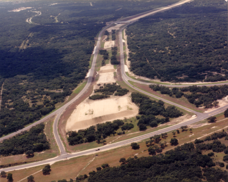
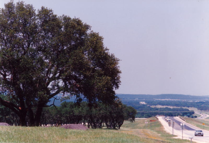
Loop 1604 at Bandera Rd. looking northeast (1988) Note the two-lane Loop 1604. The large tree in the foreground was preserved when this section was widened to a freeway and is still standing today on the southbound access road. (TxDOT) |
|
Loop 1604 at Bandera Rd. looking northeast (1988) Note the two-lane Loop 1604. The large tree in the foreground was preserved when this section was widened to a freeway and is still standing today on the southbound access road. (TxDOT) |
|
|
|
|
|
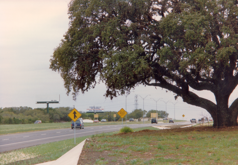
Loop 1604 near Bandera Rd. looking south (1996) This is a half mile or so south of Bandera Rd. This is the same tree as in the previous photo. (TxDOT) |
|
Loop 1604 near Bandera Rd. looking south (1996) This is a half mile or so south of Bandera Rd. This is the same tree as in the previous photo. (TxDOT) |
|
|
|
|

|
Loop 1604 at Bandera Rd. looking northeast (1996) (TxDOT) |
|
Loop 1604 at Bandera Rd. looking northeast (1996) (TxDOT) |
|
|
|
|
|
Loop 1604 at Bandera Rd. looking north (1996) (TxDOT) |
|
Loop 1604 at Bandera Rd. looking north (1996) (TxDOT) |
|
|
|
|
|
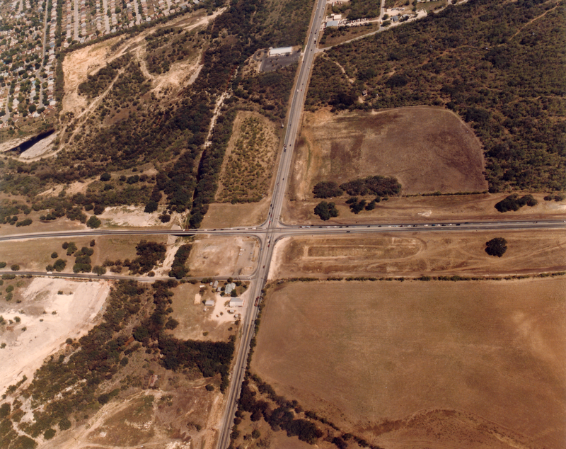
Loop 1604 at Bandera Rd. looking north (1998) (TxDOT) |
|
Loop 1604 at Bandera Rd. looking north (1998) (TxDOT) |
|
|
|
|

|
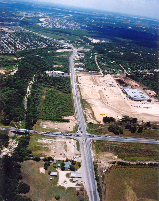
Loop 1604 at Bandera Rd. looking north (2001) (TxDOT) |
|
Loop 1604 at Bandera Rd. looking north (2001) (TxDOT) |
|
|
|
|

|
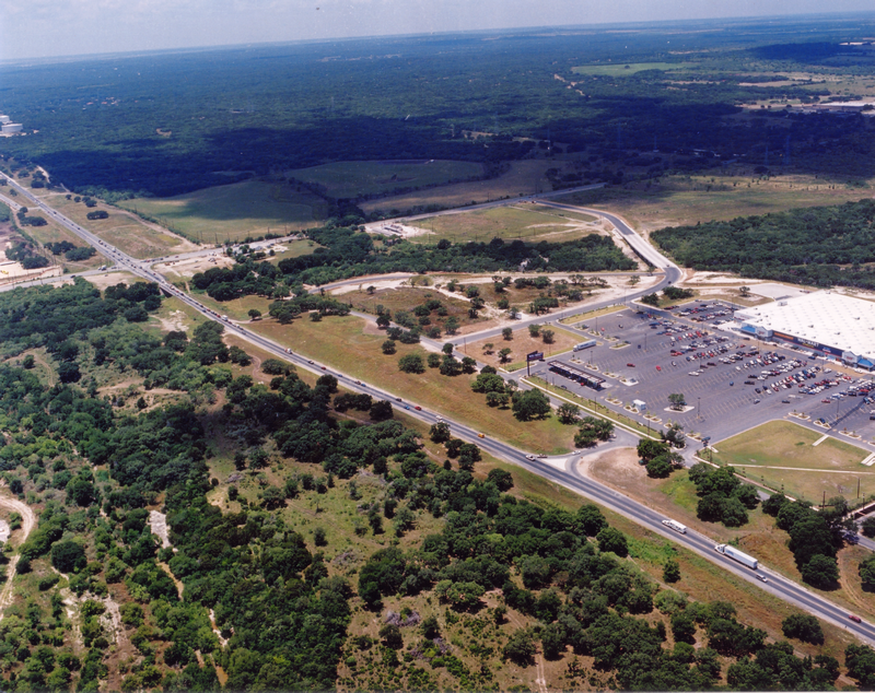
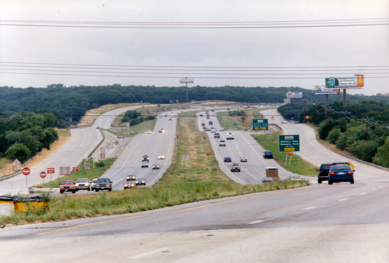
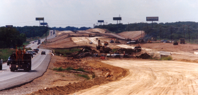
Loop 1604 at Bandera Rd. looking southwest (ca. 1998) (TxDOT) |
|
Loop 1604 at Bandera Rd. looking southwest (ca. 1998) (TxDOT) |
|
|
|
|
|
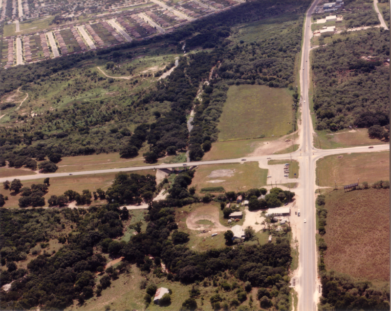
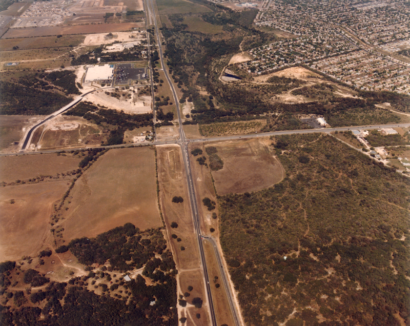
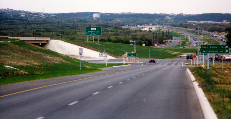
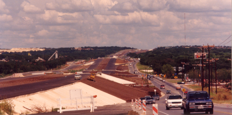
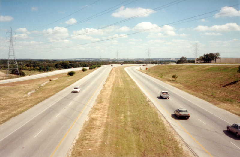
Loop 1604 at Hausman looking southwest (1996) (TxDOT) |
|
Loop 1604 at Hausman looking southwest (1996) (TxDOT) |
|
|
|
|
|
Loop 1604 at Babcock looking southeast (1971) The empty area in the center of the photo is where UTSA is today. I-10 runs left-to-right across the top. (Courtesy of Jared Maurtua) |
|
Loop 1604 at Babcock looking southeast (1971) The empty area in the center of the photo is where UTSA is today. I-10 runs left-to-right across the top. (Courtesy of Jared Maurtua) |
|
|
|
|
|
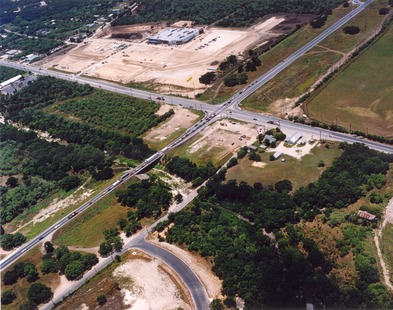
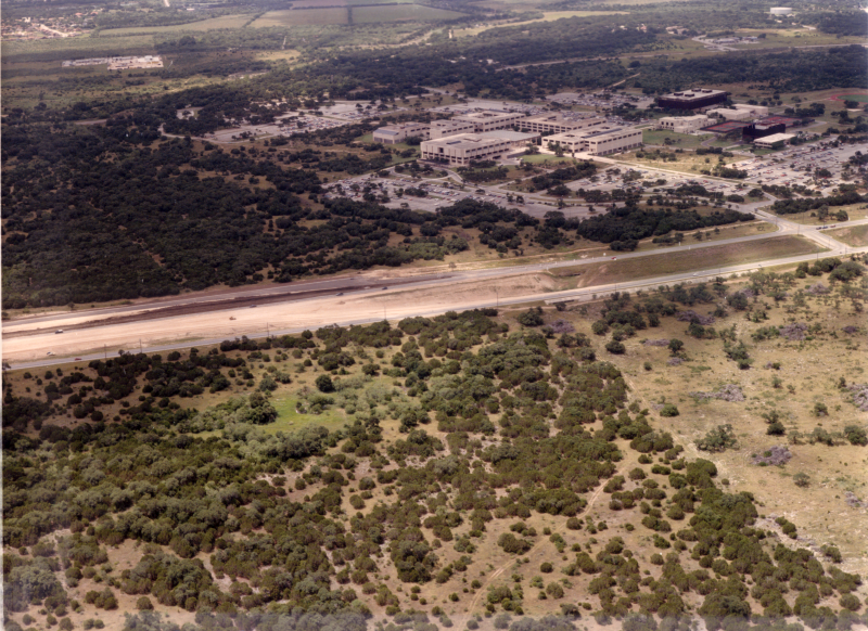
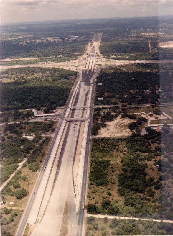
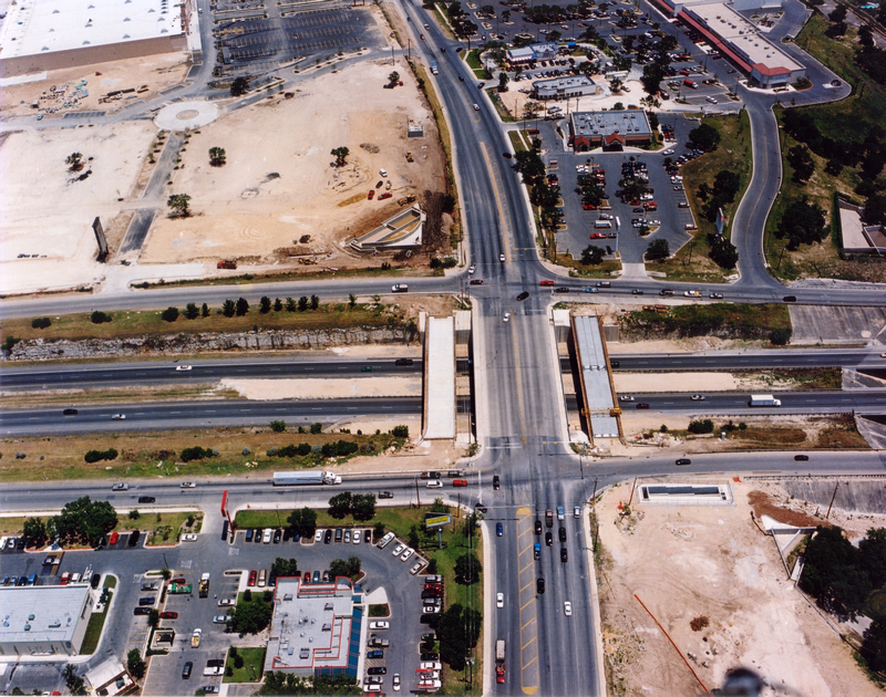
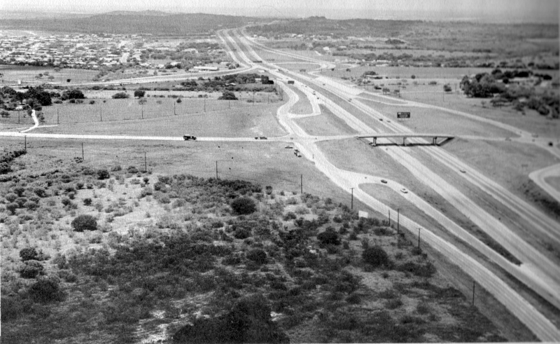
Loop 1604 at John Peace looking southwest (ca. 1985) UTSA is in the background. This was taken prior to freeway construction here. Notice Loop 1604 was a divided highway with signals. (TxDOT) |
|
Loop 1604 at John Peace looking southwest (ca. 1985) UTSA is in the background. This was taken prior to freeway construction here. Notice Loop 1604 was a divided highway with signals. (TxDOT) |
|
|
|
|
|
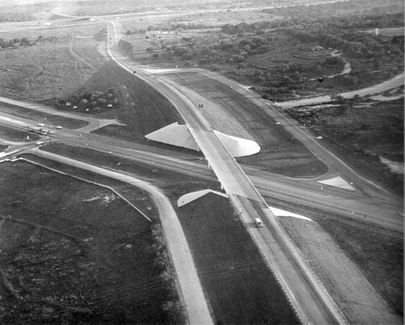
Loop 1604 at Leon Creek looking southwest (ca. 1980) This was during construction of the first phase of the I-10/Loop 1604 interchange. (TxDOT) |
|
Loop 1604 at Leon Creek looking southwest (ca. 1980) This was during construction of the first phase of the I-10/Loop 1604 interchange. (TxDOT) |
|
|
|
|
|
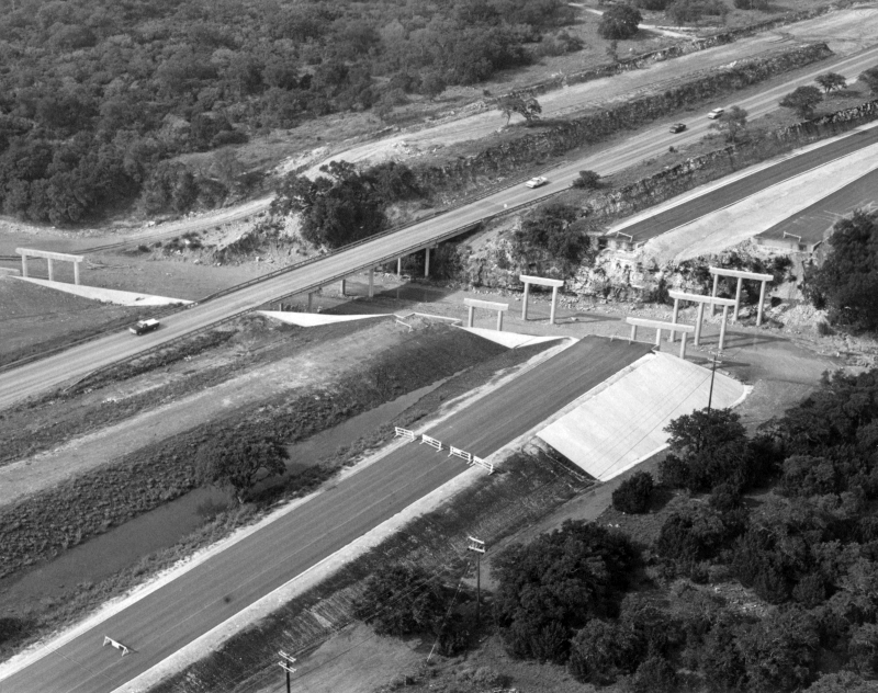
Loop 1604 at Leon Creek looking southwest (ca. 1985) This was during construction of the second phase of the I-10/Loop 1604 interchange. (TxDOT) |
|
Loop 1604 at Leon Creek looking southwest (ca. 1985) This was during construction of the second phase of the I-10/Loop 1604 interchange. (TxDOT) |
|
|
|
|
|
Loop 1604 at I-10 looking south (ca. 1985) This was during construction of the second phase of the I-10/Loop 1604 interchange. (TxDOT) |
|
Loop 1604 at I-10 looking south (ca. 1985) This was during construction of the second phase of the I-10/Loop 1604 interchange. (TxDOT) |
|
|
|
|
|
Loop 1604 at Tradesman Dr. looking south (ca. 1985) This was during construction of the second phase of the I-10/Loop 1604 interchange, which included the freeway section along here. (TxDOT) |
|
Loop 1604 at Tradesman Dr. looking south (ca. 1985) This was during construction of the second phase of the I-10/Loop 1604 interchange, which included the freeway section along here. (TxDOT) |
|
|
|
|
|
Loop 1604 at Tradesman Dr. looking east (1998) (TxDOT) |
|
Loop 1604 at Tradesman Dr. looking east (1998) (TxDOT) |
|
|
|
|
|
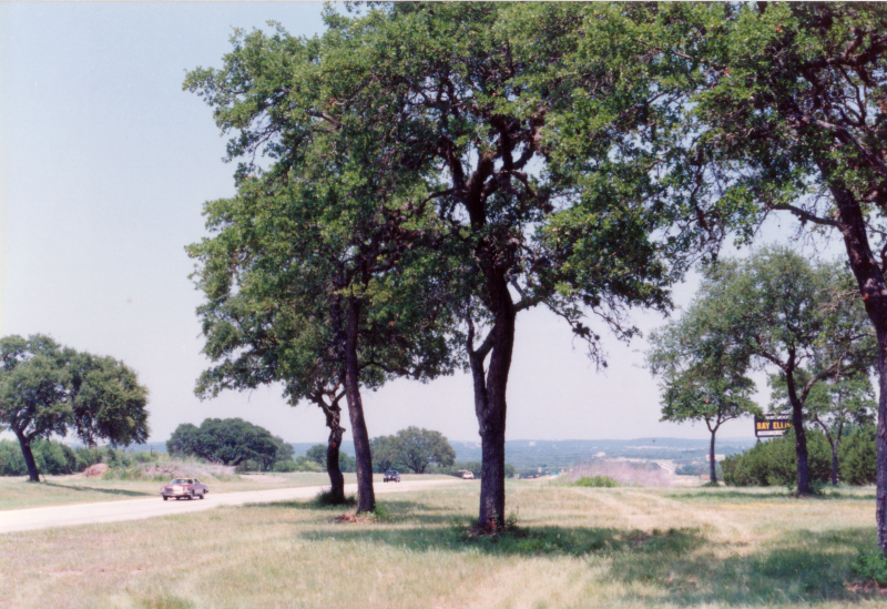
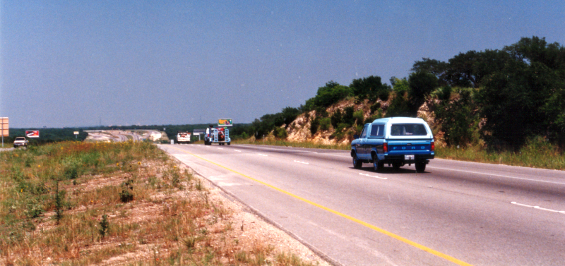
Loop 1604 at Lockhill-Selma Rd. looking west (ca. 1985) (TxDOT) |
|
Loop 1604 at Lockhill-Selma Rd. looking west (ca. 1985) (TxDOT) |
|
|
|
|

|
Loop 1604 at Lockhill-Selma Rd. looking southeast (ca. 1985) Note that the freeway ends and exits to the access road to cross Lockhill-Selma Rd. at the left, which is essentially a stub at this time. (TxDOT) |
|
Loop 1604 at Lockhill-Selma Rd. looking southeast (ca. 1985) Note that the freeway ends and exits to the access road to cross Lockhill-Selma Rd. at the left, which is essentially a stub at this time. (TxDOT) |
|
|
|
|
|
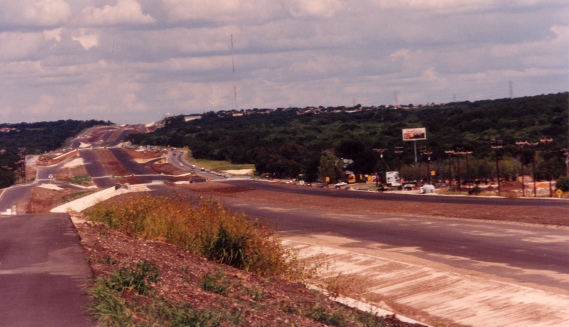
Loop 1604 at Lockhill-Selma Rd. looking east-northeast (1998) (TxDOT) |
|
Loop 1604 at Lockhill-Selma Rd. looking east-northeast (1998) (TxDOT) |
|
|
|
|
|
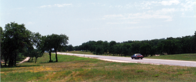
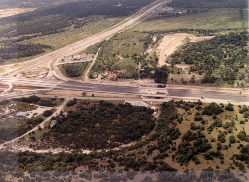
Loop 1604 at NW Military Hwy. looking east (1988) (TxDOT) |
|
Loop 1604 at NW Military Hwy. looking east (1988) (TxDOT) |
|
|
|
|
|
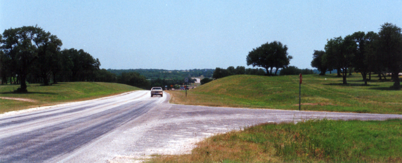
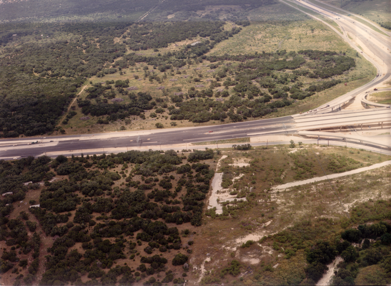
Loop 1604 between NW Military Hwy. and Bitters Rd. looking east (1988) Note there were no access roads along this stretch at this time. (TxDOT) |
|
Loop 1604 between NW Military Hwy. and Bitters Rd. looking east (1988) Note there were no access roads along this stretch at this time. (TxDOT) |
|
|
|
|
|
Loop 1604 between Bitters Rd. and NW Military Hwy. looking northwest (2001) (TxDOT) |
|
Loop 1604 between Bitters Rd. and NW Military Hwy. looking northwest (2001) (TxDOT) |
|
|
|
|
|
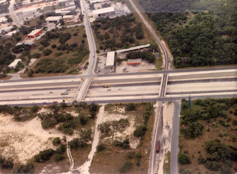
Loop 1604 at Bitters Rd. looking east (1988) (TxDOT) |
|
Loop 1604 at Bitters Rd. looking east (1988) (TxDOT) |
|
|
|
|
|
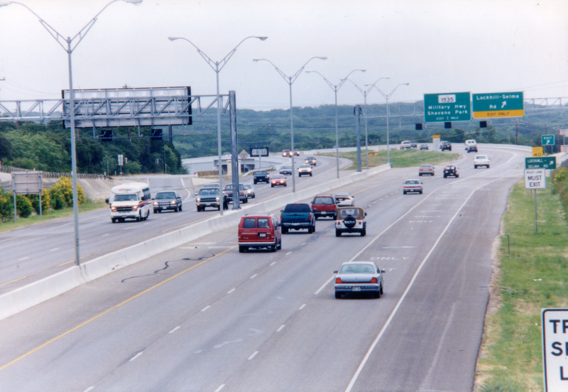
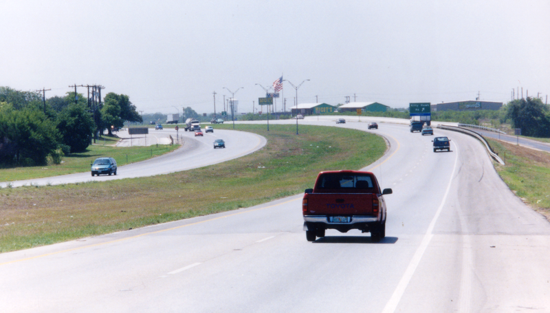
Loop 1604 at Bitters Rd. looking west (ca. 2001) (Brian Purcell) |
|
Loop 1604 at Bitters Rd. looking west (ca. 2001) (Brian Purcell) |
|
|
|
|
|
Loop 1604 at Bitters Rd. looking east (ca. 2001) (Brian Purcell) |
|
Loop 1604 at Bitters Rd. looking east (ca. 2001) (Brian Purcell) |
|
|
|
|
|
Loop 1604 at Blanco Rd. looking north (2001) (TxDOT) |
|
Loop 1604 at Blanco Rd. looking north (2001) (TxDOT) |
|
|
|
|
|
Loop 1604 at Redland Rd. looking east (1990) (TxDOT) |
|
Loop 1604 at Redland Rd. looking east (1990) (TxDOT) |
|
|
|
|
|
Loop 1604 at Redland Rd. looking east (1991) (TxDOT) |
|
Loop 1604 at Redland Rd. looking east (1991) (TxDOT) |
|
|
|
|
|
Loop 1604 at Redland Rd. looking west (1991) (TxDOT) |
|
Loop 1604 at Redland Rd. looking west (1991) (TxDOT) |
|
|
|
|
|
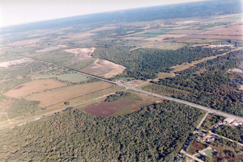
Loop 1604 at Bulverde Rd. looking west (1990) (TxDOT) |
|
Loop 1604 at Bulverde Rd. looking west (1990) (TxDOT) |
|
|
|
|
|
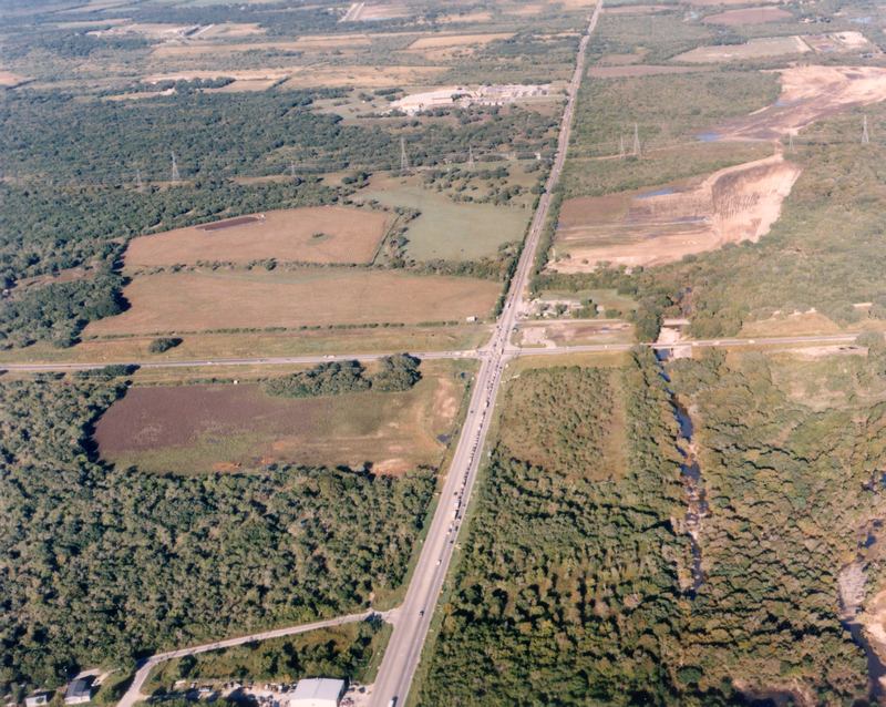
Loop 1604 at Bulverde Rd. looking east (1991) (TxDOT) |
|
Loop 1604 at Bulverde Rd. looking east (1991) (TxDOT) |
|
|
|
|
|
Loop 1604 at Bulverde Rd. looking east (1991) (TxDOT) |
|
Loop 1604 at Bulverde Rd. looking east (1991) (TxDOT) |
|
|
|
|

|
Loop 1604 at Judson Rd. looking southeast (1983) Loop 1604 is the road running from the top left to lower right. (TxDOT) |
|
Loop 1604 at Judson Rd. looking southeast (1983) Loop 1604 is the road running from the top left to lower right. (TxDOT) |
|
|
|
|
|
Loop 1604 near Judson Rd. looking southeast (1983) (TxDOT) |
|
Loop 1604 near Judson Rd. looking southeast (1983) (TxDOT) |
|
|
|
|
|
Loop 1604 at Judson Rd. looking west (1991) (TxDOT) |
|
Loop 1604 at Judson Rd. looking west (1991) (TxDOT) |
|
|
|
|
|
Loop 1604 at Judson Rd. looking east (1991) (TxDOT) |
|
Loop 1604 at Judson Rd. looking east (1991) (TxDOT) |
|
|
|
|
|
Loop 1604 at Judson Rd. looking east (1991) (TxDOT) |
|
Loop 1604 at Judson Rd. looking east (1991) (TxDOT) |
|
|
|
|
|
Loop 1604 at Green Mountain Rd. looking southeast (1991) (TxDOT) |
|
Loop 1604 at Green Mountain Rd. looking southeast (1991) (TxDOT) |
|
|
|
|
|
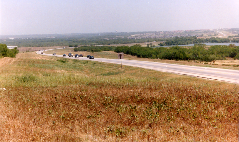
Loop 1604 at Green Mountain Rd. looking northeast (ca. 2001) (Brian Purcell) |
|
Loop 1604 at Green Mountain Rd. looking northeast (ca. 2001) (Brian Purcell) |
|
|
|
|
|
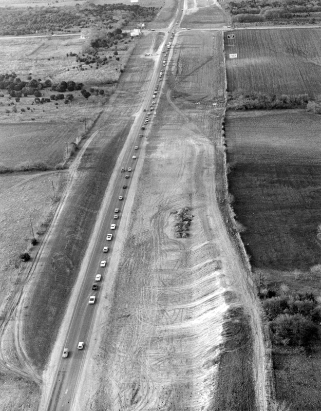
Loop 1604 at Nacogdoches Rd. looking east (1983) Loop 1604 is the road running from the bottom left to top right. (TxDOT) |
|
Loop 1604 at Nacogdoches Rd. looking east (1983) Loop 1604 is the road running from the bottom left to top right. (TxDOT) |
|
|
|
|
|
Loop 1604 at Nacogdoches Rd. looking south (1983) (TxDOT) |
|
Loop 1604 at Nacogdoches Rd. looking south (1983) (TxDOT) |
|
|
|
|
|
Loop 1604 at Nacogdoches Rd. looking northwest (1983) (TxDOT) |
|
Loop 1604 at Nacogdoches Rd. looking northwest (1983) (TxDOT) |
|
|
|
|
|
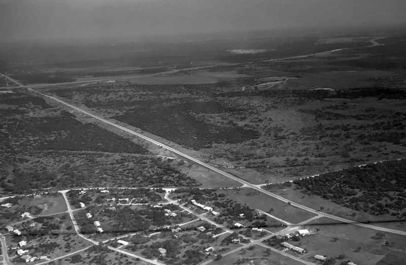
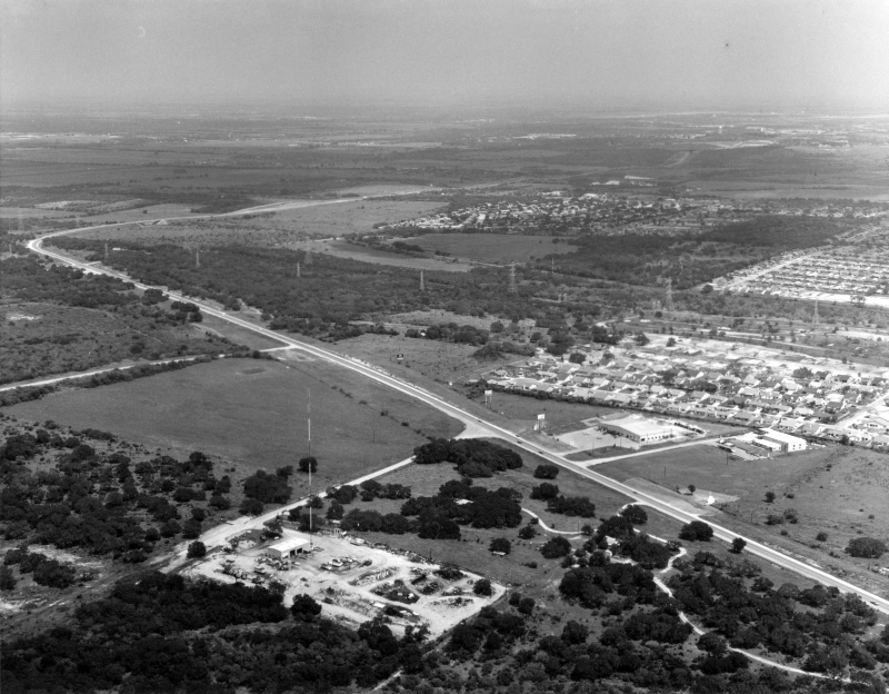
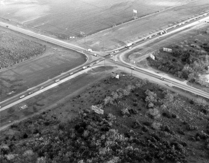
I-35 North at Loop 1604 looking southwest (ca. 1972) Notice the cleared right-of-way for a future interchange. (SABCUTS) |
|
I-35 North at Loop 1604 looking southwest (ca. 1972) Notice the cleared right-of-way for a future interchange. (SABCUTS) |
|
|
|
|
|
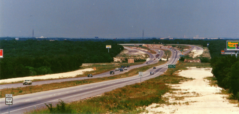
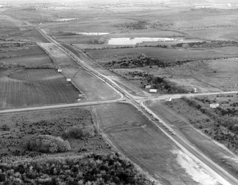
Loop 1604 at Pat Booker Rd. looking northwest (ca. 1972) (SABCUTS) |
|
Loop 1604 at Pat Booker Rd. looking northwest (ca. 1972) (SABCUTS) |
|
|
|
|
|
Loop 1604 at Kitty Hawk Rd. looking southeast (1998) (TxDOT) |
|
Loop 1604 at Kitty Hawk Rd. looking southeast (1998) (TxDOT) |
|
|
|
|
|
Loop 1604 north of I-10 East looking north-northeast (1998) (TxDOT) |
|
Loop 1604 north of I-10 East looking north-northeast (1998) (TxDOT) |
|
|
|
|

|
Loop 1604 location unknown (1983) Sign put up by the Highway Department somewhere on the North Side during the "Death Loop" period. (TxDOT) |
|
Loop 1604 location unknown (1983) Sign put up by the Highway Department somewhere on the North Side during the "Death Loop" period. (TxDOT) |
|
|
|
|
|
Loop 1604 location unknown (1988) This might be near Judson Rd. (TxDOT) |
|
Loop 1604 location unknown (1988) This might be near Judson Rd. (TxDOT) |
|
|
|
|