|
|
|
|
|
This page last updated March 7, 2024 |
Below are historical photos of State Highway 151 along with a brief history of the route. The photos were sourced from the San Antonio TxDOT district office and this website's author.
Locations are given using the present-day roadway names. The photos are arranged generally from west to east. Click on each photo for an enlarged view.
Click here to return to the historical photo galleries page.
|
ADVERTISEMENT |
Route history

In 1983, local real estate developer Marty Wender began floating the idea of a freeway through his planned Westover Hills development. Besides providing access to his new development, it would also help complete a missing link in San Antonio's freeway system. To help ensure its approval, he donated land for the freeway, coordinated the donation of right-of-way from adjacent landowners, and also kicked-in funding to cover half the cost of the initial access road construction. The Texas Transportation Commission approved the route in March 1984.
Construction of the access roads from Loop 410 to Loop 1604 began in 1985 and was completed in 1987, and the access roads between Loop 410 and US 90 opened in 1988, just in time for the opening of SeaWorld.
The access roads served as the primary route for the better part of two decades. The mainlanes were built in sections as traffic warranted and funding was available. In 1997, the first section of mainlanes opened from just east of Ingram Rd. to just west of Potranco Rd.. Mainlane overpasses at Pinn Rd. and Historical Old Highway 90 opened in 1998, and the overpass at Callaghan Rd. along with the mainlanes from just west of Callghan to US 90 opened in 2001. The remainder of the mainlanes from Callaghan all the way to Loop 1604 opened in two phases in 2004.
More details on the history of SH 151 is available here.
|
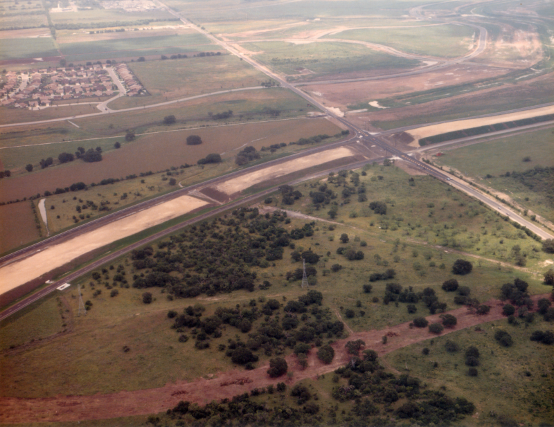
SH 151 at Loop 1604 looking east-southeast (ca. 1987) Note the two lane Loop 1604 in the foreground. (TxDOT) |
|
SH 151 at Loop 1604 looking east-southeast (ca. 1987) Note the two lane Loop 1604 in the foreground. (TxDOT) |
|
|
|
|
|
SH 151 at Loop 1604 looking southeast (ca. 1987) (TxDOT) |
|
SH 151 at Loop 1604 looking southeast (ca. 1987) (TxDOT) |
|
|
|
|
|
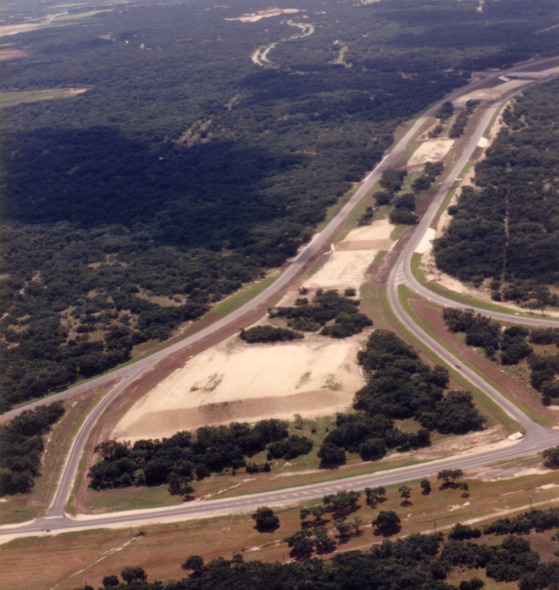
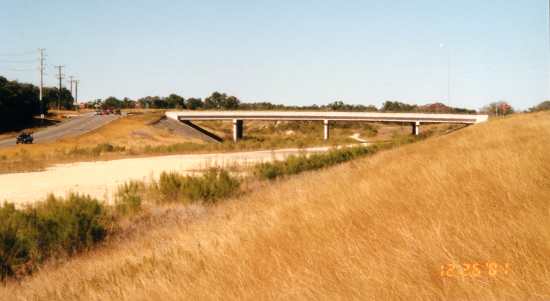
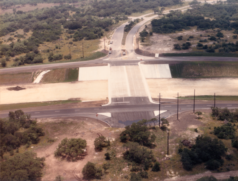
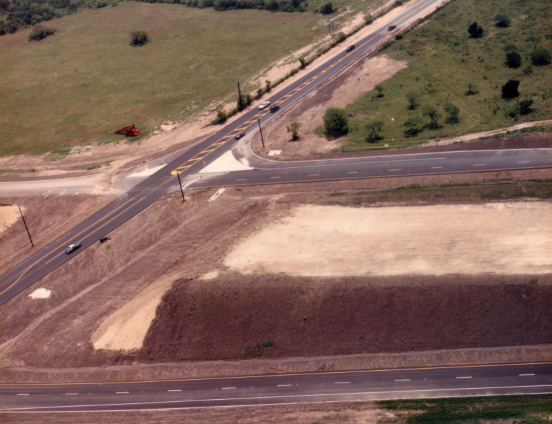
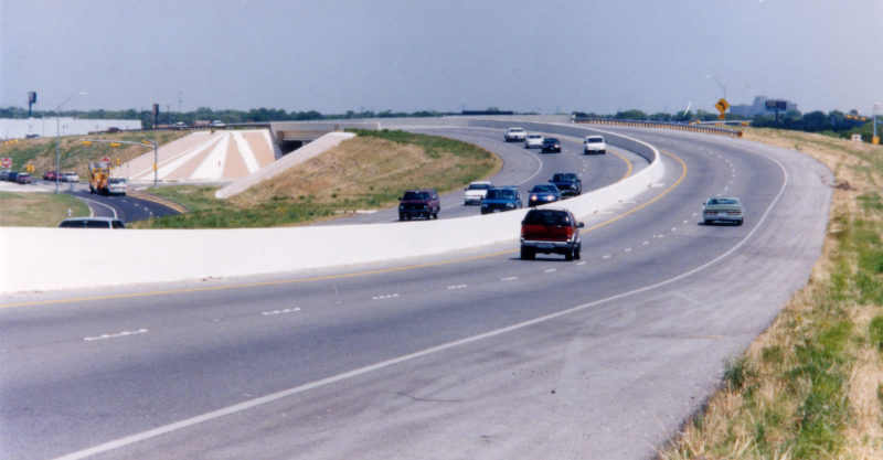
SH 151 at Wiseman Blvd. looking southeast (2001) The overpasses over the future mainlanes at Wiseman, Westover Hills, and Military were built at the same time that the access roads were built in 1987. The mainlanes were subsequently built in 2004. (Brian Purcell) |
|
SH 151 at Wiseman Blvd. looking southeast (2001) The overpasses over the future mainlanes at Wiseman, Westover Hills, and Military were built at the same time that the access roads were built in 1987. The mainlanes were subsequently built in 2004. (Brian Purcell) |
|
|
|
|

|
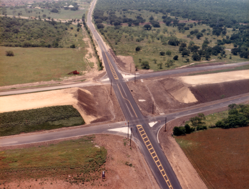
SH 151 at Wiseman Blvd. looking southeast (ca. 2001) (Brian Purcell) |
|
SH 151 at Wiseman Blvd. looking southeast (ca. 2001) (Brian Purcell) |
|
|
|
|
|
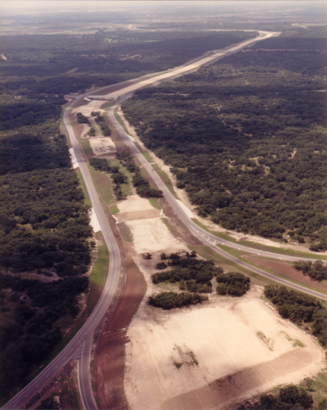
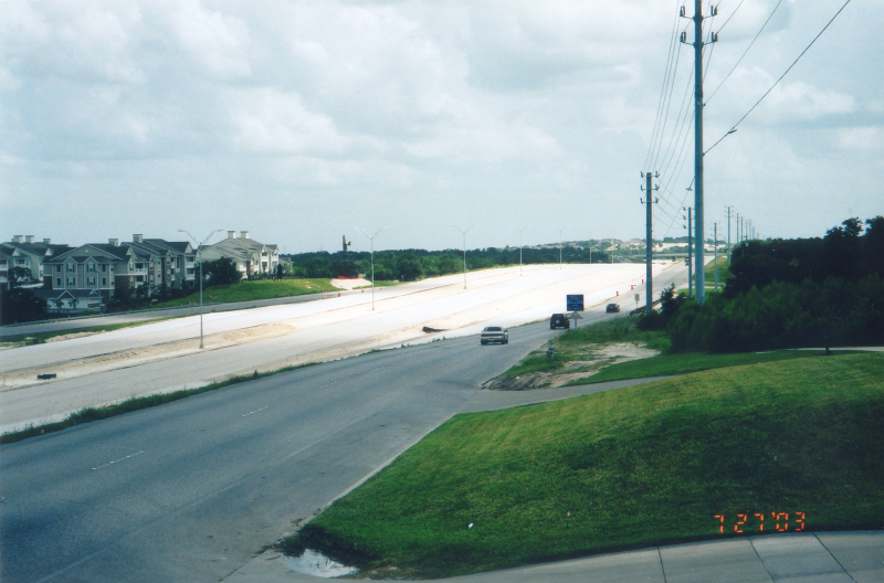
SH 151 at Wiseman Blvd. looking southeast (2003) (Brian Purcell) |
|
SH 151 at Wiseman Blvd. looking southeast (2003) (Brian Purcell) |
|
|
|
|
|
SH 151 at Wiseman Blvd. looking northwest (2001) (Brian Purcell) |
|
SH 151 at Wiseman Blvd. looking northwest (2001) (Brian Purcell) |
|
|
|
|
|
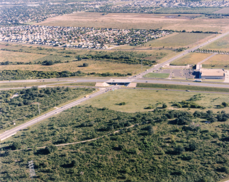
SH 151 at Westover Hills Blvd. looking southeast (2003) (Brian Purcell) |
|
SH 151 at Westover Hills Blvd. looking southeast (2003) (Brian Purcell) |
|
|
|
|
|
SH 151 at Westover Hills Blvd. looking southeast (1987) (TxDOT) |
|
SH 151 at Westover Hills Blvd. looking southeast (1987) (TxDOT) |
|
|
|
|
|
SH 151 at Westover Hills Blvd. looking south-southeast (1987) (TxDOT) |
|
SH 151 at Westover Hills Blvd. looking south-southeast (1987) (TxDOT) |
|
|
|
|

|
SH 151 east of Military Dr. looking northwest (1987) (TxDOT) |
|
SH 151 east of Military Dr. looking northwest (1987) (TxDOT) |
|
|
|
|

|
SH 151 at Military Dr. looking southeast (1987) (TxDOT) |
|
SH 151 at Military Dr. looking southeast (1987) (TxDOT) |
|
|
|
|
|
SH 151 at Military Dr. looking southwest (1987) (TxDOT) |
|
SH 151 at Military Dr. looking southwest (1987) (TxDOT) |
|
|
|
|
|
SH 151 at Military Dr. looking northwest (1987) (TxDOT) |
|
SH 151 at Military Dr. looking northwest (1987) (TxDOT) |
|
|
|
|
|
SH 151 at Hunt Ln. looking southeast (1987) (TxDOT) |
|
SH 151 at Hunt Ln. looking southeast (1987) (TxDOT) |
|
|
|
|
|
SH 151 at Hunt Ln. looking south (1987) (TxDOT) |
|
SH 151 at Hunt Ln. looking south (1987) (TxDOT) |
|
|
|
|
|
SH 151 at Potranco Rd. looking southeast (ca. 1987) (TxDOT) |
|
SH 151 at Potranco Rd. looking southeast (ca. 1987) (TxDOT) |
|
|
|
|
|
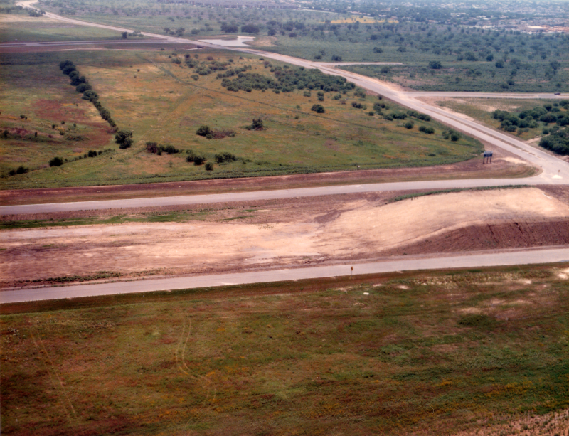
SH 151 at Potranco Rd. looking southwest (1987) (TxDOT) |
|
SH 151 at Potranco Rd. looking southwest (1987) (TxDOT) |
|
|
|
|
|
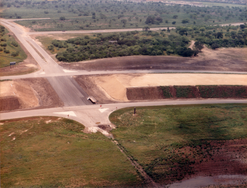
SH 151 at Potranco Rd. looking west (1987) (TxDOT) |
|
SH 151 at Potranco Rd. looking west (1987) (TxDOT) |
|
|
|
|
|
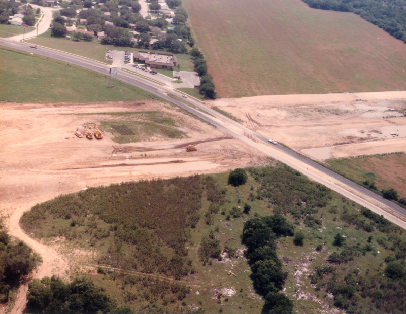
SH 151 at Potranco Rd. looking northeast (ca. 1997) This was shortly after the freeway mainlanes here were completed. The stretch of mainlanes from just east of Ingram to just west of Potranco were the first to be completed. (TxDOT) |
|
SH 151 at Potranco Rd. looking northeast (ca. 1997) This was shortly after the freeway mainlanes here were completed. The stretch of mainlanes from just east of Ingram to just west of Potranco were the first to be completed. (TxDOT) |
|
|
|
|
|
SH 151 at Potranco Rd. looking southeast (1998) (TxDOT) |
|
SH 151 at Potranco Rd. looking southeast (1998) (TxDOT) |
|
|
|
|
|
SH 151 at Ingram Rd. looking east (ca. 1997) This is the continuation of the new mainlanes discussed at Potranco above. (TxDOT) |
|
SH 151 at Ingram Rd. looking east (ca. 1997) This is the continuation of the new mainlanes discussed at Potranco above. (TxDOT) |
|
|
|
|

|
SH 151 at Ingram Rd. looking southeast (1987) (TxDOT) |
|
SH 151 at Ingram Rd. looking southeast (1987) (TxDOT) |
|
|
|
|
|
SH 151 at Ingram Rd. looking southwest (1987) (TxDOT) |
|
SH 151 at Ingram Rd. looking southwest (1987) (TxDOT) |
|
|
|
|
|
SH 151 at Ingram Rd. looking west (1987) (TxDOT) |
|
SH 151 at Ingram Rd. looking west (1987) (TxDOT) |
|
|
|
|
|
SH 151 at Ingram Rd. looking northwest (2001) (Brian Purcell) |
|
SH 151 at Ingram Rd. looking northwest (2001) (Brian Purcell) |
|
|
|
|
|
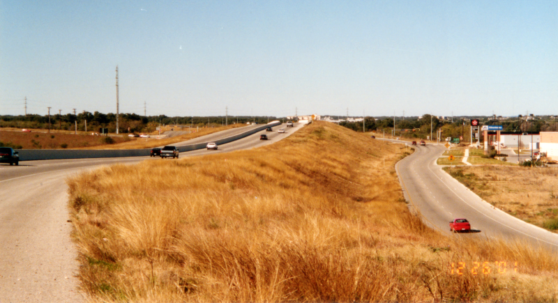
SH 151 at Ingram Rd. looking northwest (2002) Looking toward the end of the freeway mainlanes. Note the ramps to/from the access roads on either side. (Brian Purcell) |
|
SH 151 at Ingram Rd. looking northwest (2002) Looking toward the end of the freeway mainlanes. Note the ramps to/from the access roads on either side. (Brian Purcell) |
|
|
|
|
|
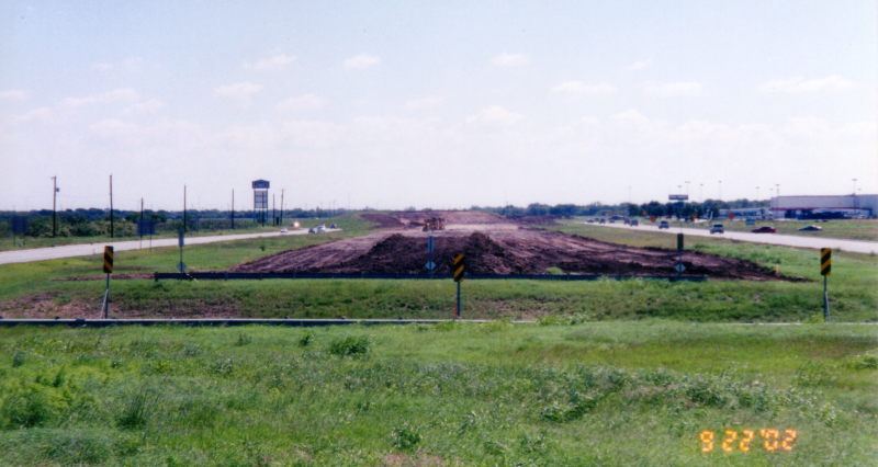
SH 151 at Ingram Rd. looking southeast (2002) Work had just started to build the mainlanes east of Ingram. (Brian Purcell) |
|
SH 151 at Ingram Rd. looking southeast (2002) Work had just started to build the mainlanes east of Ingram. (Brian Purcell) |
|
|
|
|

|
SH 151 at Ingram Rd. looking southeast (2003) (Brian Purcell) |
|
SH 151 at Ingram Rd. looking southeast (2003) (Brian Purcell) |
|
|
|
|

|
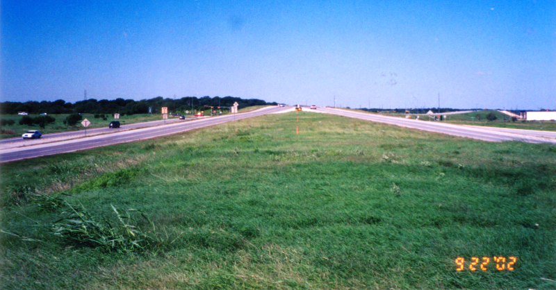
SH 151 at Ingram Rd. looking southeast (2005) This is a few months after completion of the mainlanes. (Brian Purcell) |
|
SH 151 at Ingram Rd. looking southeast (2005) This is a few months after completion of the mainlanes. (Brian Purcell) |
|
|
|
|
|
SH 151 at Loop 410 looking southwest (1987) (TxDOT) |
|
SH 151 at Loop 410 looking southwest (1987) (TxDOT) |
|
|
|
|

|
SH 151 at Loop 410 looking southwest (1987) (TxDOT) |
|
SH 151 at Loop 410 looking southwest (1987) (TxDOT) |
|
|
|
|

|
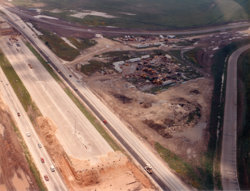
SH 151 east of Loop 410 looking west (2003) (Brian Purcell) |
|
SH 151 east of Loop 410 looking west (2003) (Brian Purcell) |
|
|
|
|

|
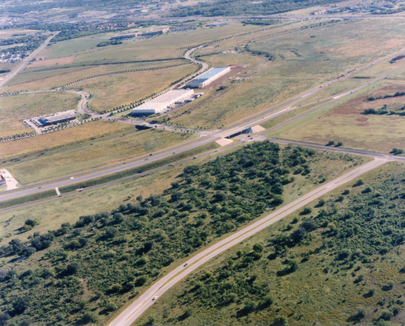
SH 151 at Tom Slick Park looking east-northeast (2002) (Brian Purcell) |
|
SH 151 at Tom Slick Park looking east-northeast (2002) (Brian Purcell) |
|
|
|
|
|
SH 151 at Military Dr. looking south (1987) (TxDOT) |
|
SH 151 at Military Dr. looking south (1987) (TxDOT) |
|
|
|
|
|
SH 151 at Military Dr. looking southwest (2002) (Brian Purcell) |
|
SH 151 at Military Dr. looking southwest (2002) (Brian Purcell) |
|
|
|
|
|
SH 151 at Military Dr. looking southwest (2003) (Brian Purcell) |
|
SH 151 at Military Dr. looking southwest (2003) (Brian Purcell) |
|
|
|
|
|
SH 151 at Leon Creek looking south (1987) (TxDOT) |
|
SH 151 at Leon Creek looking south (1987) (TxDOT) |
|
|
|
|
|
SH 151 at Leon Creek looking south (1987) (TxDOT) |
|
SH 151 at Leon Creek looking south (1987) (TxDOT) |
|
|
|
|
|
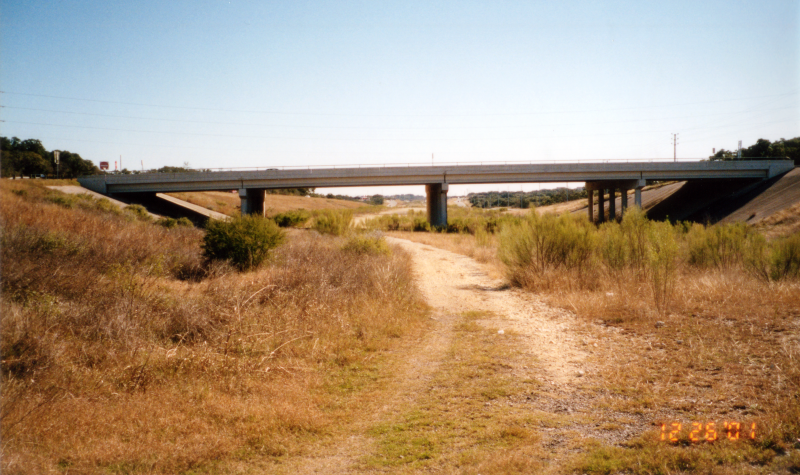
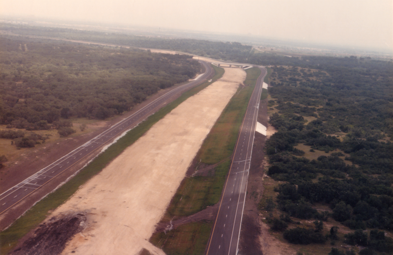
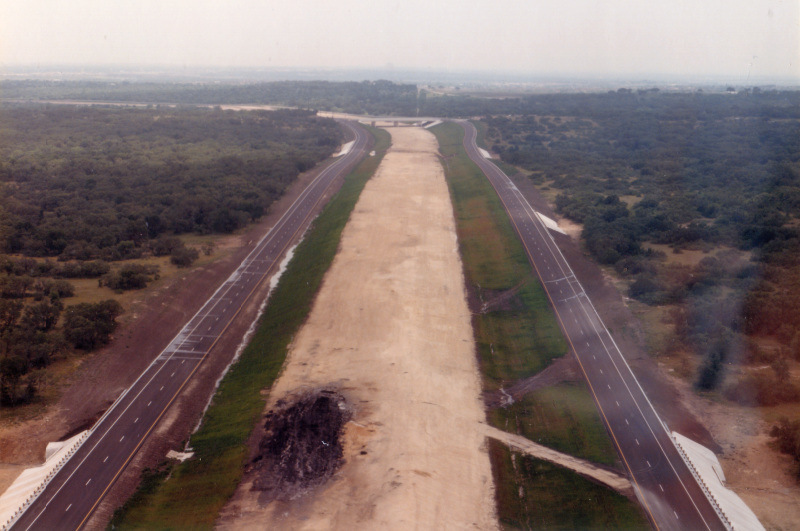
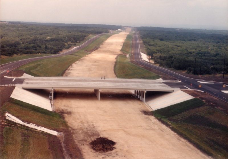
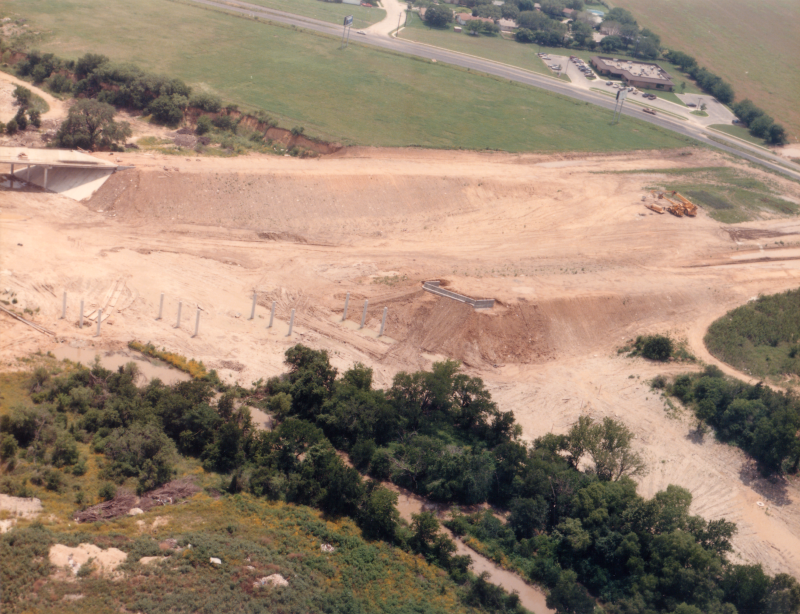
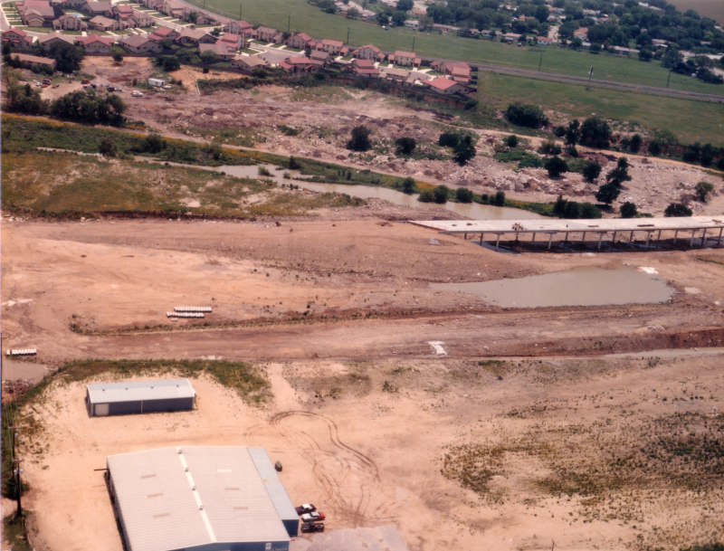
SH 151 at Pinn Rd. looking west (2002) This is looking at construction of the mainlane bridge over Leon Creek. (Brian Purcell) |
|
SH 151 at Pinn Rd. looking west (2002) This is looking at construction of the mainlane bridge over Leon Creek. (Brian Purcell) |
|
|
|
|
|
SH 151 at Pinn Rd. looking southwest (1987) (TxDOT) |
|
SH 151 at Pinn Rd. looking southwest (1987) (TxDOT) |
|
|
|
|

|
SH 151 at Pinn Rd. looking east (1998) This was a temporary entrance ramp to the overpass. It was removed when the mainlanes were completed between Callaghan and Loop 410 in 2004. (TxDOT) |
|
SH 151 at Pinn Rd. looking east (1998) This was a temporary entrance ramp to the overpass. It was removed when the mainlanes were completed between Callaghan and Loop 410 in 2004. (TxDOT) |
|
|
|
|

|
SH 151 at Callaghan Rd. looking northeast (1987) (TxDOT) |
|
SH 151 at Callaghan Rd. looking northeast (1987) (TxDOT) |
|
|
|
|

|
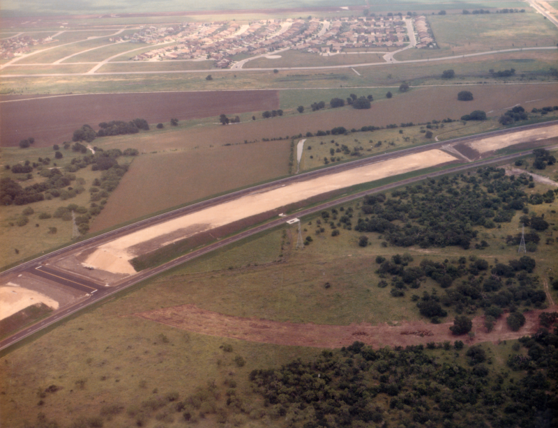
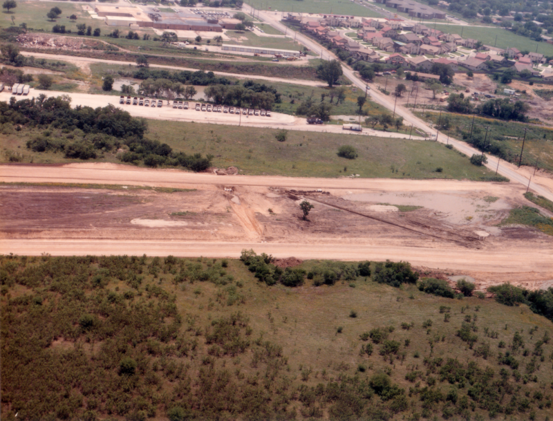
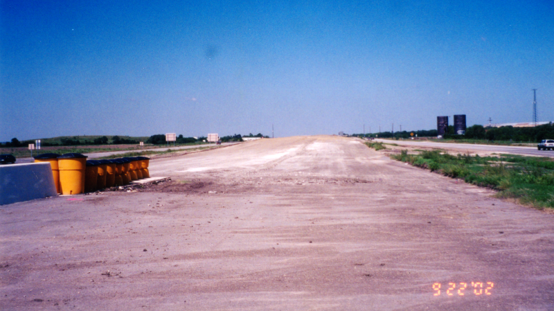
SH 151 west of Callaghan Rd. looking southeast (2001) A completed stretch of freeway began here. (Brian Purcell) |
|
SH 151 west of Callaghan Rd. looking southeast (2001) A completed stretch of freeway began here. (Brian Purcell) |
|
|
|
|
|
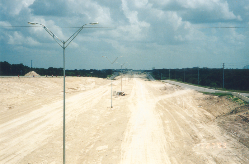
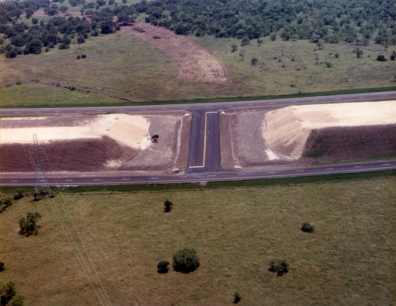
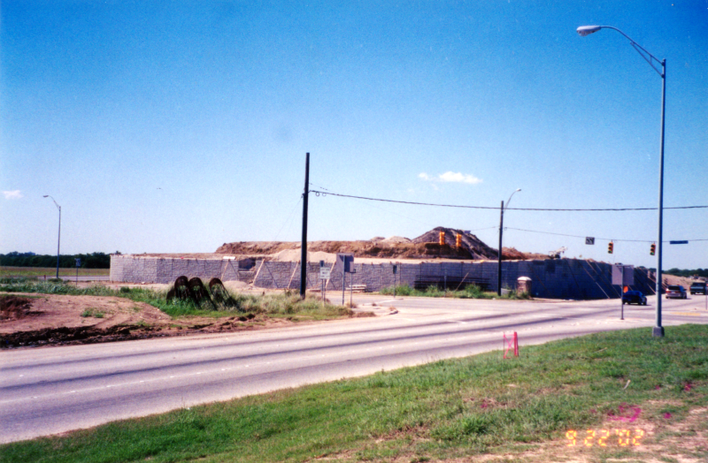
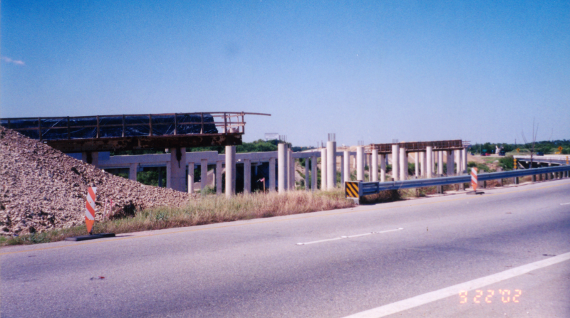
SH 151 west of Callaghan Rd. looking west (2002) Looking west at construction of the mainlanes. (Brian Purcell) |
|
SH 151 west of Callaghan Rd. looking west (2002) Looking west at construction of the mainlanes. (Brian Purcell) |
|
|
|
|