|
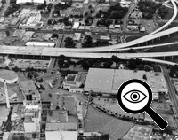
US 281 at Pearl Pkwy. Looking east (ca. 1978)
The freeway is under construction at this time.
(TxDOT)
|

US 281 at Pearl Pkwy. Looking east (ca. 1978)
The freeway is under construction at this time.
(TxDOT)
|
|
|
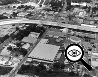
US 281 at Grayson St./The Pearl looking east (ca. 1978)
The freeway is under construction at this time.
(TxDOT)
|

US 281 at Grayson St./The Pearl looking east (ca. 1978)
The freeway is under construction at this time.
(TxDOT)
|
|
|
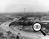
US 281 at Josephine St./The Pearl looking south (ca. 1978)
This was shortly after the freeway opened.
(TxDOT)
|

US 281 at Josephine St./The Pearl looking south (ca. 1978)
This was shortly after the freeway opened.
(TxDOT)
|
|
|
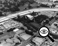
US 281 at the San Antonio River looking northeast (ca. 1978)
(TxDOT)
|

US 281 at the San Antonio River looking northeast (ca. 1978)
(TxDOT)
|
|
|
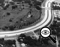
US 281 at the San Antonio River looking east (ca. 1978)
(TxDOT)
|

US 281 at the San Antonio River looking east (ca. 1978)
(TxDOT)
|
|
|
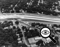
US 281 at St. Mary's St. looking east (ca. 1978)
(TxDOT)
|

US 281 at St. Mary's St. looking east (ca. 1978)
(TxDOT)
|
|
|
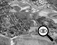
Future path of US 281 at Mulberry Ave./Stadium Dr. looking northwest (1960)
US 281 today runs roughly left-to-right across the center of this photo.
(TxDOT)
|

Future path of US 281 at Mulberry Ave./Stadium Dr. looking northwest (1960)
US 281 today runs roughly left-to-right across the center of this photo.
(TxDOT)
|
|
|
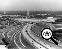
US 281 at Stadium Dr. looking northeast (ca. 1979)
(TxDOT)
|

US 281 at Stadium Dr. looking northeast (ca. 1979)
(TxDOT)
|
|
|
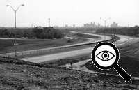
US 281 at Stadium Dr. looking south (ca. 1978)
(TxDOT)
|

US 281 at Stadium Dr. looking south (ca. 1978)
(TxDOT)
|
|
|
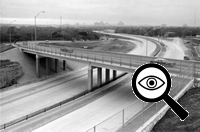
US 281 at Stadium Dr. looking south (ca. 1978)
(TxDOT)
|

US 281 at Stadium Dr. looking south (ca. 1978)
(TxDOT)
|
|
|
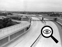
US 281 at Stadium Dr. looking southwest (ca. 1978)
(TxDOT)
|

US 281 at Stadium Dr. looking southwest (ca. 1978)
(TxDOT)
|
|

|
US 281 at Stadium Dr. looking north (2001)
(Brian Purcell)
|

US 281 at Stadium Dr. looking north (2001)
(Brian Purcell)
|
|
|
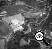
Future path of US 281 at Alamo Stadium/Sunken Gardens looking northwest (1960)
US 281 today runs between the stadium at left and the ampitheater at the bottom center.
(TxDOT)
|

Future path of US 281 at Alamo Stadium/Sunken Gardens looking northwest (1960)
US 281 today runs between the stadium at left and the ampitheater at the bottom center.
(TxDOT)
|
|
|
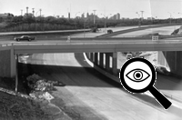
US 281 at Hildebrand Ave. looking south (ca. 1978)
(TxDOT)
|

US 281 at Hildebrand Ave. looking south (ca. 1978)
(TxDOT)
|
|
|
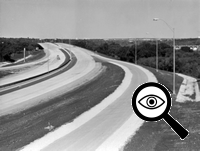
US 281 at Hildebrand Ave. looking north (ca. 1978)
(TxDOT)
|

US 281 at Hildebrand Ave. looking north (ca. 1978)
(TxDOT)
|
|
|
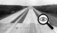
US 281 at Olmos Dr. looking north (ca. 1978)
(TxDOT)
|

US 281 at Olmos Dr. looking north (ca. 1978)
(TxDOT)
|
|
|
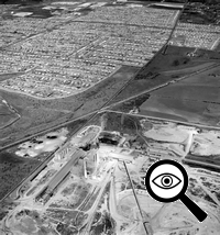
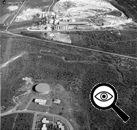
Future path of US 281 at Jones-Maltsberger Rd./The Quarry looking northwest (1960)
US 281 today parallels the railroad tracks running diagonally across the center of this photo.
(TxDOT)
|

Future path of US 281 at Jones-Maltsberger Rd./The Quarry looking northwest (1960)
US 281 today parallels the railroad tracks running diagonally across the center of this photo.
(TxDOT)
|
|
|
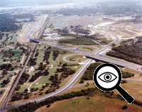
Future path of US 281 at Jones-Maltsberger Rd./The Quarry looking east (1960)
US 281 today runs roughly left-to-right across the center of this photo.
(TxDOT)
|

Future path of US 281 at Jones-Maltsberger Rd./The Quarry looking east (1960)
US 281 today runs roughly left-to-right across the center of this photo.
(TxDOT)
|
|
|
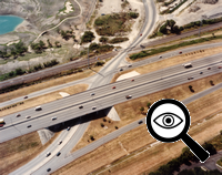
US 281 at Basse Rd. looking northeast (ca. 1993)
This was before the quarry was converted to a shopping center.
(TxDOT)
|

US 281 at Basse Rd. looking northeast (ca. 1993)
This was before the quarry was converted to a shopping center.
(TxDOT)
|
|
|
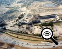
US 281 at Jones-Maltsberger Rd./The Quarry looking southeast (ca. 1996)
(TxDOT)
|

US 281 at Jones-Maltsberger Rd./The Quarry looking southeast (ca. 1996)
(TxDOT)
|
|
|
US 281 at Jones-Maltsberger Rd./The Quarry looking east (ca. 1996)
(TxDOT)
|

US 281 at Jones-Maltsberger Rd./The Quarry looking east (ca. 1996)
(TxDOT)
|
|
|
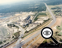
US 281 at Jones-Maltsberger Rd./The Quarry looking southeast (ca. 1996)
(TxDOT)
|

US 281 at Jones-Maltsberger Rd./The Quarry looking southeast (ca. 1996)
(TxDOT)
|
|
|
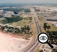
US 281 at Sunset Rd. looking north-northwest (ca. 1996)
This was before the interchange with Loop 410 was built.
(TxDOT)
|

US 281 at Sunset Rd. looking north-northwest (ca. 1996)
This was before the interchange with Loop 410 was built.
(TxDOT)
|
|
|
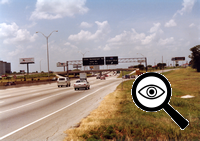
US 281 at Airport Blvd. looking northwest (ca. 1990)
This was before the interchange with Loop 410 was built. Notice the Loop 410 shield on the exit to Airport Blvd.; traffic headed to Loop 410 had to exit here and go through the signalized intersections to reach Loop 410.
(TxDOT)
|

US 281 at Airport Blvd. looking northwest (ca. 1990)
This was before the interchange with Loop 410 was built. Notice the Loop 410 shield on the exit to Airport Blvd.; traffic headed to Loop 410 had to exit here and go through the signalized intersections to reach Loop 410.
(TxDOT)
|
|
|
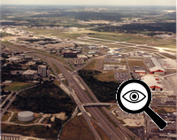
US 281 at Terminal Dr. looking north (1987)
(TxDOT)
|

US 281 at Terminal Dr. looking north (1987)
(TxDOT)
|
|
|
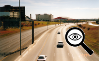
US 281 at Isom Rd. looking southeast (2001)
(TxDOT)
|

US 281 at Isom Rd. looking southeast (2001)
(TxDOT)
|
|
|
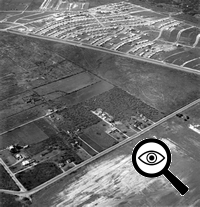
Future path of US 281 at San Pedro Ave./Sandau Rd. looking southwest (1960)
US 281 ran along San Pedro Ave. at this time, which is the roadway running roughly left-to-right across the top portion of this photo. The neighborhood at the top is Harmony Hills.
(TxDOT)
|

Future path of US 281 at San Pedro Ave./Sandau Rd. looking southwest (1960)
US 281 ran along San Pedro Ave. at this time, which is the roadway running roughly left-to-right across the top portion of this photo. The neighborhood at the top is Harmony Hills.
(TxDOT)
|
|

|
US 281 at Nakoma Dr. looking south (2001)
(Brian Purcell)
|

US 281 at Nakoma Dr. looking south (2001)
(Brian Purcell)
|
|
|
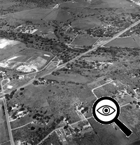
US 281 at Salado Creek looking northwest (1960)
This was when US 281 was a four-lane, undivided highway in this area.
(TxDOT)
|

US 281 at Salado Creek looking northwest (1960)
This was when US 281 was a four-lane, undivided highway in this area.
(TxDOT)
|
|
|
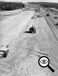
US 281 at Salado Creek looking north (1979)
During construction of the freeway here.
(SABCUTS)
|

US 281 at Salado Creek looking north (1979)
During construction of the freeway here.
(SABCUTS)
|
|

|
US 281 at Salado Creek looking north (2001)
Wurzbach Parkway crosses left-to-right across the center of this photo today.
(TxDOT)
|

US 281 at Salado Creek looking north (2001)
Wurzbach Parkway crosses left-to-right across the center of this photo today.
(TxDOT)
|
|
|
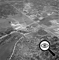
US 281 at Bitters Rd. looking northwest (1960)
This was when US 281 was a four-lane, undivided highway in this area.
(TxDOT)
|

US 281 at Bitters Rd. looking northwest (1960)
This was when US 281 was a four-lane, undivided highway in this area.
(TxDOT)
|
|
|
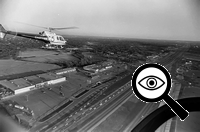
US 281 at Bitters Rd. looking northwest (1985)
(Courtesy of Jared Maurtua)
|

US 281 at Bitters Rd. looking northwest (1985)
(Courtesy of Jared Maurtua)
|
|
|
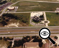
US 281 at Central Pkwy. looking east (1987)
(TxDOT)
|

US 281 at Central Pkwy. looking east (1987)
(TxDOT)
|
|
|
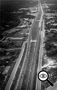
US 281 at Winding Way looking north (1986)
The freeway ended here at this time and continued north as a four-lane divided highway with signalized intersections.
(Courtesy of Jared Maurtua)
|

US 281 at Winding Way looking north (1986)
The freeway ended here at this time and continued north as a four-lane divided highway with signalized intersections.
(Courtesy of Jared Maurtua)
|
|
|
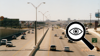
US 281 at Winding Way looking south (2001)
This was prior to this section being restriped to four lanes in each direction.
(Brian Purcell)
|

US 281 at Winding Way looking south (2001)
This was prior to this section being restriped to four lanes in each direction.
(Brian Purcell)
|
|
|
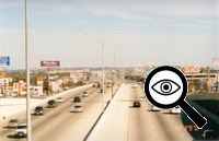
US 281 at Winding Way looking north (2001)
(Brian Purcell)
|

US 281 at Winding Way looking north (2001)
(Brian Purcell)
|
|
|
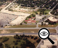
US 281 at Winding Way looking east (1987)
(TxDOT)
|

US 281 at Winding Way looking east (1987)
(TxDOT)
|
|
|
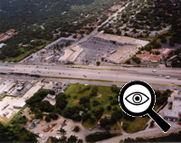
US 281 at Brook Hollow Dr. looking east (2001)
(TxDOT)
|

US 281 at Brook Hollow Dr. looking east (2001)
(TxDOT)
|
|

|
US 281 at Henderson Pass looking northeast (ca. 1998)
(TxDOT)
|

US 281 at Henderson Pass looking northeast (ca. 1998)
(TxDOT)
|
|
|
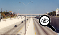
US 281 at Henderson Pass looking north (ca. 2001)
This was prior to construction of the full interchange.
(Brian Purcell)
|

US 281 at Henderson Pass looking north (ca. 2001)
This was prior to construction of the full interchange.
(Brian Purcell)
|
|


