|
||
|
|
||
This page last updated January 29, 2026 |

|
|
|
|
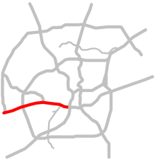
This page covers US Highway 90 west of downtown San Antonio from I‑35 to just outside of Loop 1604. US 90 continues east concurrent (multiplexed) with I‑10 East. Length: 12 miles |
|
ADVERTISEMENT |
On this page:


Overview
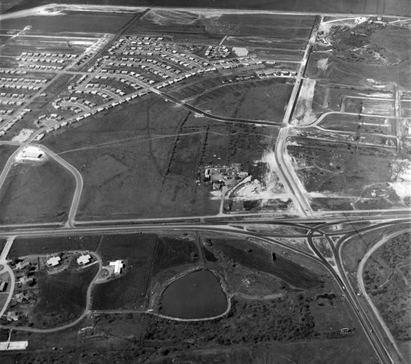
This is the main freeway serving San Antonio's West Side. It provides access to Port San Antonio (the former Kelly AFB), Joint Base San Antonio Lackland, Our Lady of the Lake University, St. Mary's University, the San Antonio Produce Market, and Nelson Wolff Municipal Stadium.
Residential areas abut the freeway along most of the corridor between I‑35 and SH 151. Near 151 are several large manufacturing plants, warehouses, and the ballpark. The freeway runs through mostly undeveloped land and parkland between Leon Creek and Old Highway 90. An older commercial area lines the access roads between there and Loop 410. Outside of Loop 410, most of the southern frontage is undeveloped land that's part of Lackland Air Force Base. The northern frontage is a mix of undeveloped land and residential areas. Major residential growth is now occurring along both sides of US 90 west of Loop 1604.
Roadway details
| EXITS |
Click here for a list of US 90 West exits. |
| SPEED LIMITS | |
|
|
|
|

| AVERAGE DAILY TRAFFIC | |||||||
| LOCATION | 2002 | 2012 | 2017 | 2019 | 2021 | 2022 | '12-'22 % CHG |
| E of Zarzamora St. | 128,000 | 152,000 | 169,413 | 165,709 | 145,201 | 162,240 | +6.74% |
| E of Cupples Rd. | 116,000 | 137,000 | 153,450 | 149,640 | 146,449 | 159,306 | +16.28% |
| W of General McMullen Dr. | 141,232 | 151,656 | N/A | ||||
| E of Old Hwy 90 | 65,000 | 73,000 | 81,311 | 80,494 | 76,940 | 81,858 | +12.13% |
| W of Military Dr. | 73,000 | 84,000 | 92,913 | 89,824 | 89,173 | 94,904 | +12.98% |
| W of Hunt Ln. | 44,000 | 61,000 | 81,073 | 83,301 | 80,978 | 86,153 | +41.23% |
| W of Loop 1604 | 30,000 | 38,000 | 61,100 | 53,373 | 50,704 | 53,929 | +41.92% |
(NOTE: In 2021, TxDOT changed the location of several traffic counting stations. New stations will show no history prior to 2021.)
|
ADVERTISEMENT |
Media gallery
Click here for historical photos of this freeway.
Click here for video of this freeway.
Construction projects
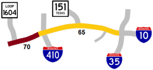
- Loop 1604 to Montgomery Rd.: Add auxiliary lanes. Click here for details on this project.
- Loop 410 to Loop 1604: Widen to ten lanes and build WB 90 to NB 1604 flyover. Click here for details on this project.
Click here to view information for all projects in this corridor.
Future plans
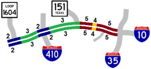
The first phase of a multi-level interchange at Loop 410 has been completed. Plans are to eventually build the remaining connectors, but funding to do so has not yet been secured.
TxDOT is planning to upgrade US 90 from Loop 1604 to SH 211 to a full freeway, build the westbound US 90 to northbound Loop 1604 flyover, and make additional improvements between Loop 410 and Loop 1604. Click here for more information on this project.
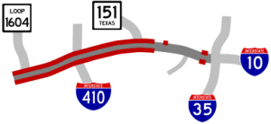
A study is underway to develop plans to reconstruct and modernize the section from Loop 410 to SH 151 which is still mostly in its original 1968 configuration.
Kelly AFB was closed in mid-2001 and the city has converted the former aircraft maintenance depot into a major civilian industrial complex and inland port called Port San Antonio. To support the new facility, interchange improvements at General Hudnell Dr. have been proposed in conjunction with a new parkway (Kelly Parkway) connecting US 90 to I‑35 South via Spur 371 (General Hudnell Dr.) At present, no timeline has been set for those projects.
History
This route was originally named the "West Expressway" but is now named for Cleto Rodriguez, a San Antonian who was the first Hispanic to be awarded the Medal of Honor. This freeway was built in the mid '60s to replace the old route for US 90 that ran on surface streets through San Antonio's West Side.
Most of the section west of Acme Rd. was part of the original US 90 and its predecessor SH 3. As part of the Arneson Plan to improve state highways in Bexar County, the section between Acme Rd. and Pinn Rd. was bypassed in 1934 with what's now Old Highway 90. Also, the segment between Medio Creek and Loop 1604 was built around 1945 to straighten that section and replace the routing along Kriewald Rd.
- 1952: The first proposed route for this expressway took it from an interchange at I‑35 at El Paso St. straight west in the El Paso St./Guadalupe St. corridor all the way to Old Highway 90, where it then would have turned southwestward to meet the current alignment near Military Dr.
- 1956: Final route approved.
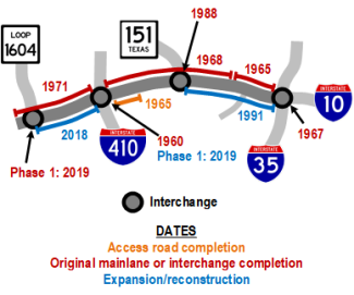
- 1960: Interchange at Loop 410 completed.
- 1965: Segment from Nogalitos St. to Cupples Rd. completed, and existing two-lane highway from Old Highway 90 to Loop 410 upgraded to access roads.
- 1967: Interchange at I‑35 opened.
- 1968: Section from Cupples Rd. to Loop 410 completed.
- 1971: Existing two-lane highway from Loop 410 to Loop 1604 upgraded to a freeway.
- 1988: Interchange at SH 151 completed.
- 1991: Freeway widened from six to 10 lanes between I‑35 and SH 151.
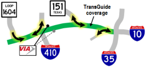
- 1995: TransGuide coverage added to the section from I‑35 to Zarzamora St. as part of the original TransGuide project.
- 1996: Eastbound access road between Leon Creek and Old Highway 90 completed.
- 2001: TransGuide coverage extended from Zarzamora St. to Hunt Lane.
- 2007: Kel-Lac Park & Ride relocated from within the Old Highway 90 interchange to its current location just west Military Dr.
- 2009: Old Highway 90 overpass rebuilt and the westbound access road through that location was realigned.
- 2018: First flyover in the Loop 410 interchange opened, and freeway widened to add a long auxiliary lane in each direction between Loop 410 and Loop 1604.
- 2019: Second flyover in the Loop 410 interchange opened as well as the flyover from southbound Loop 1604 to eastbound US 90.
|
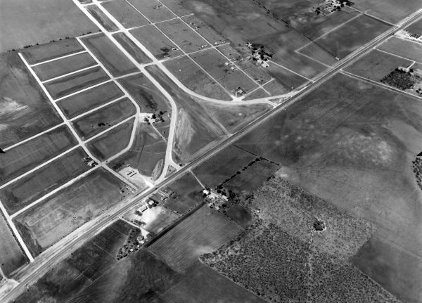
More historical photos of US 90 West are available here. |